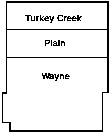
1836
1838
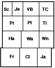
1839
Kos. co. commissioners established 3 townships
9 new townships established
1.5 miles on the eastern boarder of Harrison twp. wasattached to Wayne Township

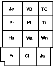
1840
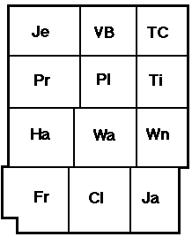
1843
1848
9 sections of land were taken away from Fulton Co. by the state legislature and attached to the SW corner of Kos. Co. Franklin twp.
In 1843 the 1840 law was declared a mistake by the state legislature and the 9 sections were given back to Fulton Co. Looks like 1839 map.
Scott Township was created out of part of Jefferson twp.
June, 1855
Dec, 1855
1848-1856
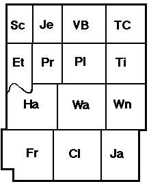
Etna Twp. created out of parts of Prairie and Harrison
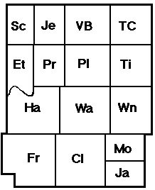
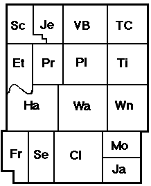
Jackson Twp. was divided into two parts, creating Monroe twp.
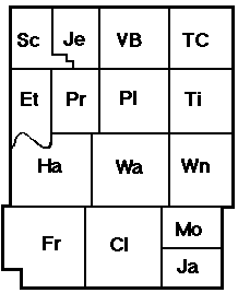
Several times between 1848 and 1856 the co. commissioners took sections away from Jefferson and added them to Scott twp. 5 sections in all were transferred in the manner, the last shift in 1856.
1859
1870
Seward twp. was created out of Franklin twp.
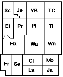
Lake twp. was created out of Clay twp. These boundaries remain to this day