| Tippecanoe
County, Indiana 1895 Atlas -
off site Map of Lafayette Indiana Dept. of Transportation, in pdf format, Adobe Acrobat Reader needed to view this map Maps of Localities (from Yahoo! Maps) |
1866 Map of Tippecanoe County showing Landowners (off-site at the Library of Congress) Let me know if the link doesn't work for you. |
| |
Panoramic view of Lafayette, Indiana in 1868 |
| Maps
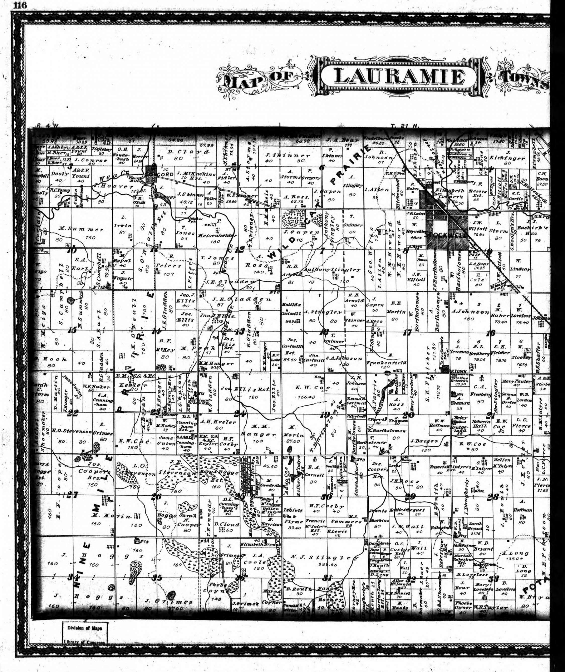
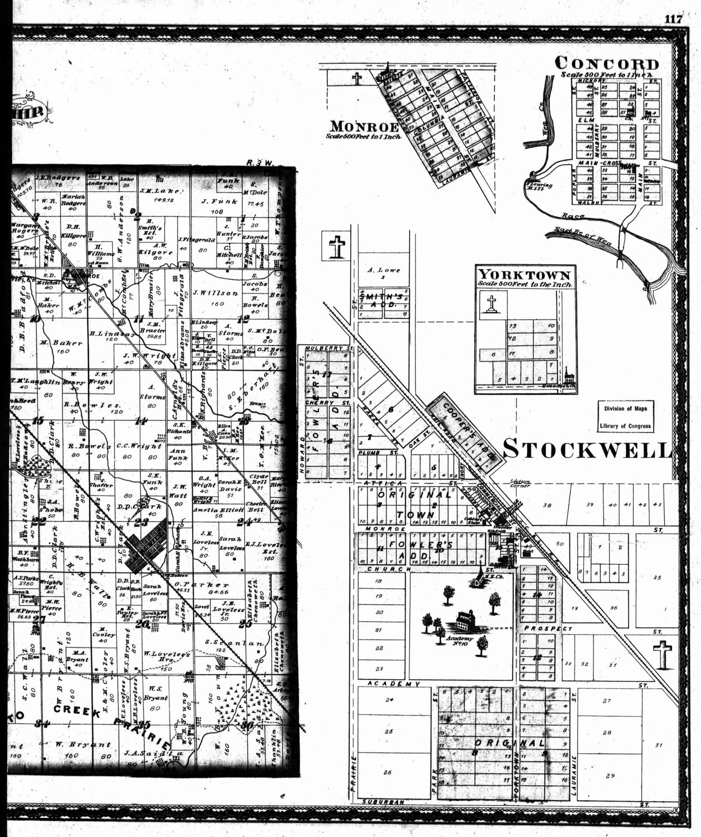
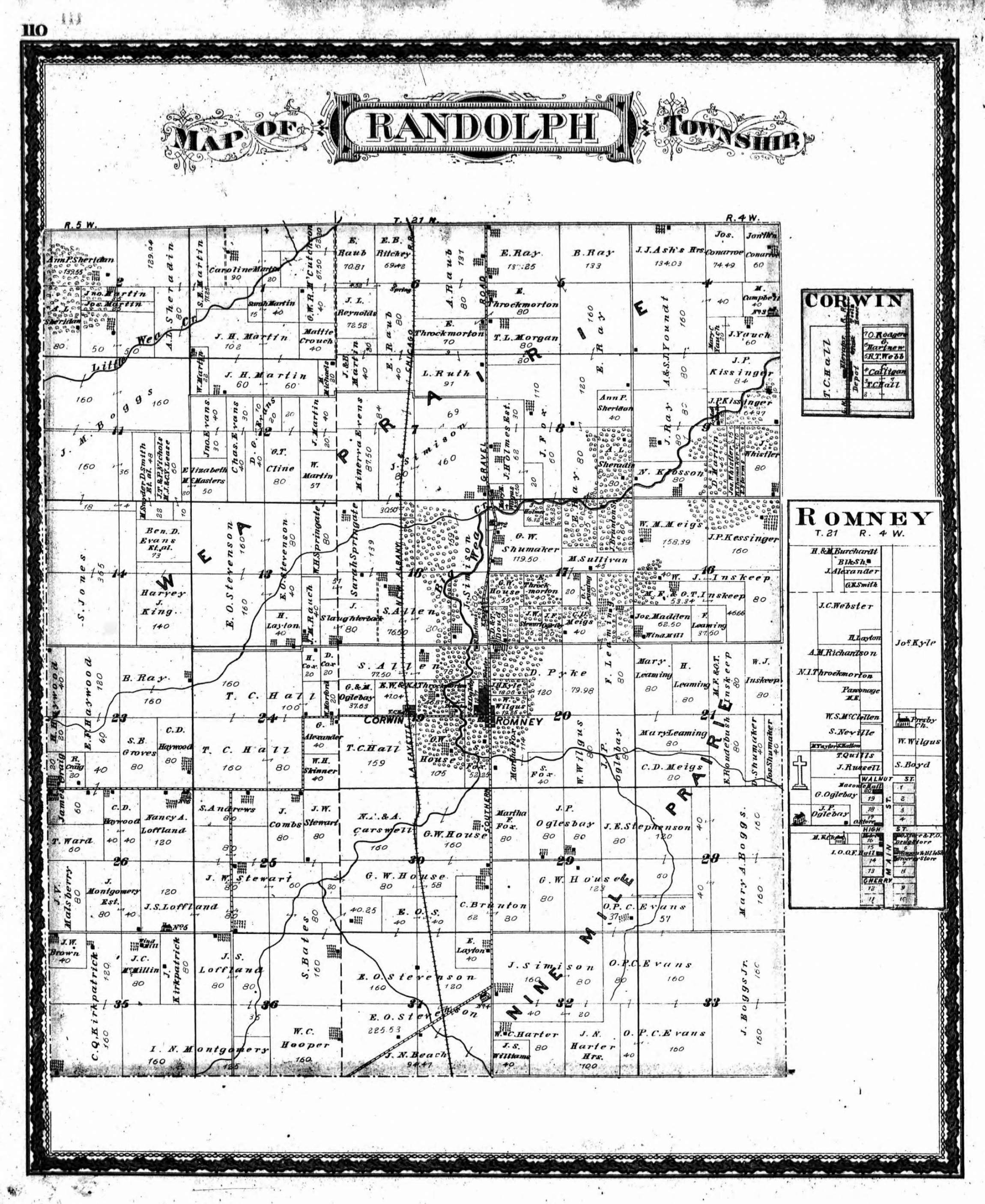
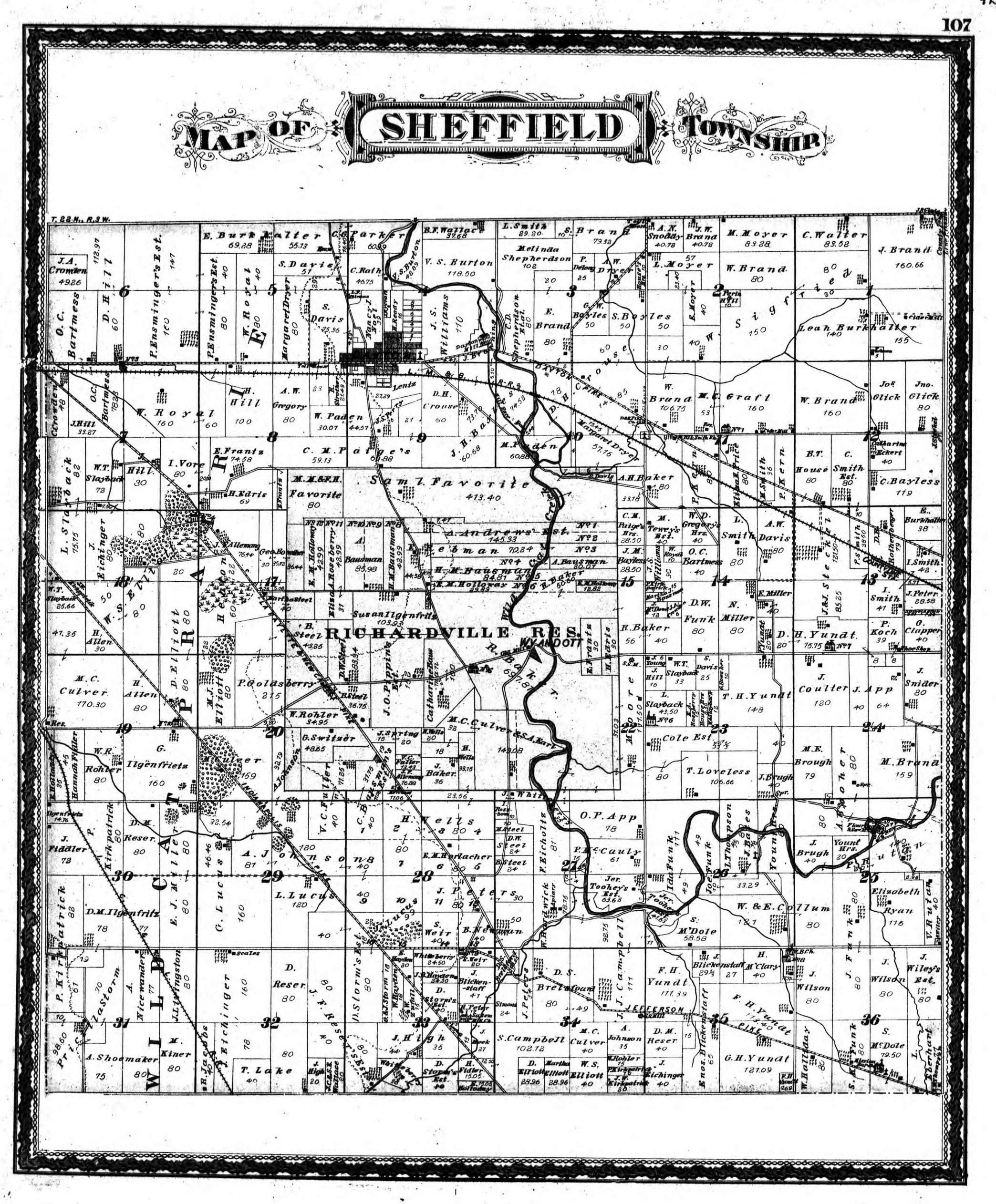
from the 1878 Illustrated Atlas of Tippecanoe County
showing Landowners The township maps are large images, I've tried to reduce the file size as much as possible, hopefully they aren't too difficult to download. |
TOWNSHIP MAPS
Fairfield Township (826kb)
Jackson Township (728kb)
Lauramie Township - in 2 parts: west half, 888kb - east half, 895kb
Perry Township - (804kb)
Randolph Township - (857kb)
Sheffield Township - (908kb)
Shelby Township - in 2 parts: north half, 752kb - south half, 731kb
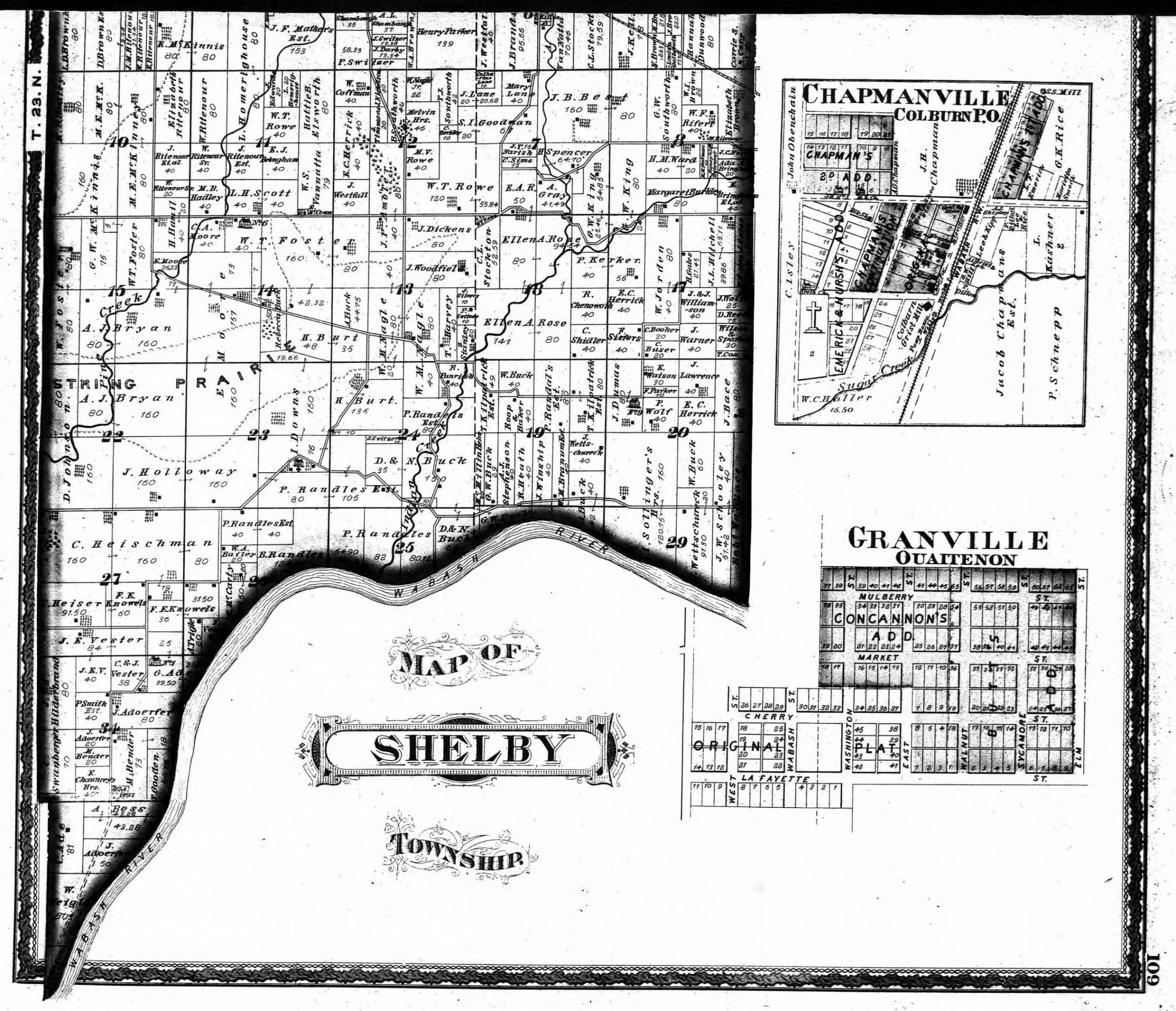
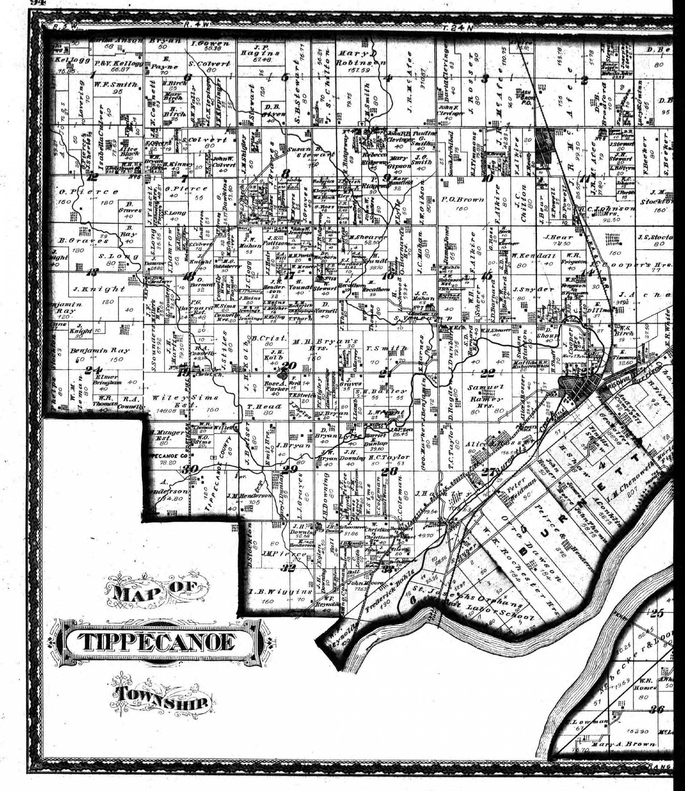
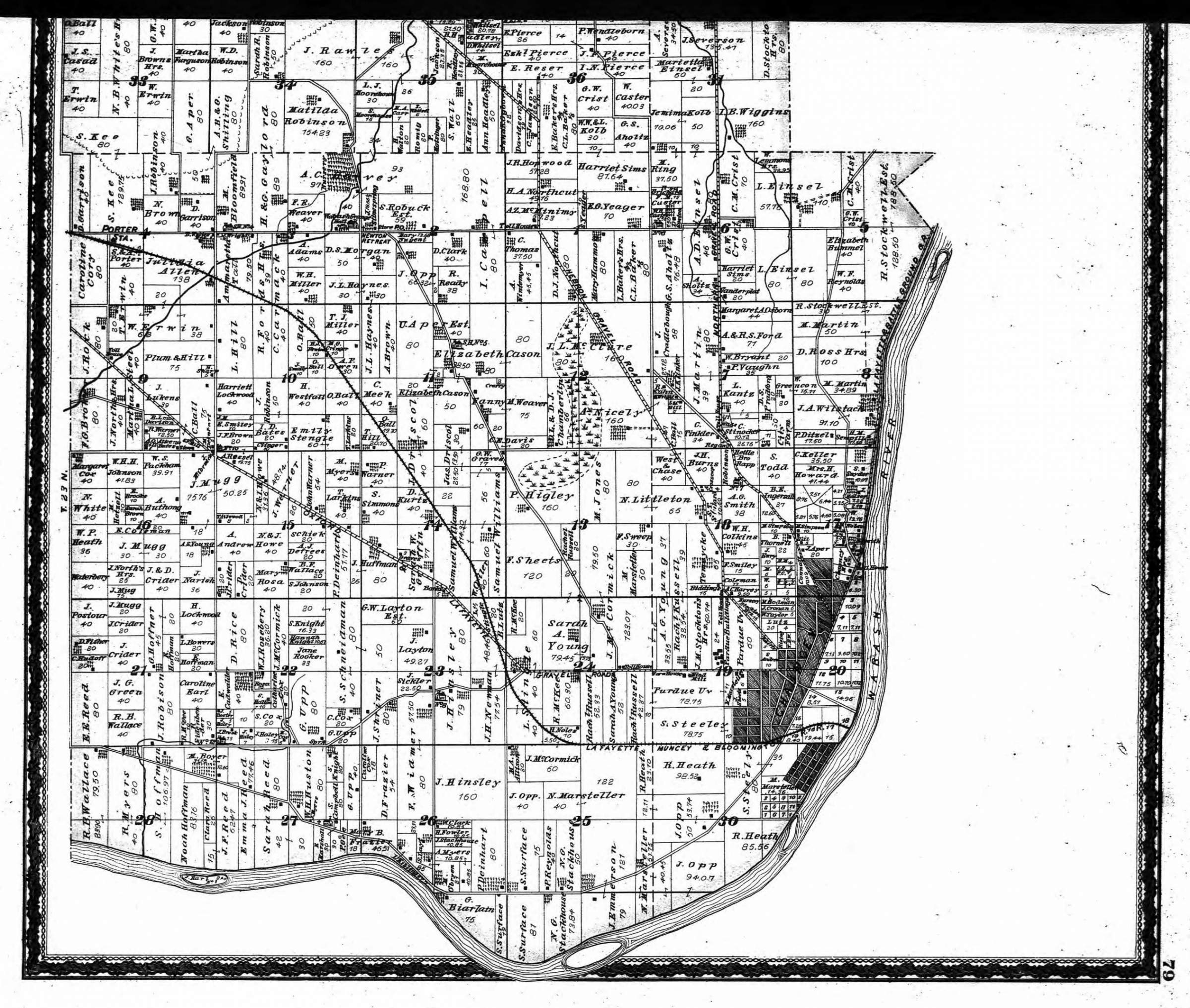
Tippecanoe Township - (931kb) west half is part of Washington Township map
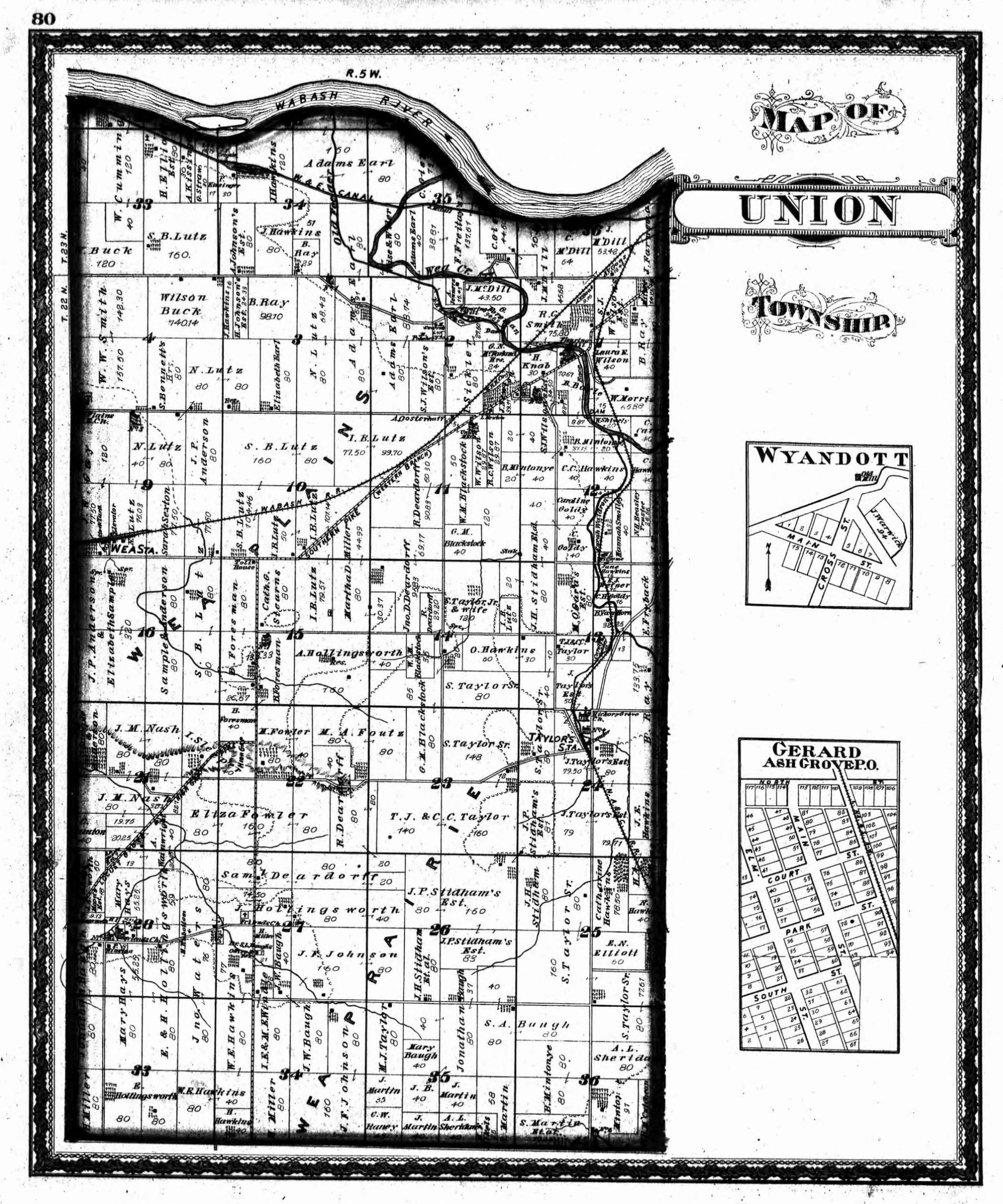
Union Township - (787kb)
Wabash Township - in 2 parts: north half (635kb) - south half (791kb)
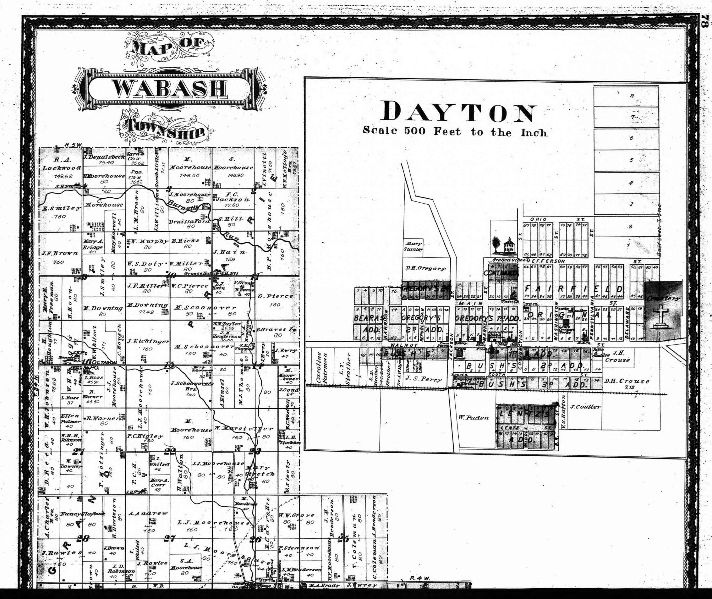
Washington Township - includes part of Tippecanoe Township, the two are separated by the river - (744kb)
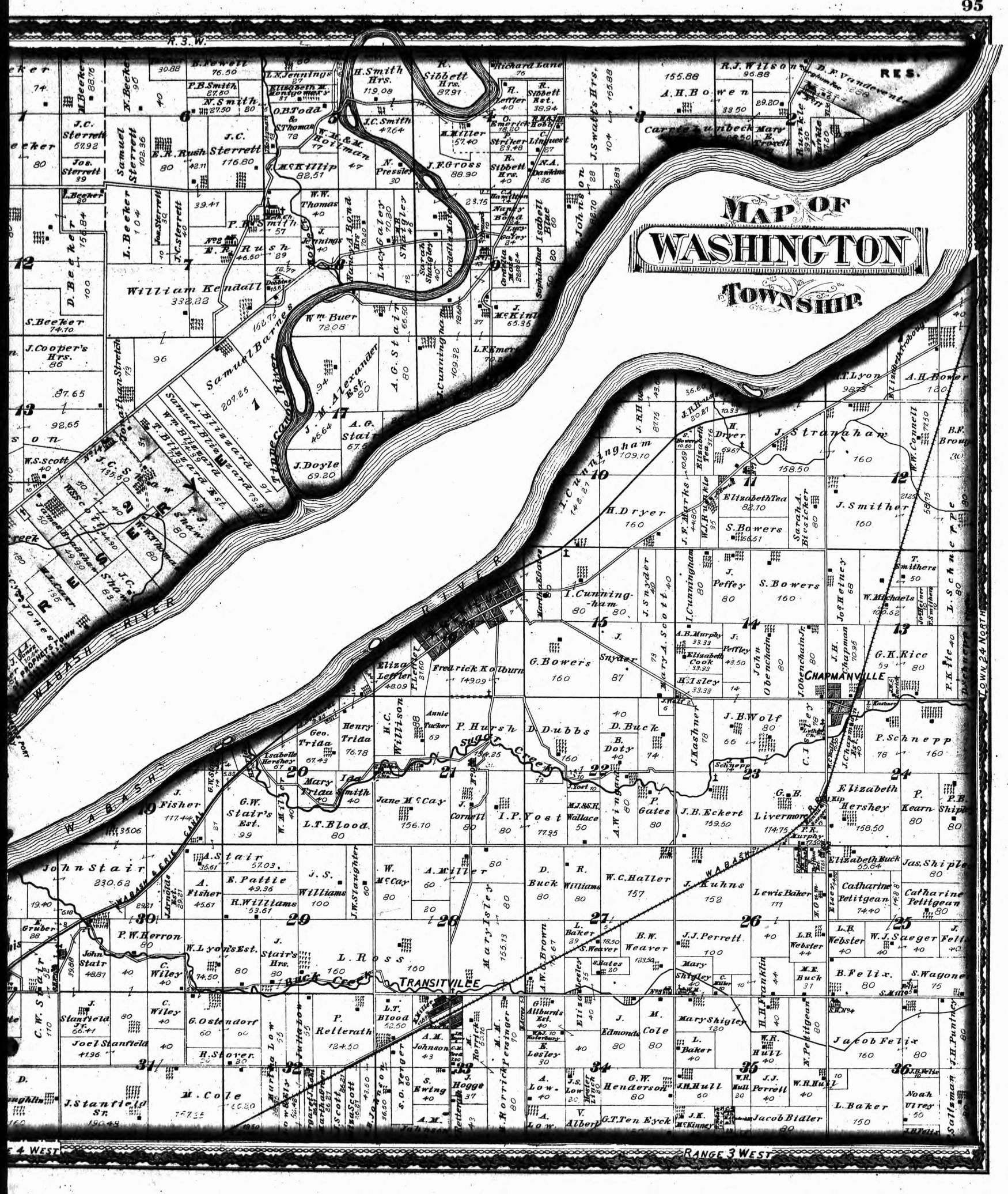
Wayne Township - (879kb)
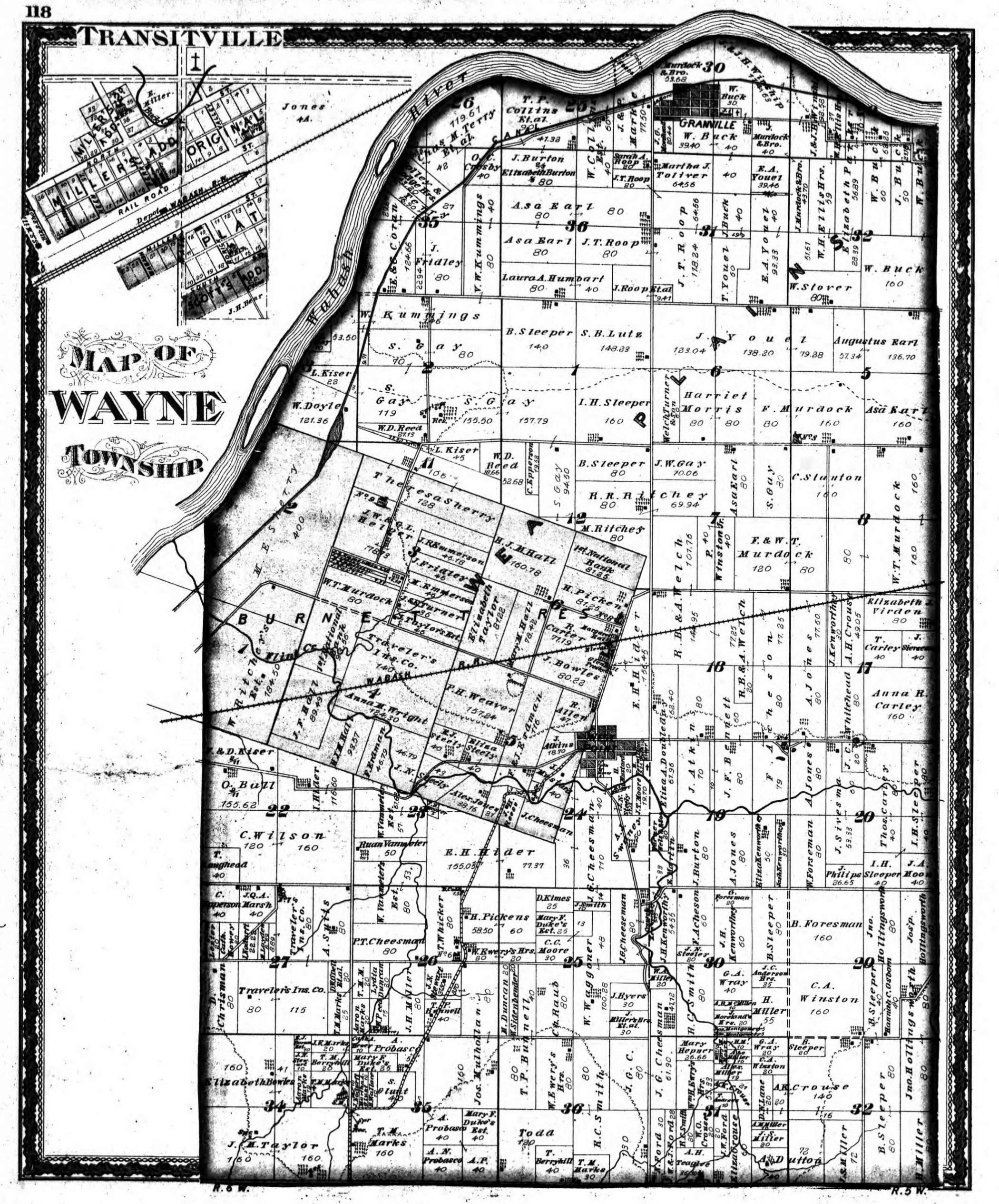
Wea Township - (814kb)
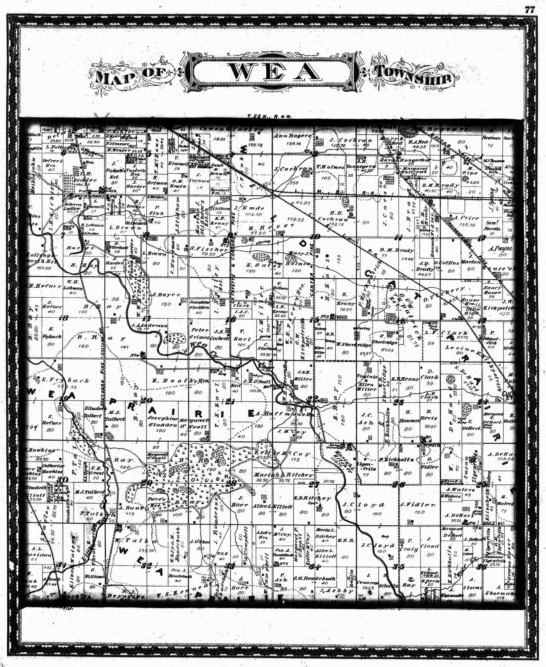
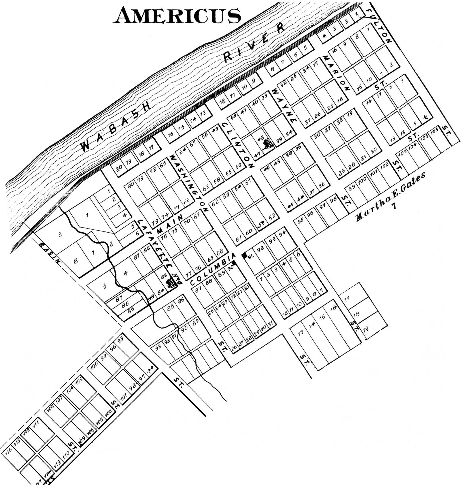
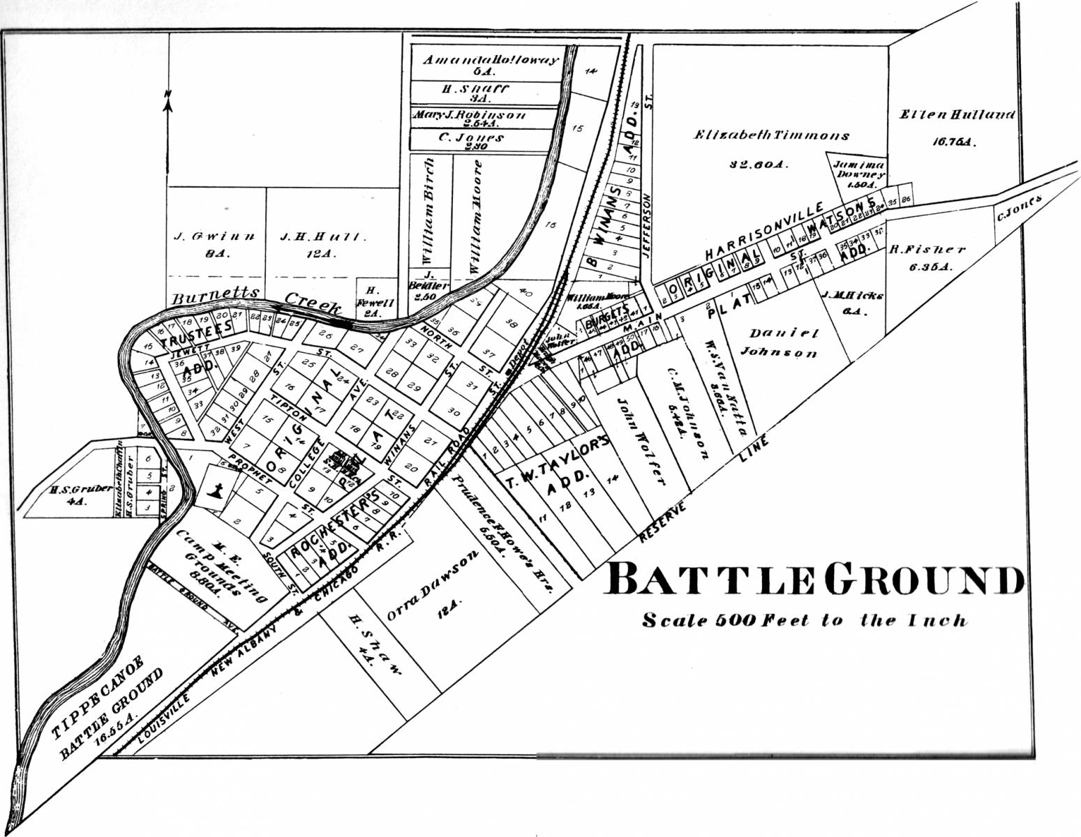
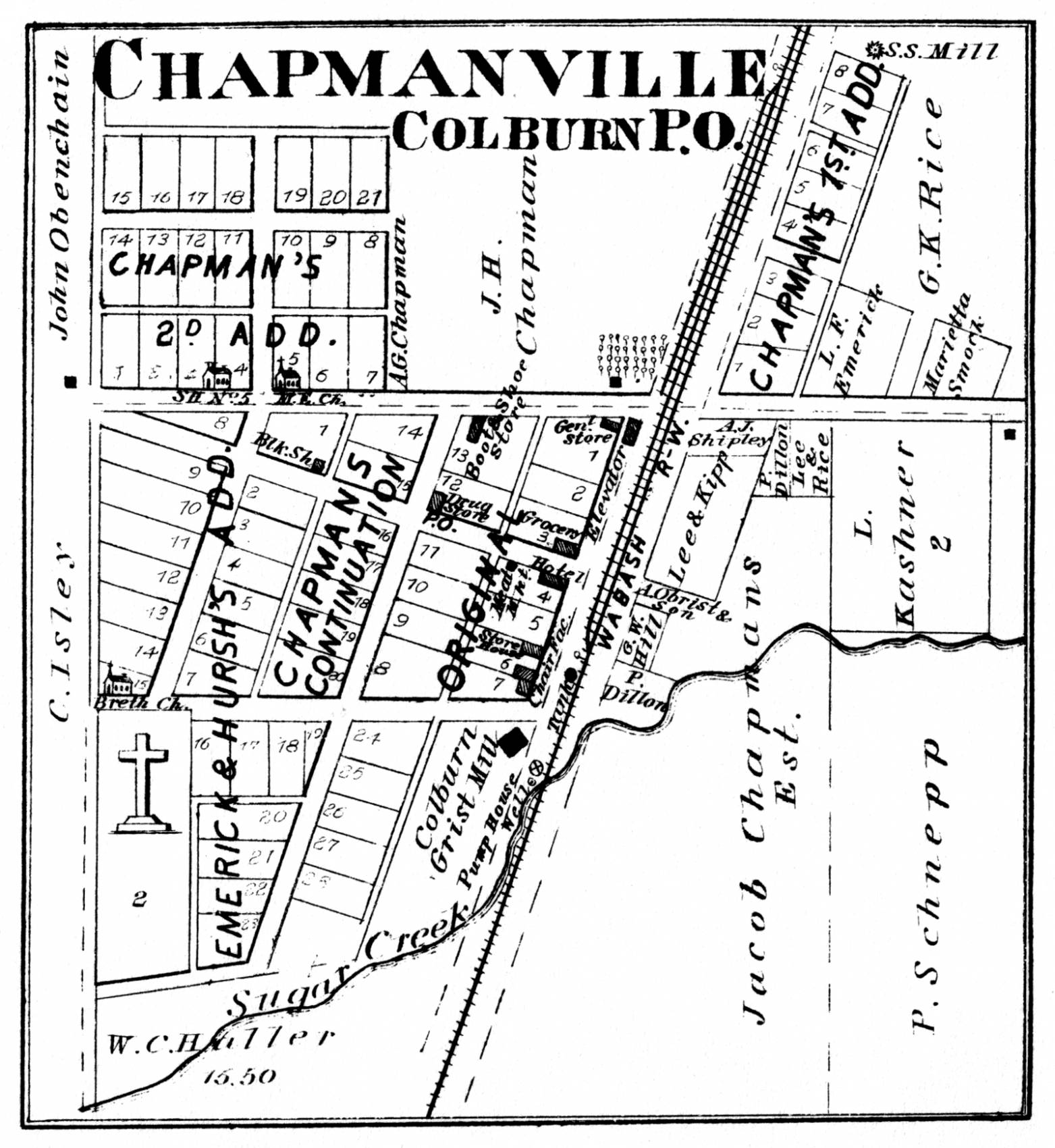
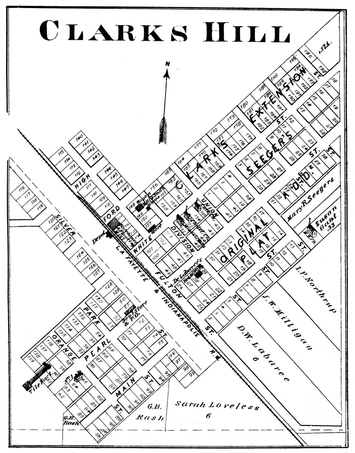
THE TOWNS IN 1878
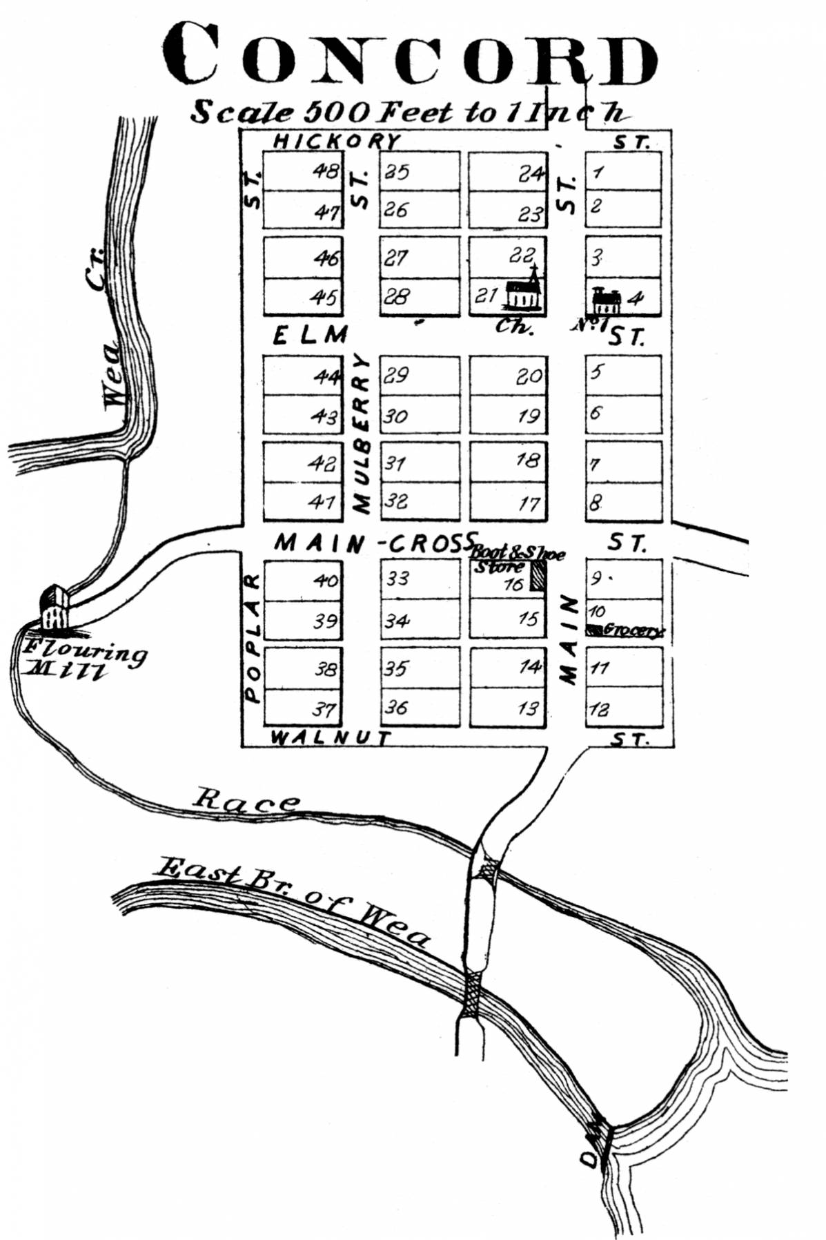
Americus - Battle Ground - Chapmanville (now Colburn) - Clarks Hill - Concord
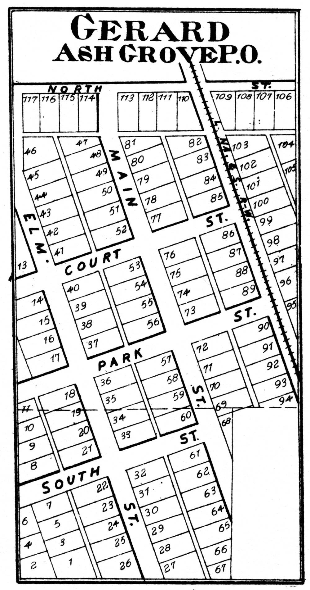
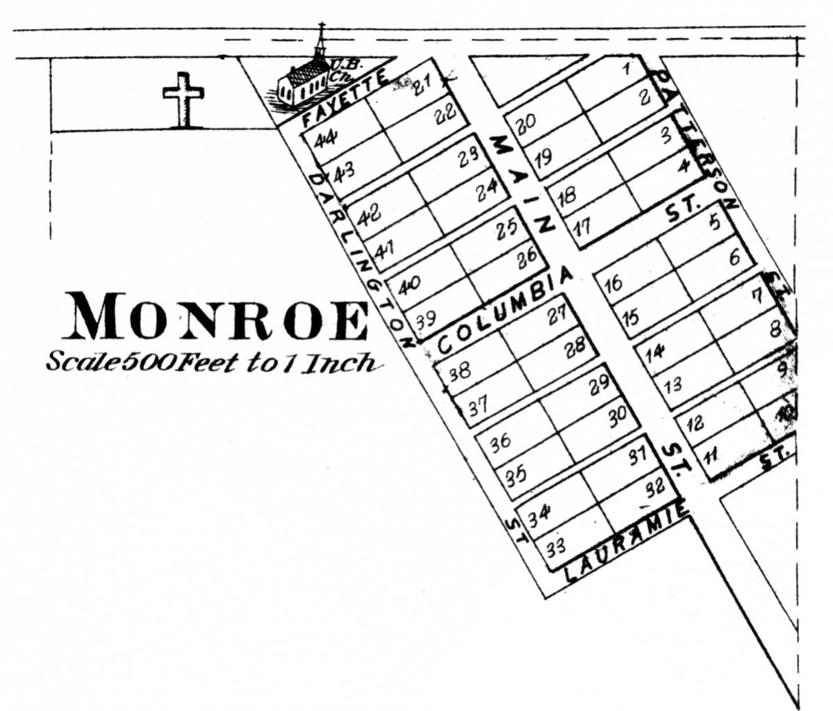
Dayton - Gerard (now known as Ash Grove) - Granville (Ouiatenon) - Monitor - Monroe - Montmorency
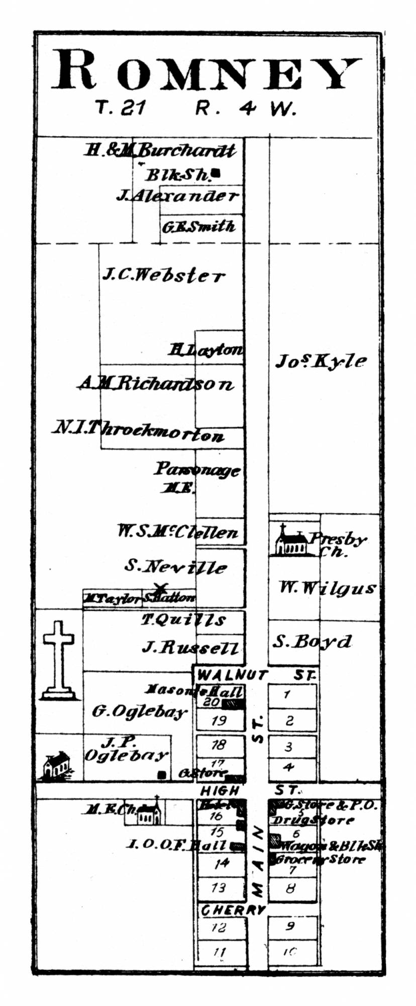
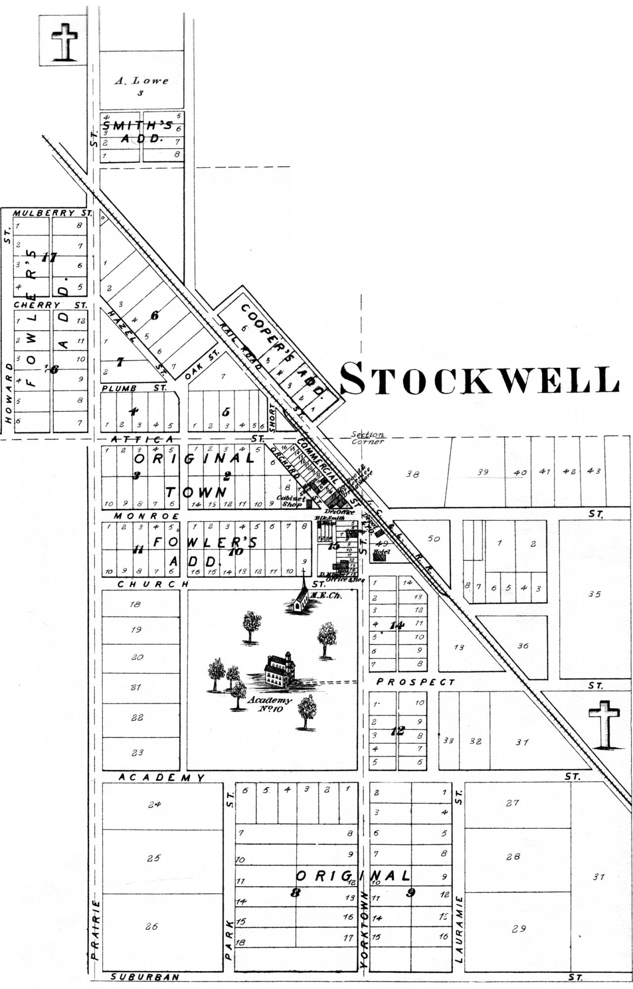
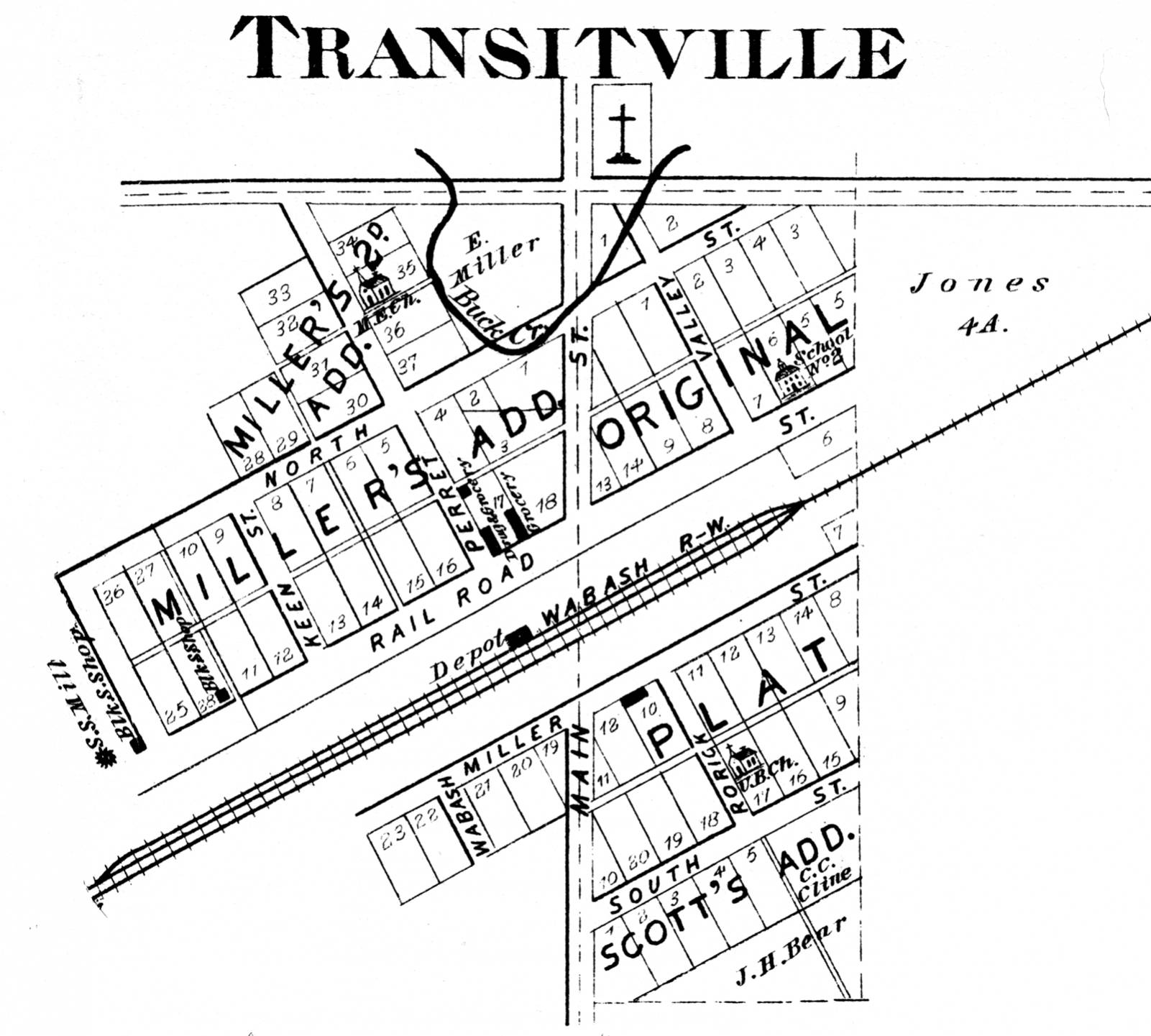
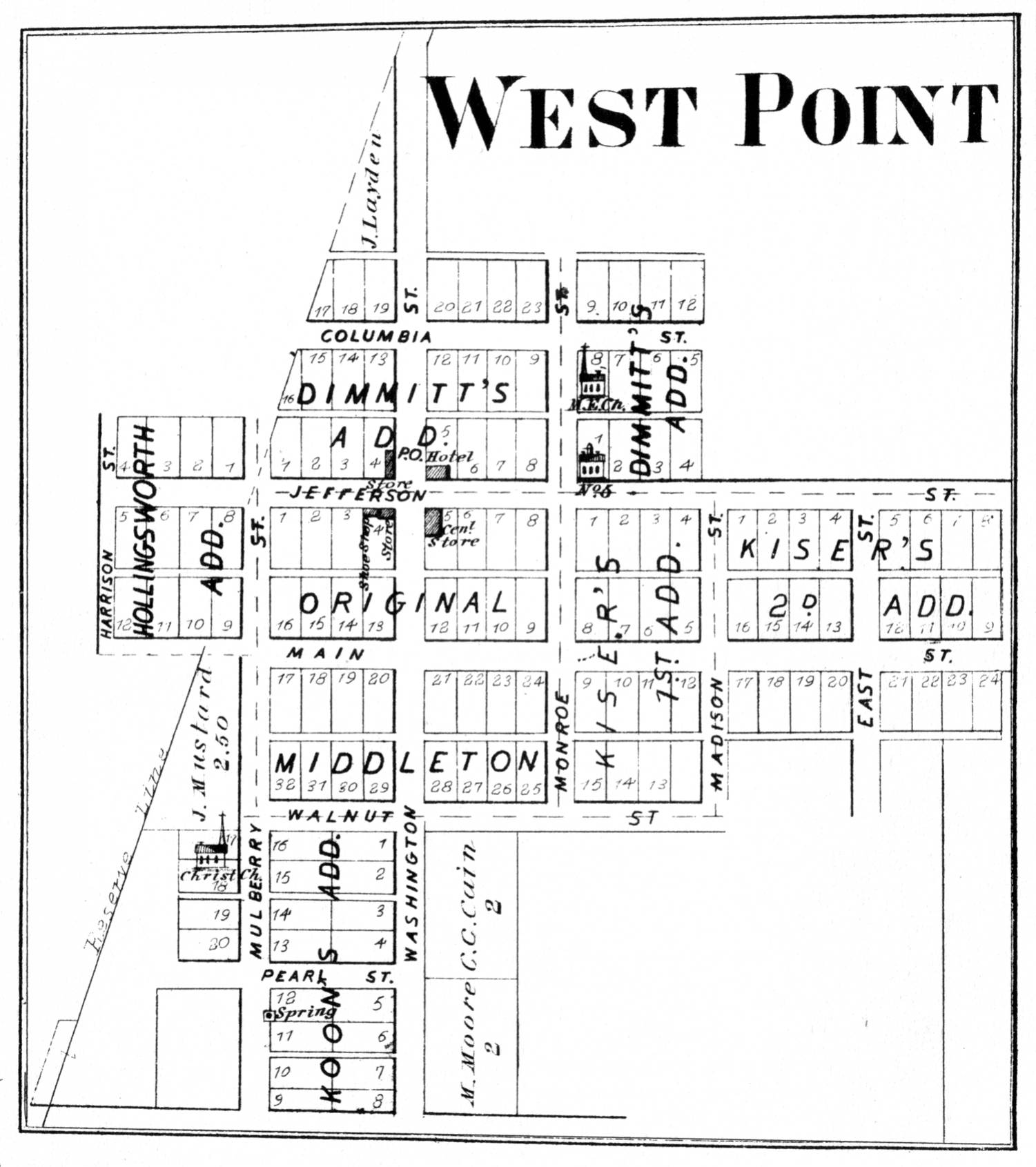
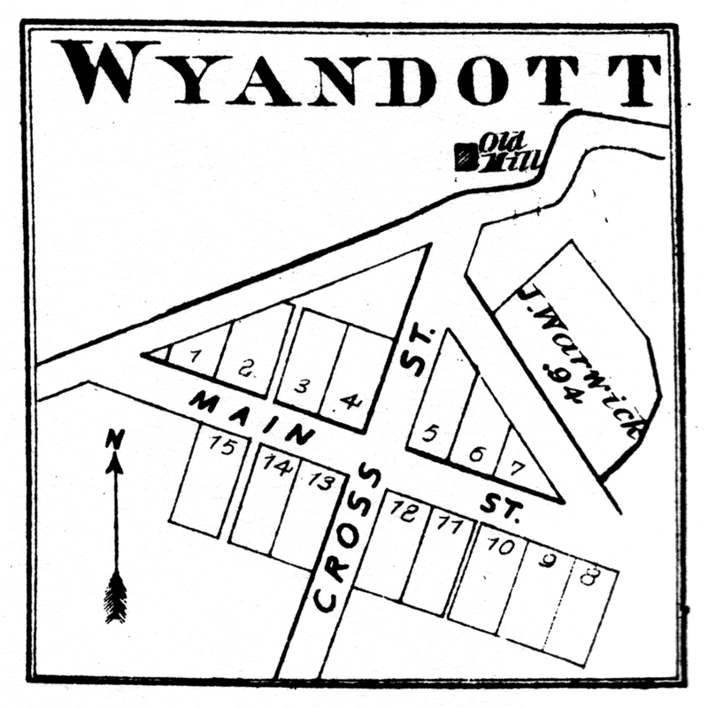
Romney - Stockwell - Transitville (now Buck Creek) - West Point - Wyandott