| Halstead |
--- |
1818 |
Burial Listing |
Brookville |
S9-T11N-R13E
39.4358N,
85.0789W |
6 miles west of Brookville on Levy Road. PHOTOS BY CEMETERY COMMISSION. |

|
RESTORED 2005 |
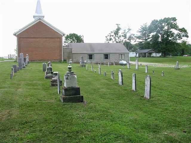
| Hamburg Catholic |
St Ann's |
1869 |
Burial Listing |
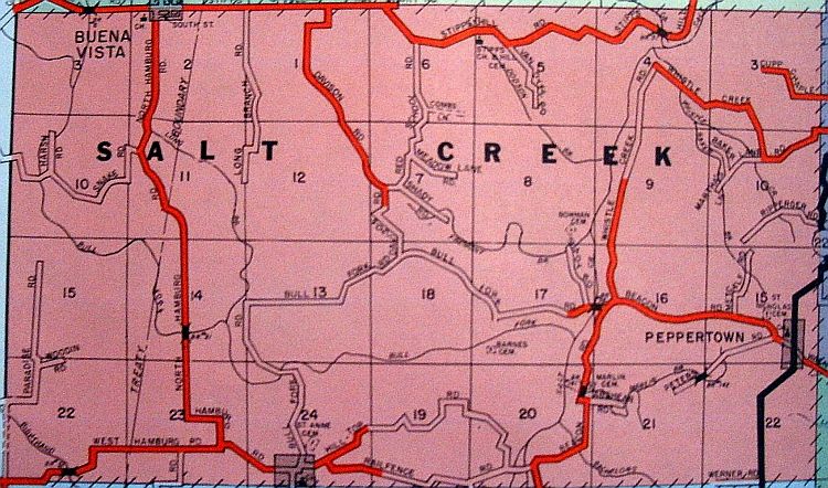
Salt Creek |
S24-T11N-R11E
39.3864N,
85.2467W |
Located on northside of Hilltop Road near intersection of
Rail Fence Road, north of Hamburg. |
|
Excellent |
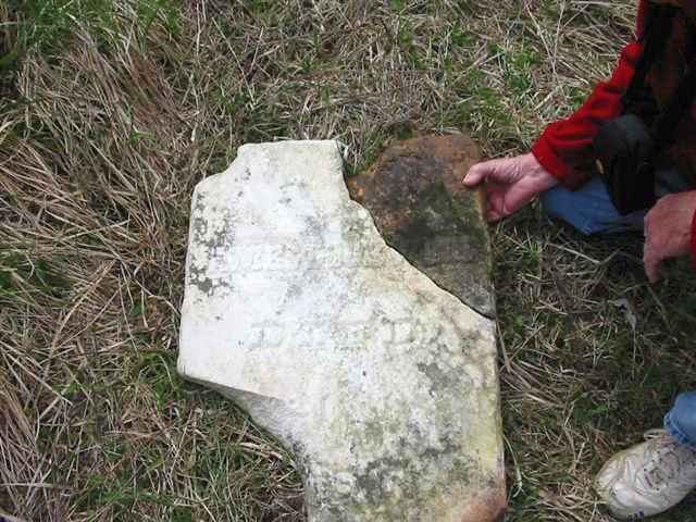
| Hancock |
--- |
Unknown |
Notes |
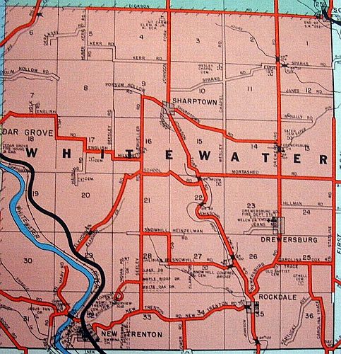
Whitewater |
S11-T8N-R1W |
No stones left in the cemetery. Exact location unknown. |
|
Unknown |
| Hansel |
--- |
1818 |
Burial Listing |
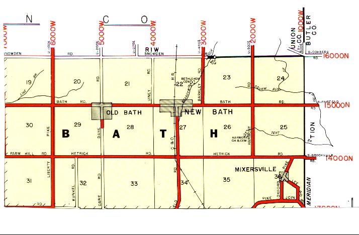
Bath |
S25-T10N-R1W
39.5059N,
84.8175W |
2.5 miles east of Bath on Bath Road. PHOTO BY CEMETERY COMMISSION. (Person in photo is Clayton Brack who helps in Bath Twp.) |
|
Unknown |
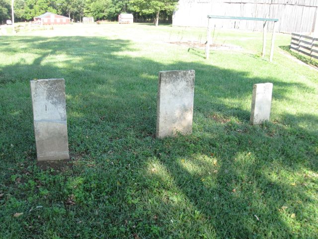
| Harding |
Berg-Harding, John Harding |
1838 |
Burial Listing |
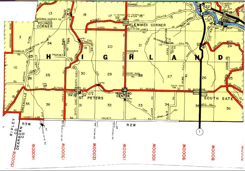
Highland |
S13-T8N-R2W |
On land formerly owned by the Harding Family. East of State Road 1. PHOTO BY CEMETERY COMMISSION. |
|
RESTORED 2005 |
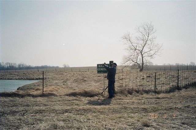
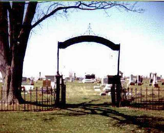
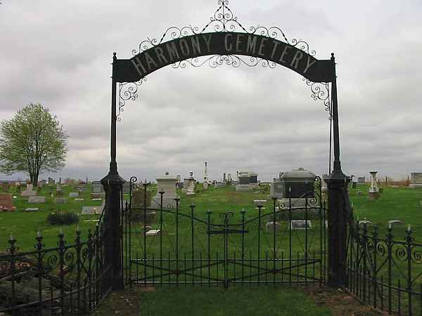
| Harmony |
--- |
1838 |
Burial Listing |
Bath |
S26-T10N-R1W
39.4978N,
84.8350W |
Located on west side of Harmony Road. PHOTO 2 BY CEMETERY COMMISSION. |
|
Fair |
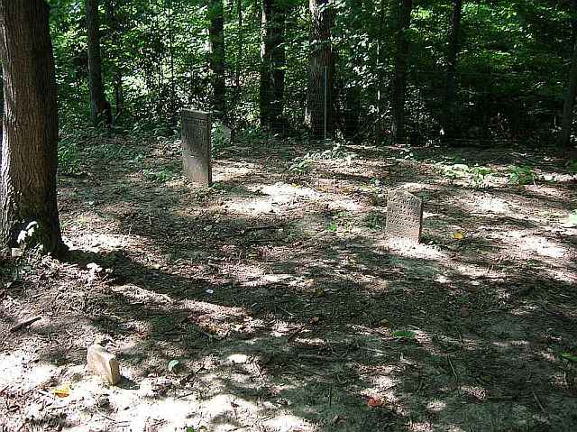
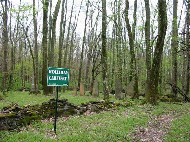
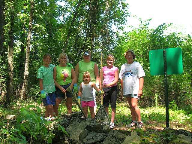
| Holliday |
--- |
1827 |
Burial Listing |
Brookville |
S36-T9N-R2W
39.3978N,
84.9358W |
4 miles east of Brookville and 1.5 miles south of State Road 252 on Whitcomb Road South. Picture 2 shows a group of Girl Scouts who cleaned up the cemetery some years ago. PHOTOS BY CEMETERY COMMISSION. |
|
RESTORED 2005 |
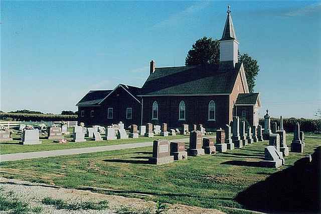
| Holy Family |
--- |
1861 |
Burial Listing |
Ray |
S4-T10N-R2E
39.3436N,
85.2042W |
Located in Oldenburg. The Sisters of St. Francis cemetery, listed as Oldenburg Catholic, is beside this cemetery but separated by a fence. PHOTOS BY CEMETERY COMMISSION. |
|
Excellent |
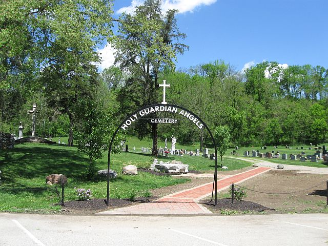
| Holy Guardian Angel |
Cedar Grove Catholic |
Unknown |
Burial Listing |
Highland |
S13-T8N-R2W
39.3586N,
84.9378W |
Located in Cedar Grove. PHOTO #3 BY DON DUNAWAY. |
| Unknown |
| Hopewell |
--- |
1830 |
Burial Listing |
Rush Co, IN |
S20-T12N-R11E
39.4742,
85.3176W |
On Rush Co Rd 700E, South of St Rd 244, approx 1 mi West of Andersonville |
|
Unknown |
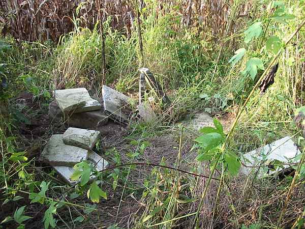
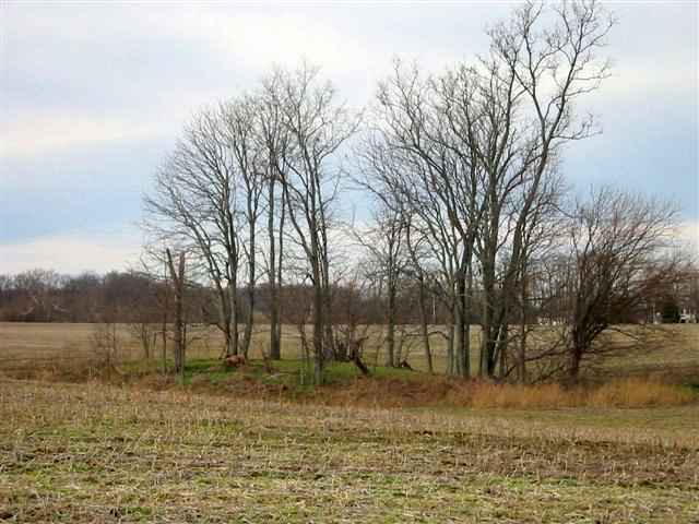
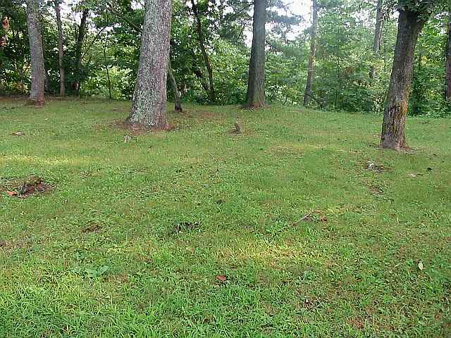
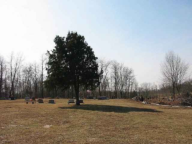
| Hughes Farm |
--- |
Unknown |
Notes |
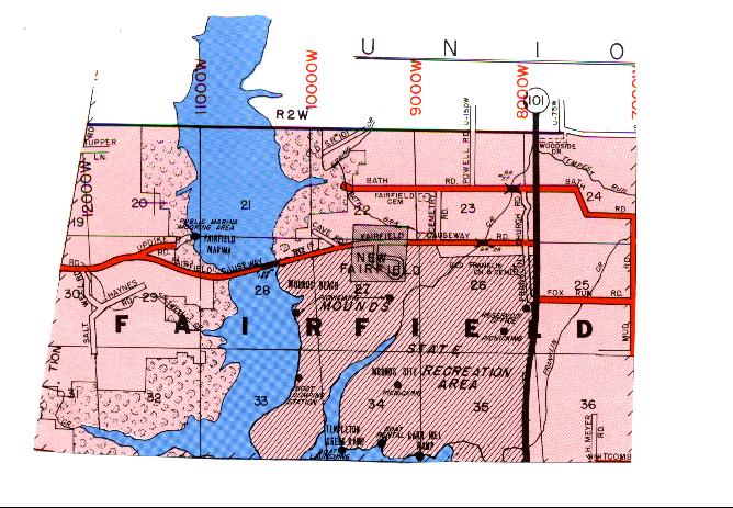
Fairfield |
S32 |
South of Causeway Rd off Saltwell Rd, 1.3 miles South of the end of the road. |
|
Poor |
| Huntersville |
St John |
1836 |
Burial Listing |
Ray |
S19-T10N-R12E |
Located on north side of the extension of Columbus Avenue just west of Batesville. |
|
Unknown |
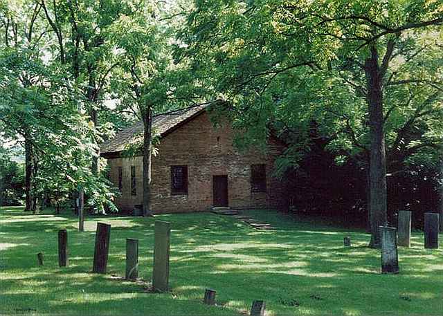
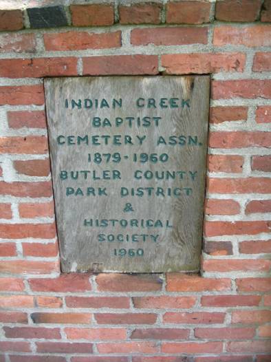
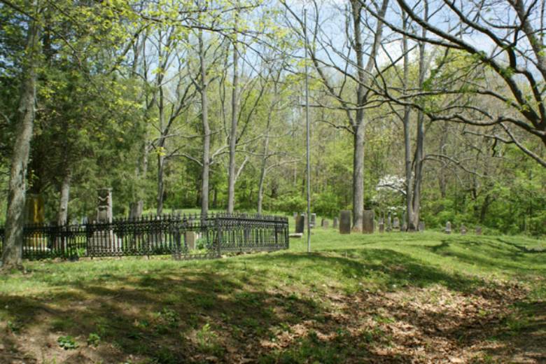
| Indian Creek Burial Ground |
--- |
1812 |
Burial Listing |
Butler Co OH |
39.4647N
84.7849W |
Located just across the Indiana-Ohio State Line in Butler County, Ohio. The Indian Creek church was a daughter church of the Little Cedar Grove Baptist Church. One of the latter's ministers, Rev. William Tyner rode cross county from here to there. The church was built c. 1830. The cemetery dates from 1812 and was the first burial ground in Butler County. It is maintained by the Butler County Park Board, and repairs were made to the stones in 2005. PHOTO BY CEMETERY COMMISSION. |
|
Good |
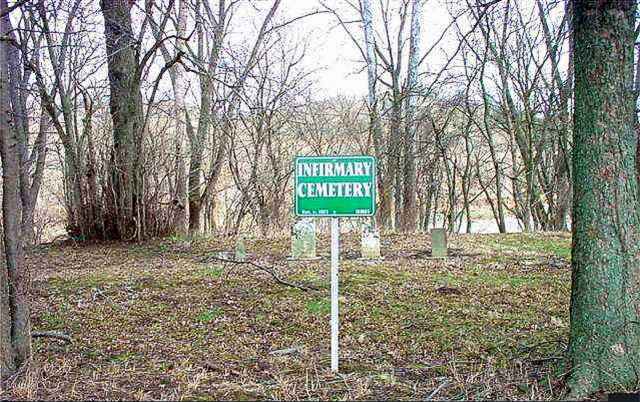
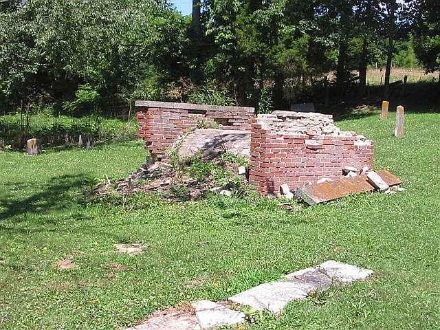
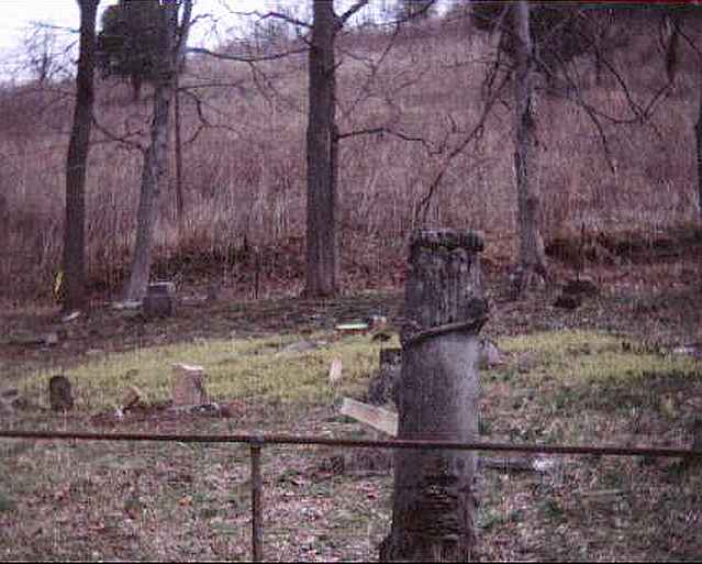
| Infirmary |
Poor Farm |
1815 |
Burial Listing |
Brookville |
S32-T9N-R2W
39.4056N,
85.0125W |
Located off Blue Creek Rd, opposite the Franklin County Park. The tombstones shown behind the sign in the picture are actually in the Stringer Family Cemetery, and the Infirmary Cemetery is the field in front. There are no markers in the field. We do not know the location of any graves but our research indicates sixty or more inmates were buried in the Infirmary Cemetery. The ground was farmed at one time. PHOTOS BY CEMETERY COMMISSION. |
|
RESTORED 2010 |
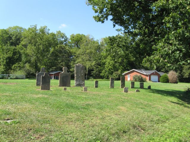
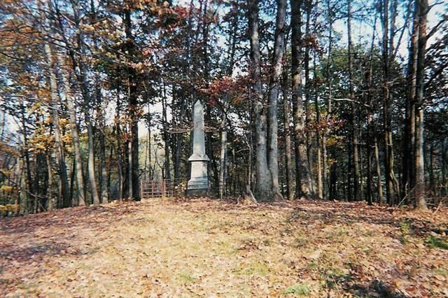
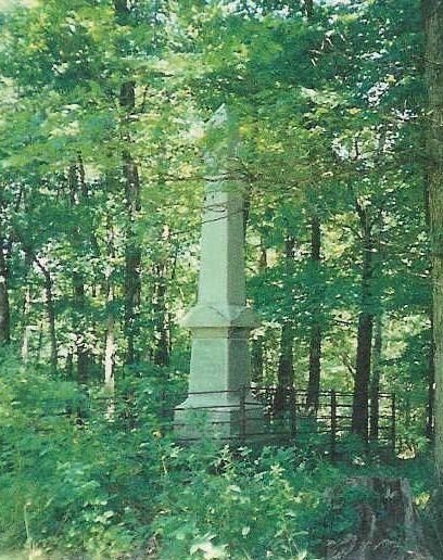
| Jones-Gloshen |
Jones-Clawson,
John Alley
Frank White |
1830 |
Burial Listing |
Butler |
S21-T11N-R13E
39.3839N,
85.0800W |
2.5 miles west of Oak Forest on Pump House Road. PHOTO BY CEMETERY COMMISSION. |
| RESTORED 2007 |
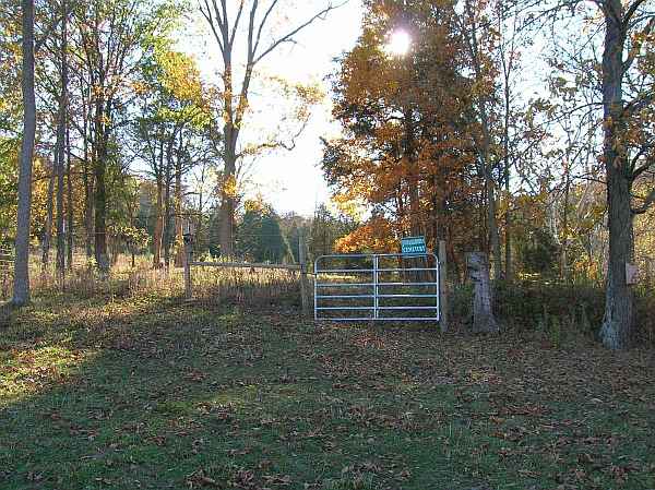
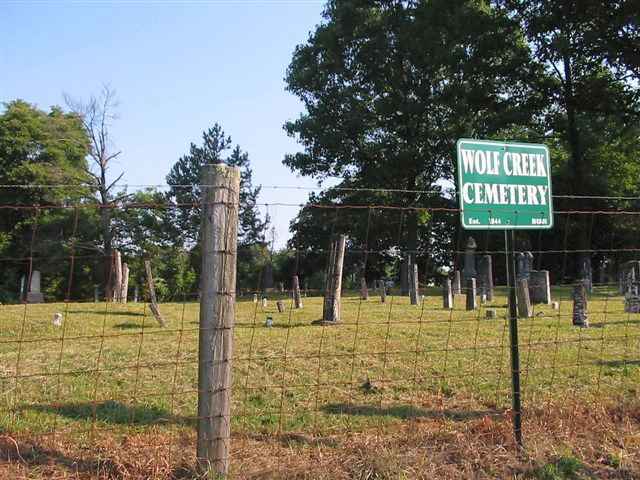
| Jones-Lanning |
Wolf Creek |
1844 |
Burial Listing |
Butler |
--- |
.3 miles east of Oak Forest junction of St Mary's and Wolf Creek Roads. PHOTO BY CEMETERY COMMISSION. |
|
Very Good |
| Klemme's Corner |
St Peter UCC, Gobel's Creek, Blue Creek |
1845 |
Burial Listing |
Highland |
S17-T8N-R2W
39.3547N,
85.0039W
39.3574N,
85.0067W |
Old cemetery on Highland Center Road, new cemetery on Bossert
Road just west of Klemme's Corner. PHOTOS 2 & 3 BY CEMETERY COMMISSION. |
|
Excellent |
| Klemme's Corner |
Trinity Lutheran |
1849 |
Burial Listing |
Highland |
S16-T8N-R2W
39.3508N,
85.0033W |
On east side of Highland Center Road at intersection of James Road south of Klemme's Corner. PHOTO 2 BY CEMETERY COMMISSION. |
|
Excellent |
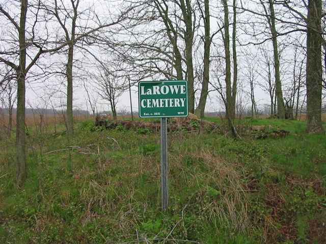
| LaRowe |
LaRue |
1835 |
Burial Listing |
Whitewater |
S11-T8N-R1W
39.3761N,
84.8383W |
PHOTOS BY CEMETERY COMMISSION. |
|
RESTORED 2009 |
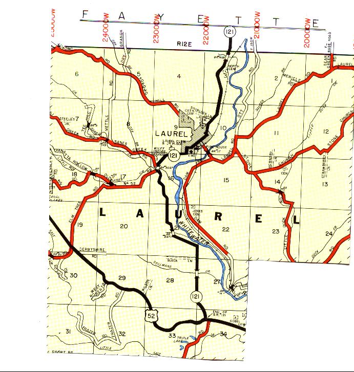
| Laurel Old Catholic |
St Raphael |
1876 |
Burial Listing |
Laurel |
S9-T12N-R12E
39.5047N,
85.1872W |
Located between Kokomo Hill Road and Commerce Street at the west edge of Laurel. |
|
Unknown |
| Laurel North |
--- |
1836 |
Burial Listing |
Laurel |
S3-T12N-R112E
39.5208N,
85.1778W |
1 mile northeast of Laurel on State Road 121 |
|
Excellent |
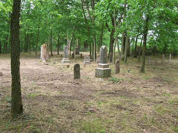
| Laurel Township |
Adjacent to Conwell Cem |
1832 |
Burial Listing |
Laurel |
S9/10-T12N-R12E
39.5053N,
85.1853W |
Located on State Road 121 at the top of the hill on the northside of the town of Laurel. |
|
Fair |
| Liberty Church |
--- |
1855 |
Burial Listing |
Brookville |
--- |
Not located |
|
Unknown |
| Little Cedar Grove Baptist |
--- |
1810 |
Burial Listing |
Brookville |
S3-T8N-R2W
39.3872N,
84.9817W |
One stone is in church. Cemetery has a number of unmarked graves. |
|
Unknown |
| Little Cedar Public |
--- |
1821 |
Burial Listing |
Brookville |
S4-T8N-R2W
39.3900N,
84.9853W |
West of Little Cedar Baptist Church on State Road 52, cross Little Cedar Creek, west end of north field and up a steep hill over private land. PHOTOS BY CEMETERY COMMISSION. |
|
RESTORED 2006 |
| Little Children |
Little Children's Home |
1974 |
Burial Listing |
Blooming Grove |
S6-T12N-R13E
39.5139N,
85.1211W |
PHOTO BY CEMETERY COMMISSION. |
|
Unknown |
| Lockwood |
--- |
Abt 1838 |
Burial Listing |
Posey |
--- |
PHOTO BY CEMETERY COMMISSION. |
|
Exact location not known |
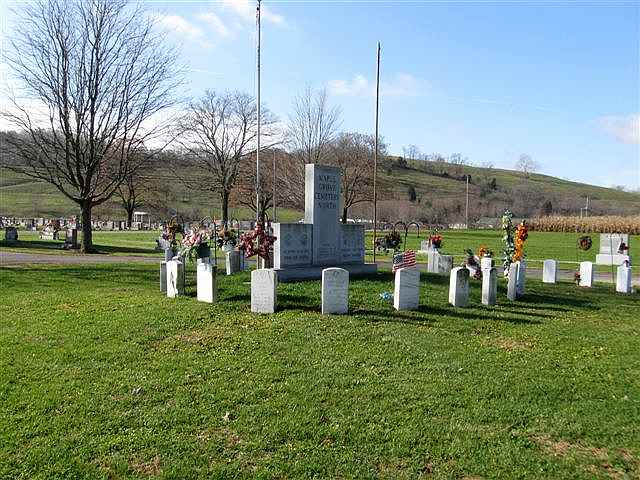
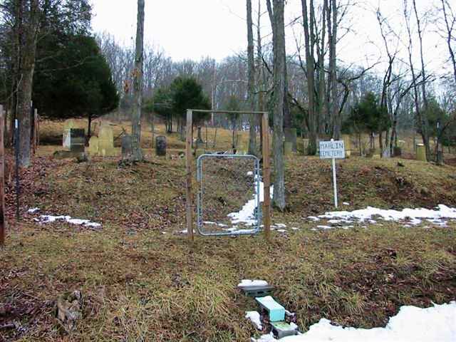
| Marlin |
--- |
1850 |
Burial Listing |
Salt Creek |
S20-T11N-R12E
39.3947N,
85.2083W |
East of Beacon road on Harvey's Branch Road..east side of roadway. PHOTO BY CEMETERY COMMISSION. |
|
RESTORED 2004 |
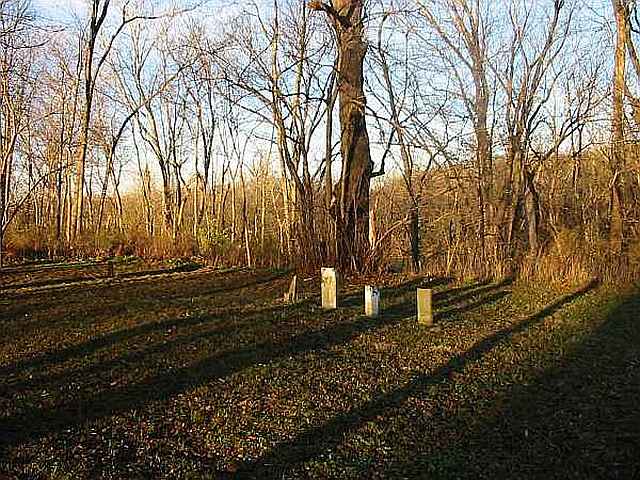
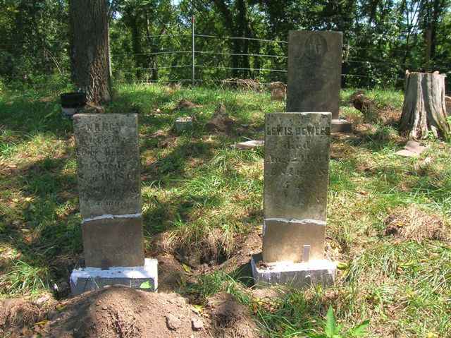
| Martin |
--- |
1819 |
Burial Listing |
Brookville |
S11-T11N-R13E
39.4189N,
85.0478W |
Located 2 miles west of Brookville on River Road. Access is via Levee Road. PHOTOS BY CEMETERY COMMISSION. |
|
RESTORED 2014 |
| McKendrie |
McKenzie |
1840 |
Burial Listing |
Metamora |
S29-T12N-R13E
39.4664N,
85.0925W |
The correct name of this cemetery is McKendrie, not McKendric as shown on the county map. A portion of cemetery is in Brookville Township. Located south of McGuire Ridge Road. PHOTO 2 BY CEMETERY COMMISSION. |
|
RESTORED 2009 |
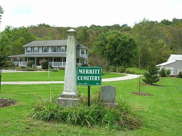
| Merritt |
--- |
1879 |
Burial Listing |
Brookville |
S12-T8N-R3W
39.3725N,
85.0414W |
Located on westside of Blue Creek Road, north of Cane Mill Road. PHOTO 2 BY CEMETERY COMMISSION. |
|
RESTORED 2005 |
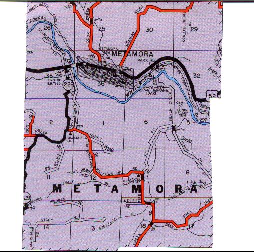
| Metamora |
Duck Creek |
1845 |
Burial Listing |
Metamora |
S36-T12N-R12E
39.4517N,
85.1389W |
Located on eastside of Duck Creek Road. PHOTOS 2 & 3 BY CEMETERY COMMISSION and are of the old section of the cemetery. |
|
RESTORED 2012 |
| Metamora Township |
--- |
|
Burial Listing |
Metamora |
S1-T11N-R12E |
--- |
|
Unknown |
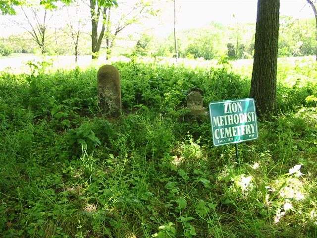
| Methodist |
Zion Methodist |
1872 |
Burial Listing |
Whitewater |
S16-T8N-R1W
39.3539N,
84.8839W |
Intersection of English Hill and Mueller Road, south of
English, west of Mueller. PHOTO BY CEMETERY COMMISSION. |
|
RESTORED BY WHITEWATER TWP TRUSTEE IN 2009 |
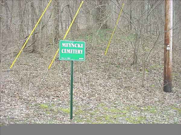
| Meyncke Hill |
Meyncke |
1862 |
Burial Listing |
Brookville |
S5-T8N-R2W
39.3881N,
85.0014W |
PHOTO BY CEMETERY COMMISSION. |
|
Poor |
| Miller |
--- |
1850 |
Burial Listing |
Whitewater |
S17-T8N-R1W
39.3525N,
84.0994W |
3240 Haining Rd, New Trenton. PHOTO BY CEMETERY COMMISSION. |
|
Poor |
| Mixerville |
Gray Private |
1823 |
Burial Listing |
Bath |
S36-T10N-R1W
39.4908N,
84.8172W |
1 mile south and 2.5 miles east of Bath and northeast of Mixerville, southside of Brookville Road in pasture. |
|
RESTORED 2004 by Bruce Coleman Family |
| Mountain Assembly of God |
--- |
1950 |
Burial Listing |
Metamora |
--- |
On St Rd 229 atop Haytown Hill Rd. |
|
Unknown |
| Mt Carmel |
--- |
1827 |
Burial Listing |
Springfield |
S33-T9N-R1W
39.4067N,
84.8872W |
West of Mt Carmel on south side of State Road 252. |
|
Excellent |
| Mt Carmel Presbyterian |
Presbyterian at Mt Carmel |
1828 |
Burial Listing |
Springfield |
S28-T9N-R1W
39.4083N,
84.8747W |
On northside of State Road 252 in Mt Carmel. PHOTOS BY CEMETERY COMMISSION. |
|
Poor |
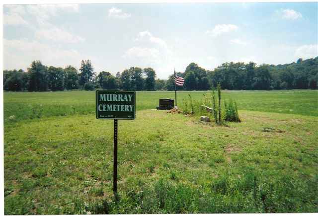
| Murray |
--- |
1836 |
Burial Listing |
Metamora |
S26-T12N-R12E
39.4653N,
85.1569W |
PHOTO BY CEMETERY COMMISSION. |
|
Good |
| New Trenton |
Possum Hollow? |
1817 |
Burial Listing |
Whitewater |
S32-T8N-R1W
39.3142N,
84.9025W |
North of New Trenton on east side of US 52. PHOTO 2 BY CEMETERY COMMISSION. |
|
RESTORED BY ROY HALL, WHITEWATER TWP TRUSTEE, IN 2005 |
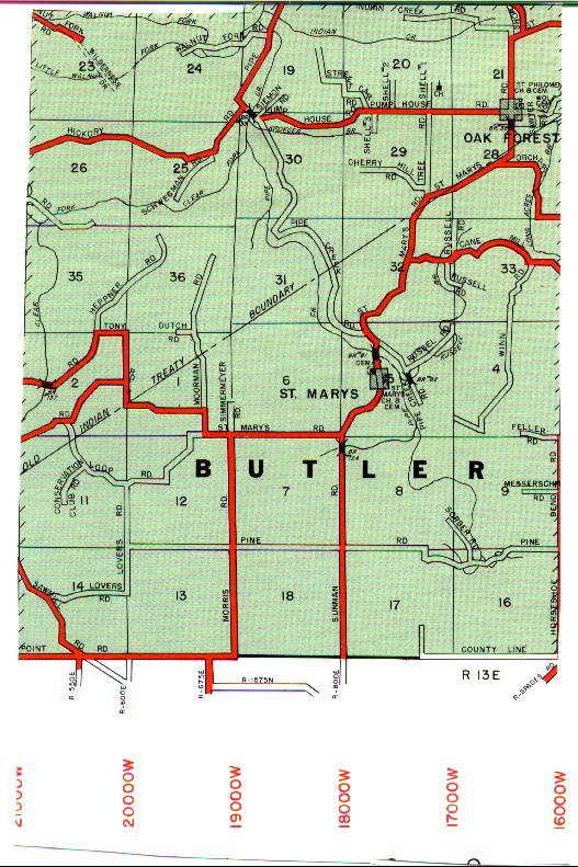
| Oak Forest Catholic |
St Cecelia |
1873 |
Burial Listing |
Butler |
S21-T11N-R13E
39.3858N,
85.0842W |
On east side of St Mary's Road at Oak Forest. |
|
Unknown |
| Old Brick |
--- |
1848 |
Burial Listing |
Posey |
S11-T12N-R11E
39.4997N,
85.2789W |
East side of Scott Road, north of US 52 northeast of Andersonville. PHOTO BY DON DUNAWAY. |
|
RESTORED 2007 |
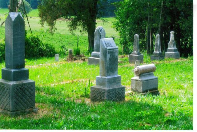
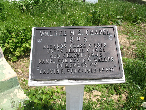
| Old Chapel |
Walker Chapel, Union Chapel |
1818 |
Burial Listing |
Butler Co, OH |
39.4578N
84.8068W |
Reily Township, Butler Co, OH |
|
Unknown |
| Old Franklin |
--- |
1810 |
Burial Listing |
Fairfield |
S26-T10N-R2W
39.5061N,
84.9492W |
Located on South Franklin Church Road near Fairfield Causeway Road on the west side of the roadway. PHOTO BY DON DUNAWAY. |
| Good |
| Old Johnson Fork Baptist |
Baptist |
1815 |
Burial Listing |
Whitewater |
S26-T8N-R1W
39.3272N,
84.8389W |
1 mile south of Drewersburg, on the corner of Drewersburg Road and Carolina Trace Road. |
|
Excellent |
| Oldenburg Catholic |
Sisters of St Francis |
1867 |
Burial Listing |
Ray |
S4-T10N-R2E
39.3436N,
84.9378W |
In Oldenburg, adjacent to Holy Family Cemetery |
|
Excellent |
| Osborn-Harvey |
St Mary's Public |
1848 |
Burial Listing |
Butler |
S5-T10N-R13E
39.3486N,
85.1092W |
On west side of St Mary's Road across from St Mary's Catholic Cemetery. PHOTOS BY CEMETERY COMMISSION. |
|
Good |
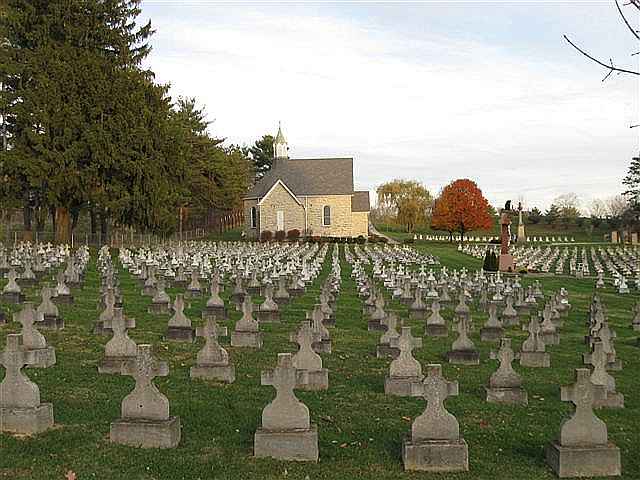
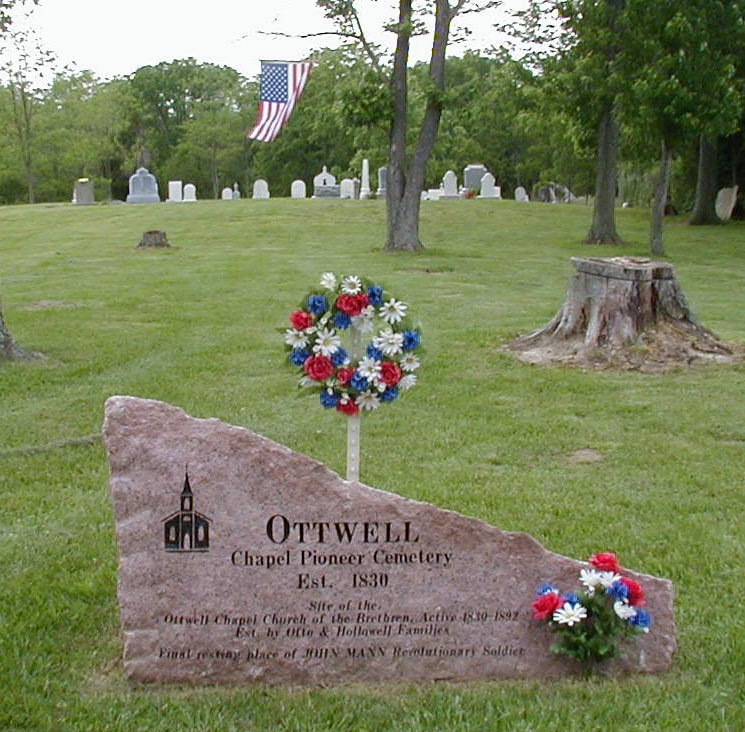
| Ottwell |
Ottwell Chapel, Otwell |
1830 |
Burial Listing |
Whitewater |
S25-T8N-R1W
39.3236N,
84.8278W |
West side of Carolina Trace Road, South of the junction with Cox Road. PHOTOS BY MERLE & RUTH SCHLEMMER |
|
RESTORED 1999 by Merle & Ruth Cox Schlemmer
and later by WHITEWATER TWP TRUSTEE |
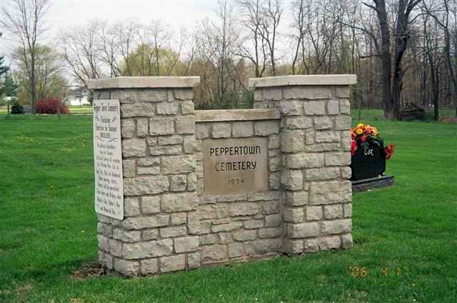
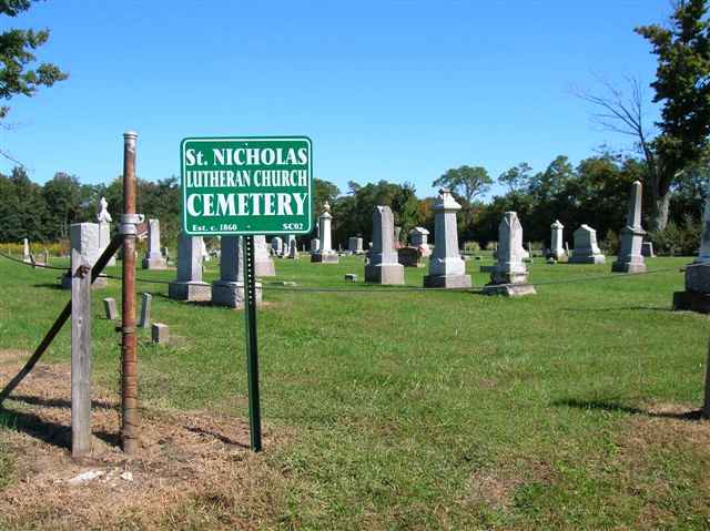
| Peppertown German Lutheran |
St Nicholas |
1860 |
Burial Listing |
Salt Creek |
S15-T11N-R12E
39.4025N,
85.1783W |
On northside of Beacon Road just west of Peppertown. PHOTOS BY CEMETERY COMMISSION. |
|
RESTORED BY PEPPERTOWN CEMETERY ASSN IN 2012 |
| Peppertown Public |
--- |
1850 |
Burial Listing |
Salt Creek |
S15-T11N-R12E
39.4017N,
85.1786W |
On southside of Beacon Road west of Peppertown. |
|
Unknown |
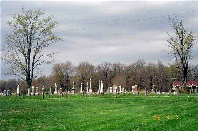
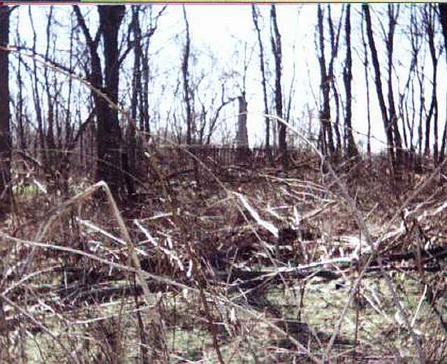
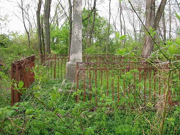
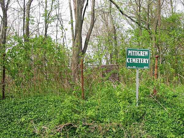
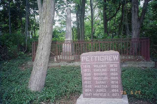
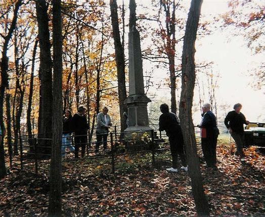
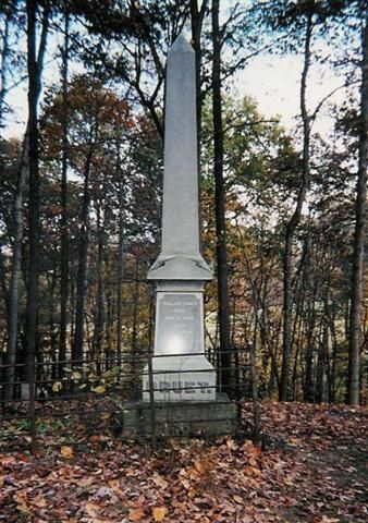
| Pettigrew |
--- |
1838 |
Burial Listing |
Blooming Grove |
S11-T12N-R13E
39.5022N,
85.0503W |
One mile east of Blooming Grove, south of Fairfield Causeway Road. PHOTOS BY CEMETERY COMMISSION. |
|
RESTORED 2007 by Daniel Wyatt as an Eagle Scout Project |
| Poor Farm |
Infirmary |
1815 |
Burial Listing |
Brookville |
S32-T9N-R2W
39.4056N,
85.0125W |
Located off Blue Creek Rd, opposite the Franklin County Park. The tombstones shown behind the sign in the picture are actually in the Stringer Family Cemetery, and the Infirmary Cemetery is the field in front. There are no markers in the field. We do not know the location of any graves but our research indicates sixty or more inmates were buried in the Infirmary Cemetery. The ground was farmed at one time. PHOTOS BY CEMETERY COMMISSION. |
|
RESTORED 2010 |
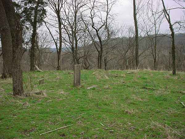
| Posey Twp (abandoned) |
--- |
|
Burial Listing |
Posey |
--- |
--- |
|
Poor |
| Possum Hollow? |
New Trenton |
1817 |
Burial Listing |
Whitewater |
S32-T8N-R1W
39.3142N,
84.9025W |
North of New Trenton on east side of US 52. PHOTO 2 BY CEMETERY COMMISSION. |
|
RESTORED BY ROY HALL, WHITEWATER TWP TRUSTEE, IN 2005 |
| Presbyterian at Mt Carmel |
Mt Carmel Presbyterian |
1828 |
Burial Listing |
Springfield |
S28-T9N-R1W
39.4083N,
84.8747W |
On northside of State Road 252 in Mt Carmel. PHOTOS BY CEMETERY COMMISSION. |
|
Poor |
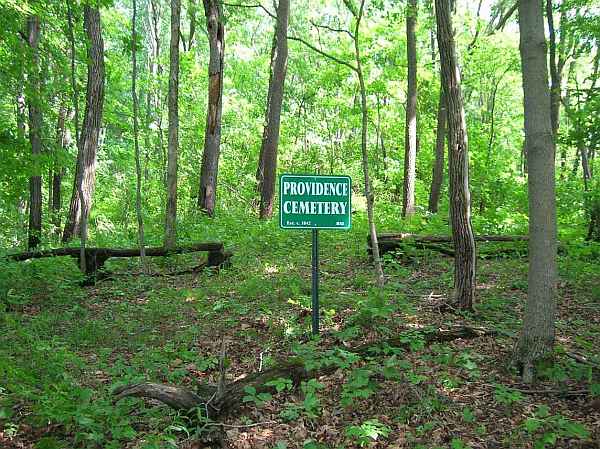
| Providence |
Providence Methodist |
1845 |
Burial Listing |
Butler |
S14-T10N-R12E
39.3192N,
85.1526W |
West of Lovers Lane Road near Oldenburg. PHOTO BY CEMETERY COMMISSION. |
|
RESTORED 2012 |
| Pruet |
--- |
1856 |
Burial Listing |
Posey |
--- |
Photos by Karen Pruet |
|
Unknown |
| Reid |
--- |
1817 |
Burial Listing |
Metamora |
--- |
At the west end of the town of Metamora, south of US 52 and west of Duck Creek Rd. PHOTO BY CEMETERY COMMISSION. |
|
Good |
| Riker Family |
--- |
1846 |
Burial Listing |
Brookville |
S33-T12N-R13E |
On east side of Goose Creek Road .6 mile from its junction with State Road 52. Access is difficult. PHOTOS BY CEMETERY COMMISSION. |
|
RESTORED 2006 |
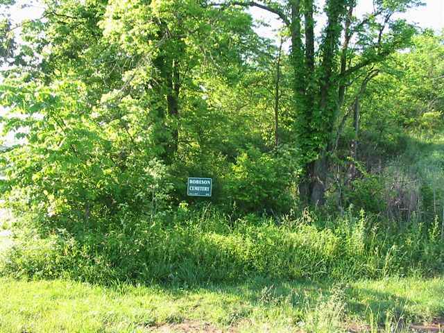
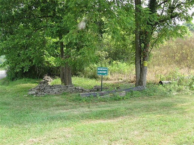
| Robeson |
--- |
1855 |
Burial Listing |
Brookville |
S7-T8N-R2W
39.3694N,
85.0386W |
3 miles Southwest of Brookville on the North side of Blue Creek Road. PHOTO #1 BY CEMETERY COMMISSION. PHOTO #2 BY DON DUNAWAY AFTER HE, ED BAKER AND WAYNE MONROE CLEARED IT ON A VOLUNTEER BASIS. (This cemetery was established after 1850 and cannot be restored with county funds.) |
|
Fair |
| Rudicel |
--- |
1850 |
Burial Listing |
Whitewater |
S20-T8N-R1W
39.3376N,
84.8829W |
1 mile South of Elkhorn Road, 200 ft East of Seeley Road. All stones have been removed. PHOTO BY CEMETERY COMMISSION; |
|
RESTORED 2012 |


