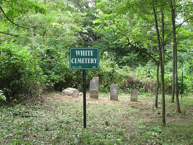
| Abel White |
--- |
1817 |
Burial Listing
Notes |
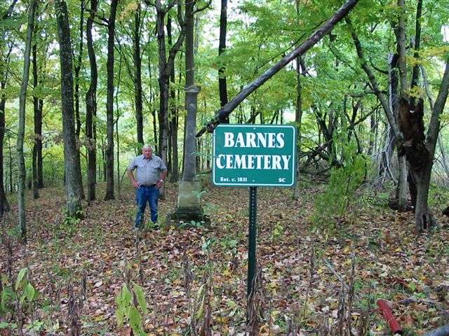
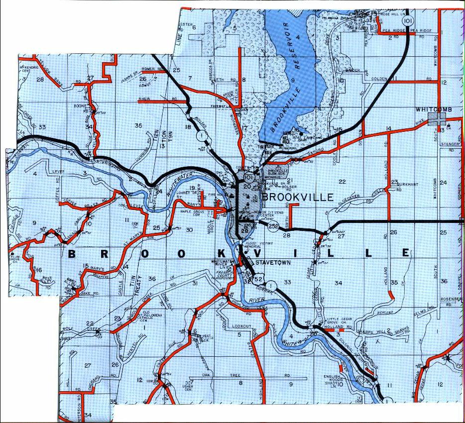
Brookville |
S24 |
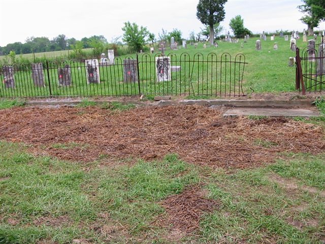
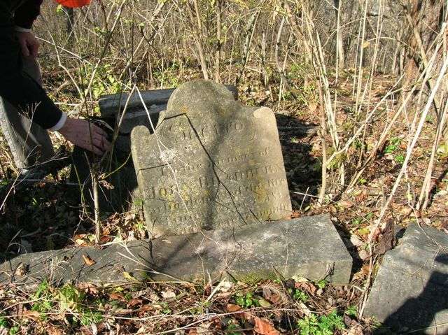
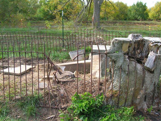
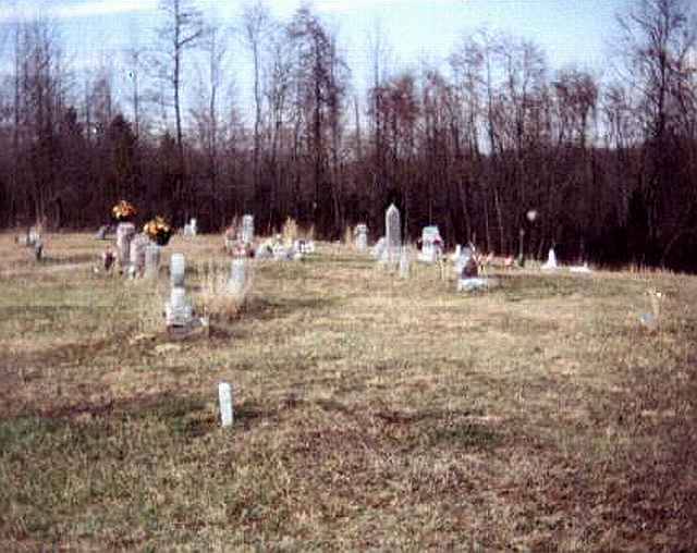
Located in the northwest corner of Section 24 of Brookville Twp, off Whitcomb Road. This cemetery involved the same White family as in Bath Twp which was restored in 2009. PHOTO BY DON DUNAWAY |
 |
RESTORED 2010 |
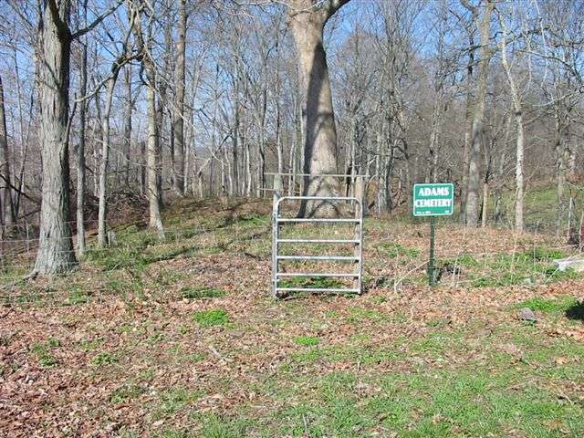
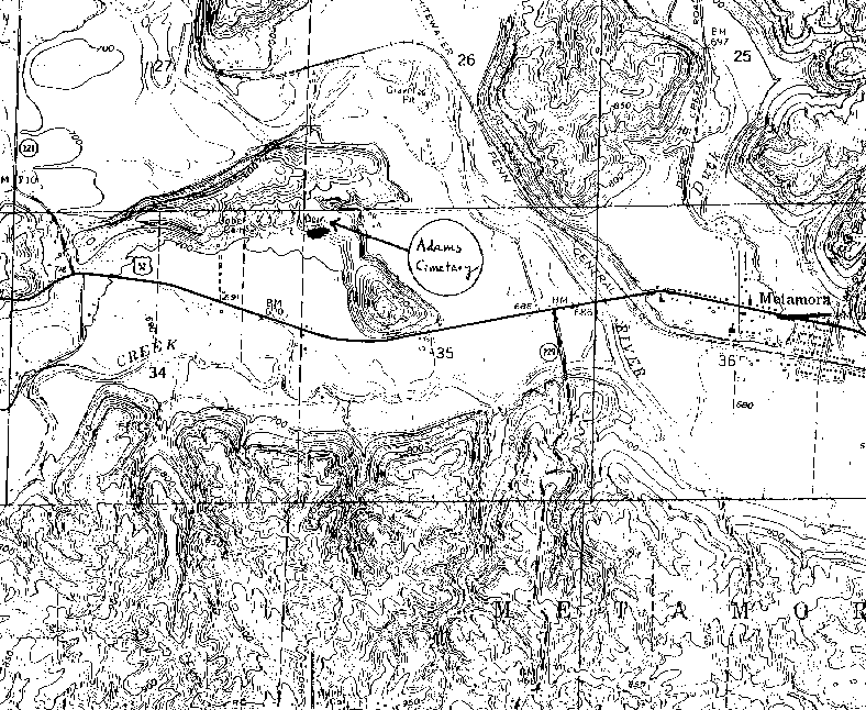
| Adams |
--- |
1826 |
Burial Listing |
Laurel |
S34-T12N-R12E
39.4536N,
85.1672W |
1/2 mile North of US 52, 2 miles West of Metamora. Located on private property with no public access. PHOTO BY CEMETERY COMMISSION |
|
RESTORED 2009 |
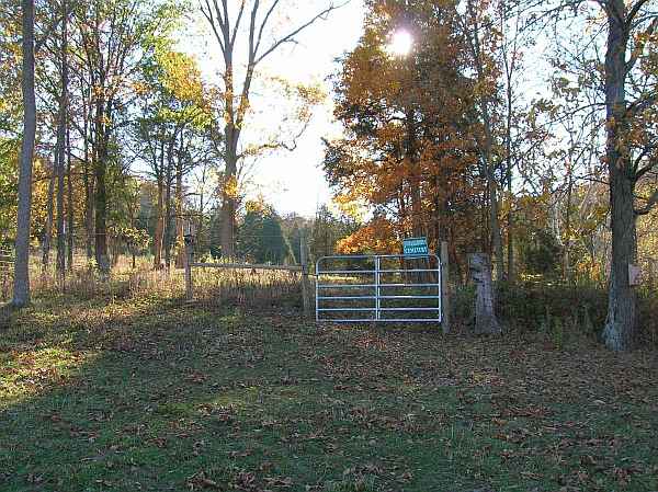
| Alden |
--- |
1844 |
Burial Listing |
Dearborn Co |
S23-T8N-R3W
39.2592N,
85.0744W |
On West County Line Road, south of Walters Road in Dearborn County |
|
Unknown |
| Alley, John |
Jones-Gloshen
Jones-Clawson
Frank White
Wolf Creek |
1830 |
Burial Listing |
Butler | S21-T11N-R13E
39.3839N,
85.0800W |
.3 miles east of Oak Forest junction of St Mary's and Wolf Creek Roads |
|
RESTORED 2007 |
| Alley-Wolf |
--- |
1879 |
Burial Listing |
Metamora | --- |
Intersection of Hundley Rd and Pipe Creek Rd, E. side of road. |
|
Fair |
| Altare |
--- |
Unknown |
Burial Listing |
--- |
--- |
--- |
|
Unknown |
| Ancient Grave Yard |
--- |
|
Burial Listing |
Brookville |
S20-T9N-R2 |
On Fairfield Avenue in Brookville east of 11th Street-no stones |
|
Unable to locate |
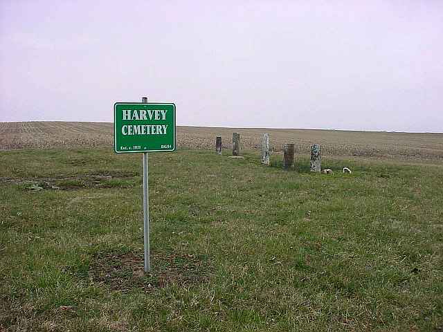
| Anspach Farm |
Harvey |
1821 |
Burial Listing |
Blooming Grove |
--- |
East of Blooming Grove, northside of Fairfield Causeway Road |
|
RESTORED 2005 |
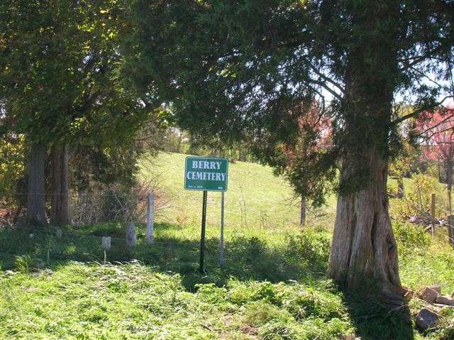
| Berry |
--- |
1834 |
Burial Listing |
Brookville |
S26-T9N-R2W
39.4164N,
84.9539W |
Located 3.5 miles east of Brookville on State Road 252 on the southside of the road, 500 south of 252 and east of Holland Road. PHOTOS BY CEMETERY COMMISSION |
|
RESTORED 2005 |
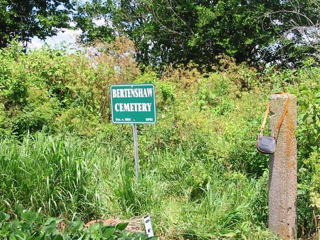
| Bertenshaw |
--- |
1865 |
Burial Listing |
Springfield |
S33-T9N-R1W
39.3937N,
84.8762W |
Cemetery is situated on a knoll south of small stream in the middle of a corn field. PHOTO BY CEMETERY COMMISSION (The commission cannot provide care for Bertenshaw, as it was established after 1850. |
|
Unknown |
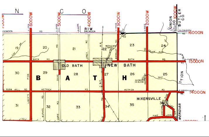
| Bethlehem |
--- |
1831 |
Burial Listing |
Bath |
S22-T10N-R1W
39.5156N,
84.8558W |
North on Barkley Road from Bath about 1/2 mile on the left. PHOTO 2 BY CEMETERY COMMISSION. |
|
RESTORED 2010 |
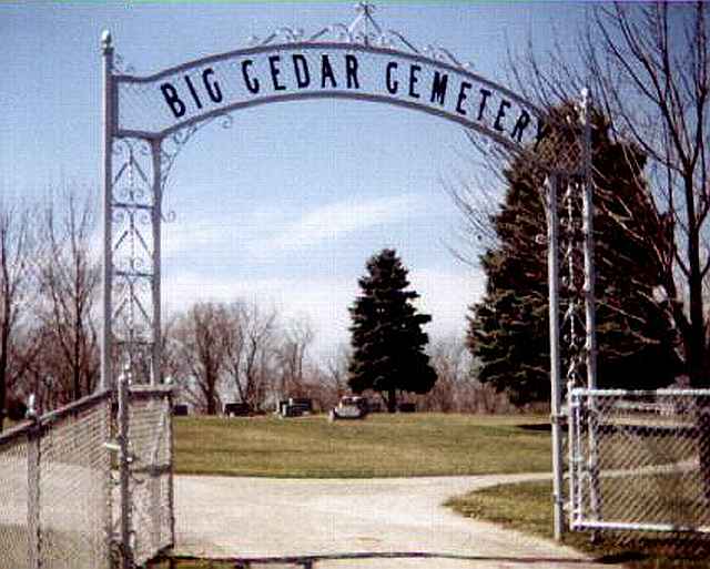
| Big Cedar |
Big Cedar Grove |
1817 |
Burial Listing |
Springfield |
S7-T9N-R1W
39.4517N,
84.9111W |
Located on Liberty Pike on the westside of the road. NOT A COMPLETE LISTING. |
|
PARTIALLY RESTORED BY PRIVATE CONTRIBUTIONS IN 2012 |
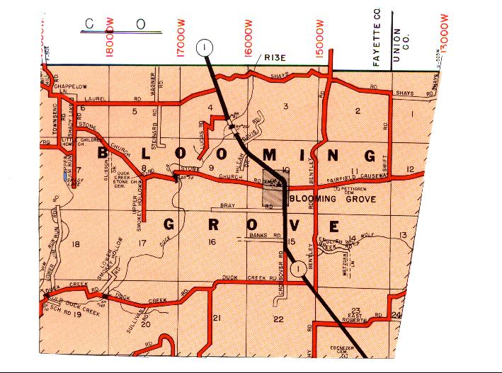
| Blooming Grove |
--- |
1811 |
Burial Listing |
Blooming Grove |
S10-T2N-R13E
39.5047N,
85.0639W |
Located on east side of State Road 1. PHOTOS 1 & 2 BY ED BAKER. |
|
RESTORED 2009 |
| Blue Creek Catholic |
St Jacob |
1838 |
Notes |
Dearborn Co |
S1-T7N-R3W
39.3064N,
85.0536W |
Located just south across the county line in Dearborn County
on west side of Blue Creek Road |
|
Unknown |
| Blue Creek |
St Peter UCC, Klemme's Corner, Gobel's Creek |
1845 |
Burial Listing |
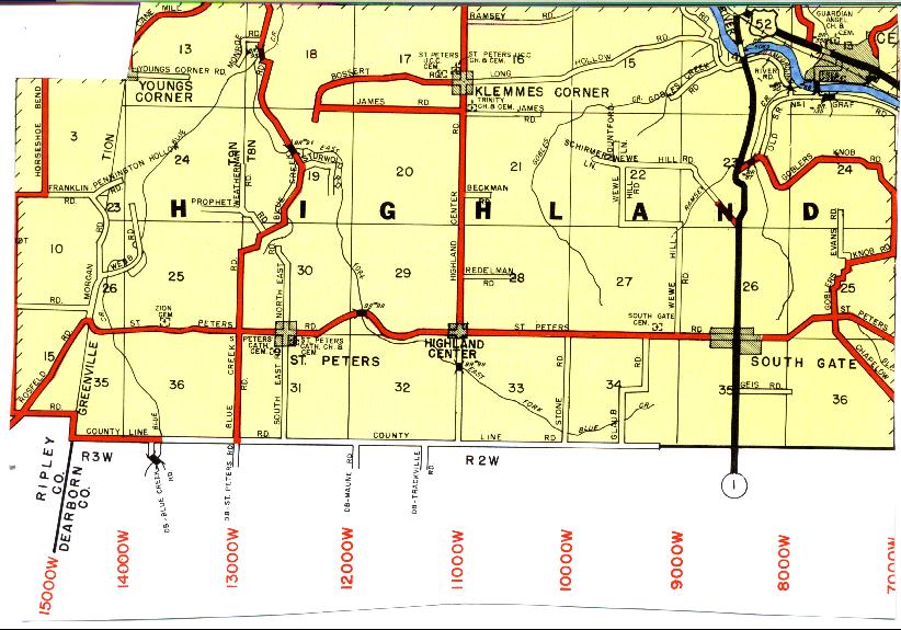
Highland |
S17-T8N-R2W
39.3547N,
85.0039W
39.3574N,
85.0067W |
Old cemetery on Highland Center Road, new cemetery on Bossert
Road just west of Klemme's Corner. PHOTOS 2 & 3 BY CEMETERY COMMISSION. |
|
Excellent |
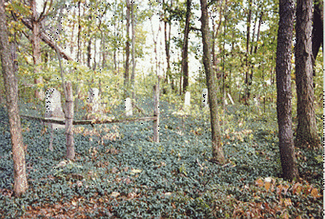
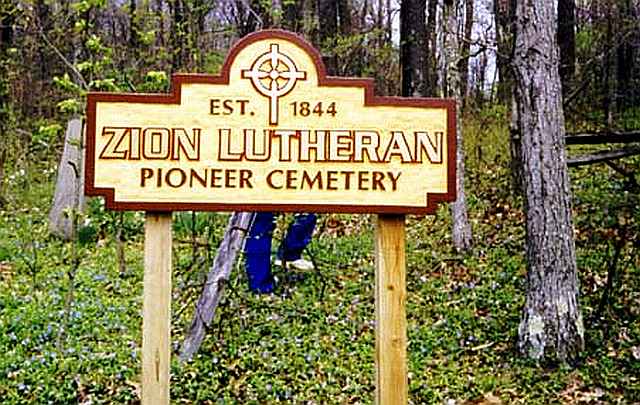
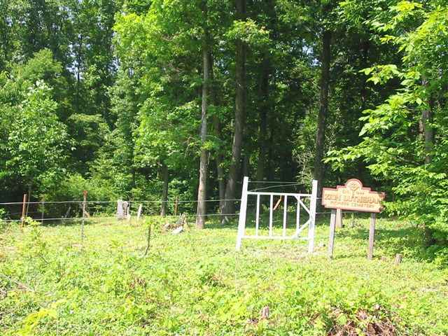
| Blue Creek Lutheran |
Zion Lutheran |
1844 |
Burial Listing |
Highland | S25-T8N-R3W
39.3222N,
85.0525W |
On Pine Road west of St Peter's. Cemetery is hidden from the road and difficult to find. PHOTO 3 BY CEMETERY COMMISSION. |
|
RESTORED 2006 |
| Bochim |
Bocum |
1810 |
Burial Listing |
Laurel |
S3-T12N-R12E
39.5203N,
85.1758W |
1 mile northeast of Laurel on State Road 121...east of Laurel North Cemetery |
|
Excellent |
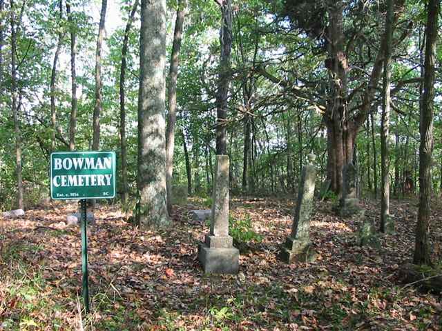
| Bowman |
--- |
1853 |
Burial Listing |
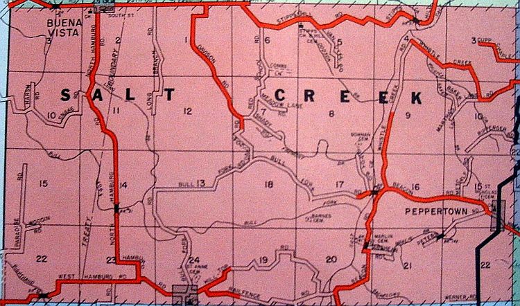
Salt Creek |
S8-T11N-R12E
39.4128N,
85.2136W |
On Shady Road, 1 mile north of Bull Fork Rd. PHOTO BY CEMETERY COMMISSION. |
|
Poor |
| Bradburn Family Cemetery |
--- |
1818 |
Burial Listing |
Brookville |
S28-T9N-R2W
39.4139N,
84.9825W |
On State Road 252 about 2 miles east of Brookville on a knoll 400 feet off the northside of the road. PHOTOS BY CEMETERY COMMISSION. |
|
RESTORED 2009 |
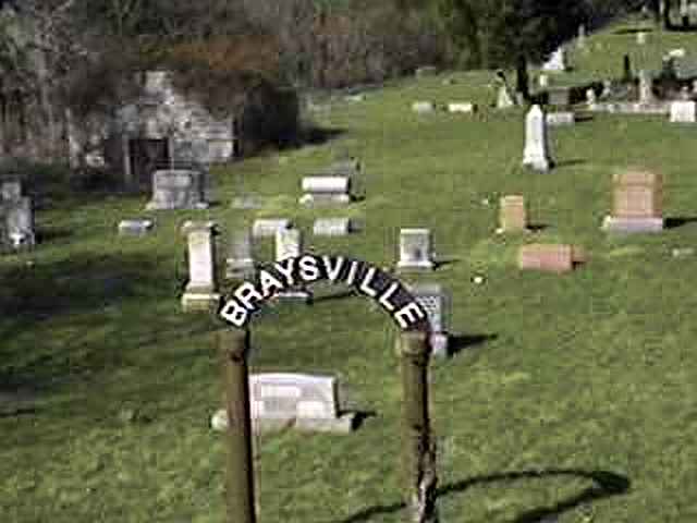
| Braysville (Longnecker) |
--- |
1818 |
Burial Listing |
Dearborn Co |
S10-T7N-R1W
39.2850N,
84.8692W |
On US 52 near junction of State Road 46 in Dearborn County |
|
Good |
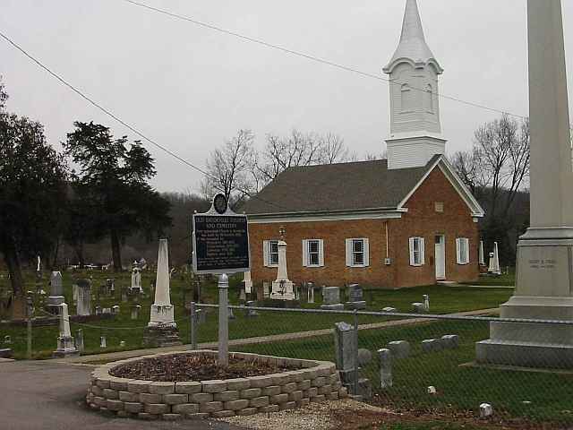
| Brookville Catholic |
St. Michael |
1854 |
Burial Listing |
Brookville |
S20-T9N-R2W
39.4303N,
85.0086W |
South of State Road 101 at north edge of Brookville PHOTOS 2 & 3 BY CEMETERY COMMISSION. |
|
Excellent |
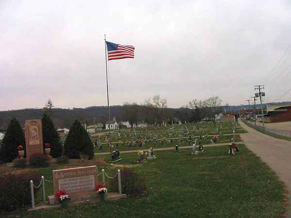
| Brookville Town |
Old Brookville |
1816 |
Burial Listing |
Brookville |
S20-T9N-R2W
39.4250N,
85.0100W |
Site of the old brick church. Restored with the help of a Dept. of the Interior Grant through the DNR. PHOTO 1 BY DON DUNAWAY. |
|
RESTORED 2009 |
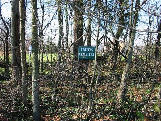
| Brookville Township |
Fruit |
1880 |
Burial Listing |
Brookville |
S22-T9N-R2W
39.4347N,
84.9828W |
PHOTO BY CEMETERY COMMISSION. |
|
Poor |
| Caldwell |
--- |
1815 |
Notes |
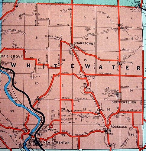
Whitewater |
--- |
On State Line Road and Sparks Road |
|
Poor |
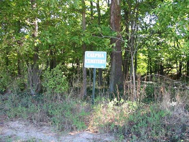
| Calpha |
Calfee |
1844 |
Burial Listing |
Brookville |
S10-T11N-R13E
39.4261N,
85.0711W |
On Coffee Road, 4 miles west of Brookville. PHOTOS BY CEMETERY COMMISSION. |
|
Poor |
| Cassiday |
--- |
Unknown |
Notes |
Brookville |
--- |
Not located. |
|
Unknown |
| Cedar Grove Catholic |
Holy Guardian Angel |
|
Burial Listing |
Highland |
S13-T8N-R2W
39.3586N,
84.9378W |
Located in Cedar Grove |
|
Unknown |
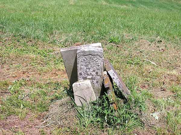
| Chance |
--- |
1829 |
Burial Listing |
Laurel |
S10-T12N-R12E
39.5025N,
85.1717W |
East of Laurel on Laurel-Blooming Grove Road. PHOTO BY CEMETERY COMMISSION. |
|
RESTORED 2010 |
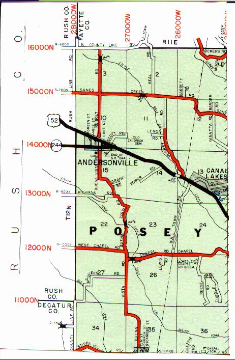
| Chapel |
--- |
1860 |
Burial Listing |
Posey |
S25-T12N-R11E
39.4669N,
85.2586W |
1.7 miles from junction of State Road 52 and Chapel Road. It is on the southside of the road and east of the Buena Southern Missionary Church. |
|
Good |
| Collect |
Warne |
1842 |
Burial Listing |
Brookville |
S2-T11N-R2W
39.4336N,
85.0472W |
Southside of US 52 3 miles west of Brookville |
|
Unknown |
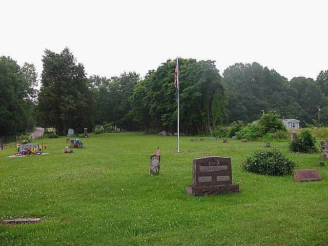
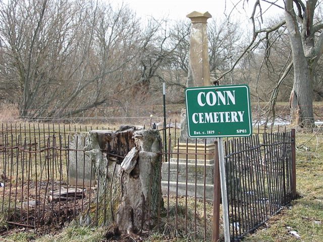
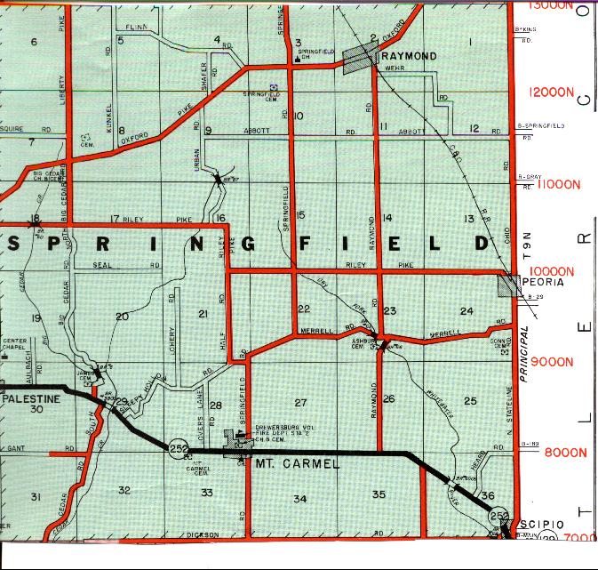
| Conn |
--- |
1819 |
Burial Listing |
Springfield |
S24-T9N-R1W
39.4225N,
84.8178W |
West side of State Line Road, on mound, 150 ft off road, north of Scipio. PHOTOS BY ED BAKER AND DON DUNAWAY. |
|
RESTORED 2008 |
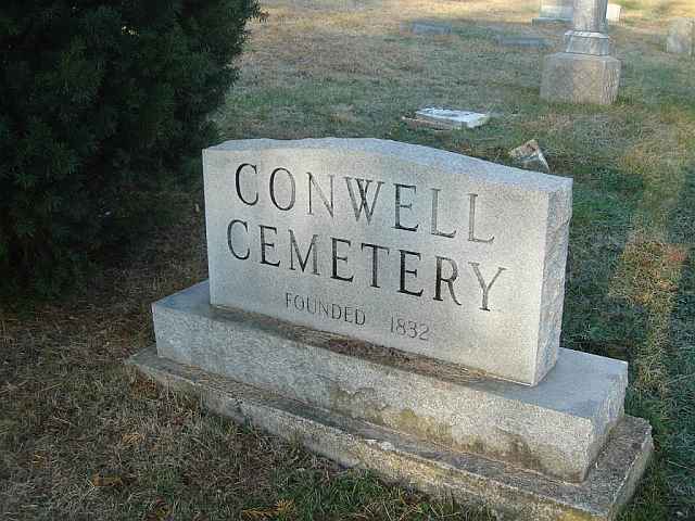
| Conwell |
Laurel Township Cem is adjacent |
1832 |
Burial Listing |
Laurel |
S3-T12N-R12E
39.5053N,
85.1853W |
Located on State Road 121 at the top of the hill on the northside of the town of Laurel |
|
Fair |
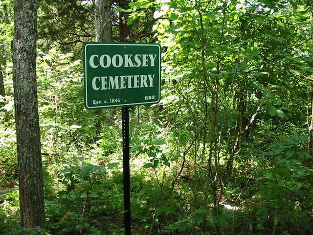
| Cooksey |
--- |
1846 |
Burial Listing |
Brookville |
S10-T8N-R2W
39.3714N,
84.9800W |
Located between River Road and Oak Tree Road. Access is very difficult due to the steep slope, and it is on private land. PHOTO BY CEMETERY COMMISSION.. |
|
Poor |
| Crawford-Bolton |
--- |
|
Burial Listing |
Brookville |
--- |
|
|
Unknown |
| Crawford Family |
--- |
1834 |
Burial Listing |
Brookville |
S10-T8N-R2W
39.3681N,
84.9664W |
North side of River Road, South of Highland Center & River Road. PHOTO BY CEMETERY COMMISSION |
|
Fair |
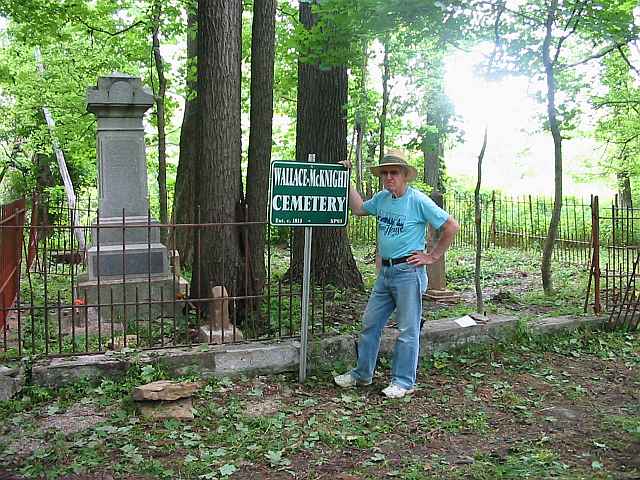
| Cummins |
Wallace-McKnight, Drake Farm |
1813 |
Burial Listing |
Springfield |
S8-T9N-R1W
39.4583N,
84.9089W |
On Liberty Pike, 1/2 mi N of Oxford Pike. PHOTOS BY CEMETERY COMMISSION. |
|
RESTORED 2004 |
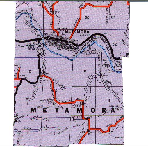
| Cupp's Chapel |
--- |
1846 |
Burial Listing |
Metamora |
S2-T11N-R12E
39.4294N,
85.1633W |
Located on Cupps Chapel road off State Road 229 between Metamora and Peppertown. |
|
Fair |
| Drake Farm |
Wallace-McKnight, Cummins |
1813 |
Burial Listing |
Springfield |
S8-T9N-R1W
39.4583N,
84.9089W |
On Liberty Pike, 1/2 mi N of Oxford Pike. PHOTOS BY CEMETERY COMMISSION. |
|
RESTORED 2004 |
| Drewersburg Baptist |
Baptist |
|
Burial Listing |
Springfield |
--- |
Located behind church in Mt Carmel. |
|
Good |
| Duck Creek |
Metamora |
1845 |
Burial Listing |
Metamora |
S36-T12N-R12E
39.4517N,
85.1389W |
1/4 mile North of Metamora on Duck Creek Road. PHOTOS 2 & 3 BY CEMETERY COMMISSION AND ARE OF THE OLD SECTION. |
|
Good |
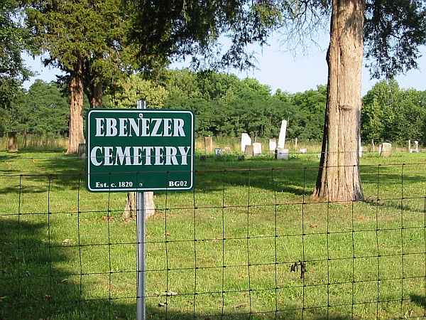
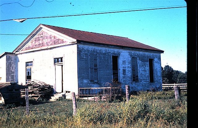
| Ebenezer |
Ebenezer Methodist |
1823 |
Burial Listing |
Blooming Grove |
S23-T12N-R13E
39.4689N,
85.0464W |
West of State Road 1, approx 4 miles NW of Brookville. PHOTOS 2 & 3 BY CEMETERY COMMISSION. The building is what remains of the Ebenezer Methodist Church, located at the entrance of the lane to the cemetery. |
|
RESTORED 2010 |
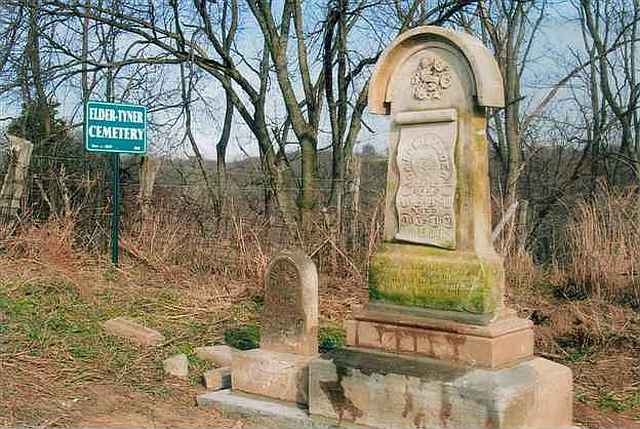
| Elder-Tyner |
Tyner |
1830 |
Burial Listing |
Brookville |
S33-T9N-R2W
39.3986N,
84.9850W |
This is an abandoned cemetery 2.9 miles south of Brookville on Lee Orschell Farm. PHOTO BY CEMETERY COMMISSION. |
|
RESTORED 2007 |
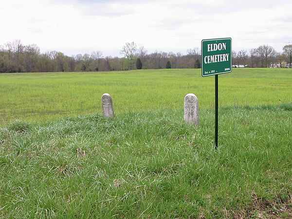
| Eldon Family |
--- |
1852 |
Burial Listing |
Brookville |
S26-T9N-R2W |
Located 4 miles east of Brookville and 2 miles south of State Road 252 |
|
Fair |
| Enochsburg Catholic |
St John the Evangelist |
Unknown |
Burial Listing |
Decatur Co |
S9-T10N-R11E
39.3350N,
85.2978W |
On south side of Enochsburg Road at the intersection of
Franklin/Decatur County Line Road at Enochsburg. Church is in Franklin
County and cemetery in Decatur |
|
Unknown |
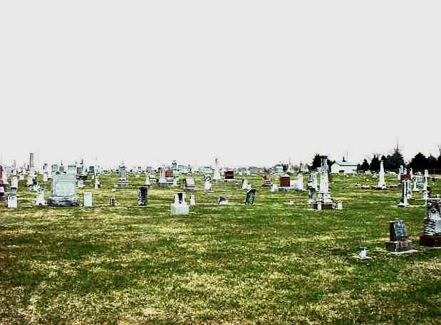
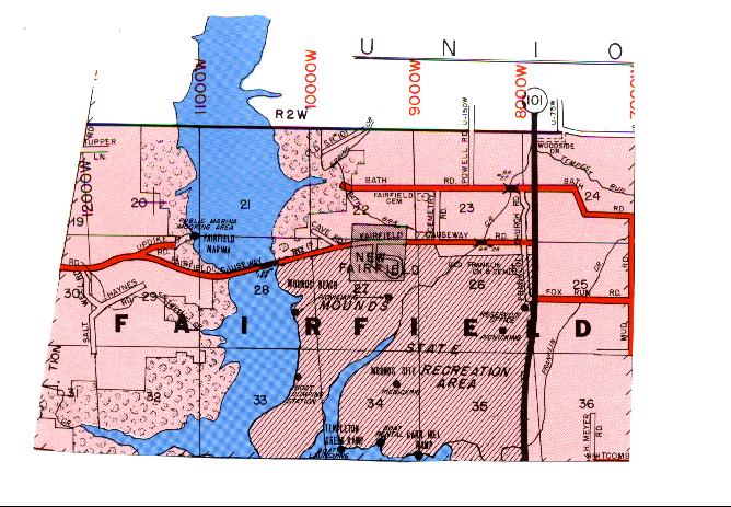
| Fairfield Community |
Sims-Brier |
|
Burial Listing |
Fairfield |
S23-T10N-R2W |
The cemetery is made up of graves moved from 13 cemeteries from Franklin and Union Counties that were moved when the Brookville Lake was built in the early 70s. |
|
Excellent |
| Faurote |
--- |
1872 |
Burial Listing |
Posey |
--- |
1.9 miles South of the intersection of US52 and Chapel Hill Road |
|
Poor |
| Flint |
--- |
Unknown |
Notes |
Bath |
--- |
Was located in Bath Township on Liberty Pike. Stones have been removed. |
|
Gone |
| Franklin (Old) |
--- |
1810 |
Burial Listing |
Fairfield |
S26-T10N-R2W
39.5061N,
84.9492W |
Located on South Franklin Church Road near Fairfield Causeway Road on the west side of the roadway. PHOTO BY DON DUNAWAY. |
| Good |
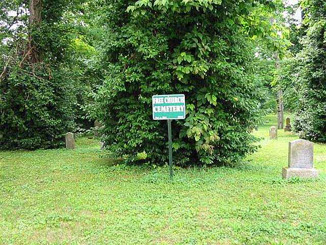
| Free Church |
Free, Union |
1844 |
Burial Listing |
Highland |
S13-T8N-R2W
39.3550N,
84.9378W |
Located at south end of 4th Street in Cedar Grove behind the old fire department. PHOTO 2 BY CEMETERY COMMISSION. |
|
RESTORED 2010 |
| Freeman-Sholts |
Stokes, Whitewater Twp Abandoned |
1845 |
Burial Listing |
Whitewater |
S35-T10N-R1W
39.3194N,
84.8481W |
On hill at the north edge of Rockdale, listed as an abandoned cemetery. PHOTO BY CEMETERY COMMISSION. |
|
Poor |
| Fruit |
Brookville Township |
1880 |
Burial Listing |
Brookville |
S22-T9N-R2W
39.4347N,
84.9828W |
PHOTO BY CEMETERY COMMISSION. |
|
Poor |
| Fruits |
Asbury |
1820 |
Burial Listing |
Springfield |
S23-T9N-R1W
39.4244N,
84.8450W |
2.5 miles NE of Mt Carmel-2.5 miles NW of Scipio. It is locatedon a high mound west of Raymond Road and south of Merrill Road overlooking Dry Fork Creek. The Asbury Methodist Church was torn down on the site in 1925. PHOTO BY DON DUNAWAY. |
|
RESTORED 2008 |
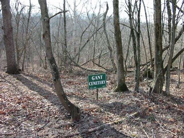
| Gant |
--- |
1856 |
Burial Listing |
Whitewater |
S7-T8N-R1W
39.3748N,
84.9114W
| On lower Possum Hollow Road. PHOTO BY CEMETERY COMMISSION. |
|
RESTORED BY WHITEWATER TWP TRUSTEE IN 2009 |
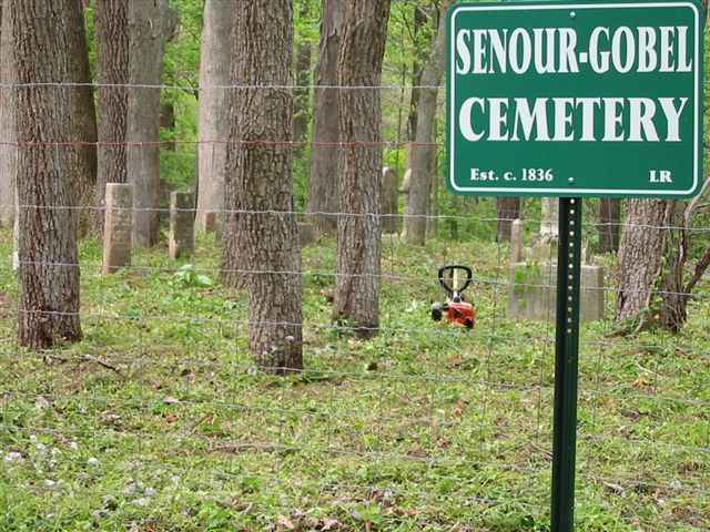
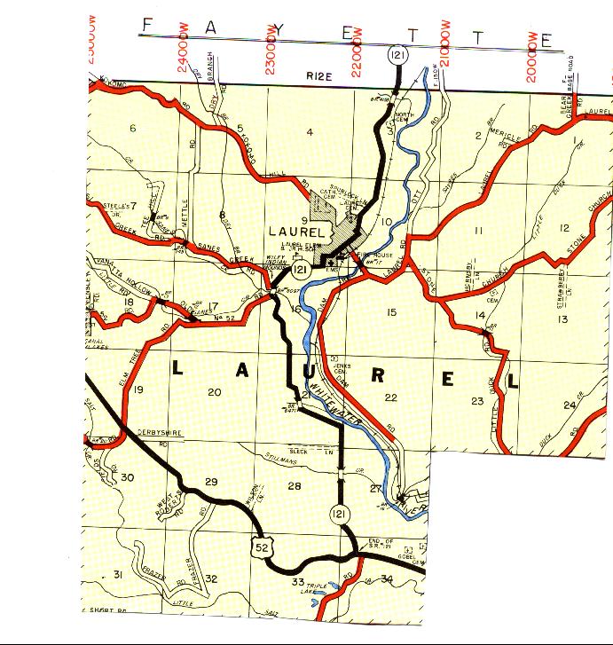
| Gobel |
Senour-Gobel |
1836 |
Burial Listing |
Laurel |
S34-T12N-R12E
39.4533N,
85.1706W |
2 1/2 miles west of Metamora on northside of US 52. PHOTO
BY CEMETERY COMMISSION. |
|
RESTORED 2007 |
| Gobel's Creek |
St Peter UCC, Klemme's Corner, Blue Creek |
1845 |
Burial Listing |
Highland |
S17-T8N-R2W
39.3547N,
85.0039W
39.3574N,
85.0067W |
Old cemetery on Highland Center Road, new cemetery on Bossert
Road just west of Klemme's Corner. PHOTOS 2 & 3 BY CEMETERY COMMISSION. |
|
Excellent |
| Gray Private |
Mixerville |
1823 |
Burial Listing |
Bath |
S36-T10N-R1W
39.4908N,
84.8172W |
1 mile south and 2.5 miles east of Bath and northeast of Mixerville, southside of Brookville Road in pasture. |
|
RESTORED 2004 by Bruce Coleman Family |

