| Symbol Key: |
 Cemetery Photo |
 Headstone Photos |
 DAR / Sheila Watson Transcriptions |
 DAR / Sheila Watson Notes |
 GPS location & link to Wikimapia ® |
| Cemetery Name(s) ( * = Lost Cemeteries) | Photo | Headstone Photos | Location...(Locations marked with # according to Indiana Genealogical Society. Not confirmed by visit) | Transcript or Notes |
|||||||||||||||||||||||||||||||||||||||||||||||||||||||||||||||||||||||||||||||||||||||||
| Atkinson Cemetery Updated January 2019 |
 | | Located on a hill on the East side of SR5 (CR900E) between CR300S and CR400S North of Upland N 40° 30' 01" ;W 85° 30' 07" | | |||||||||||||||||||||||||||||||||||||||||||||||||||||||||||||||||||||||||||||||||||||||||
| Back Creek Cemetery (Jonesboro IOOF, Evergreen) Updated September 2015 (Restorations) |  | | Located on the West side of CR150E at CR750S next to Friends Church.(1.5 miles north of SR26 on Main Street, Fairmount)N40° 26' 42" ;W85° 38' 43" | | |||||||||||||||||||||||||||||||||||||||||||||||||||||||||||||||||||||||||||||||||||||||||
| Baldwin Cemetery (Richland Chapel) |  | | On the south side of CR400N about 0.2 mi west of CR900W is a large wooden sign for Baldwin Cemetery. From the sign walk south between the fields toward the wooded area about 0.2 mi. At the woods a path leads in about 100 yd to a small graveled area, then splits. The right path leads a few yards to part of the stones. The left path leads about 30 yd further to more.N40° 36' 26" ;W85° 51' 01" | | |||||||||||||||||||||||||||||||||||||||||||||||||||||||||||||||||||||||||||||||||||||||||
| Ballinger Cemetery (Hog Creek) Updated Feb 2013 | 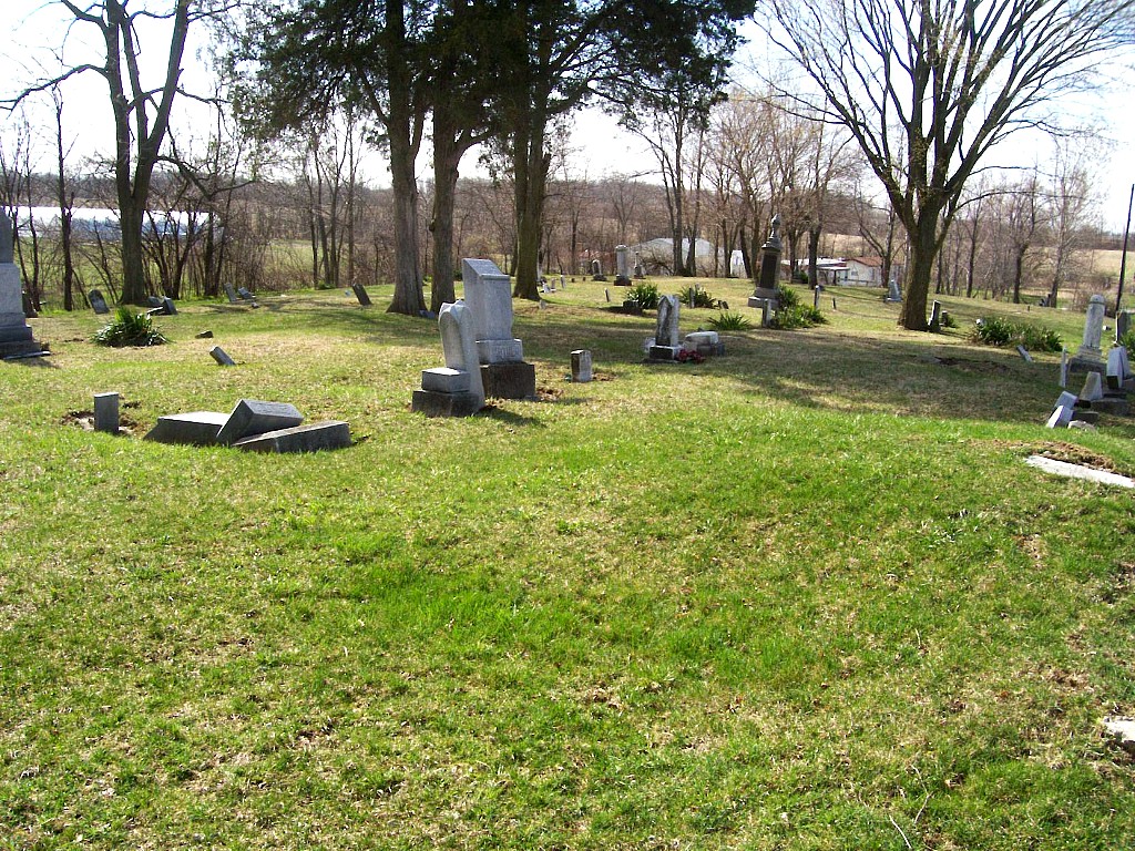 | | Located northwest of Upland, on the east side of CR800E, about 1/2 mile south of SR22.(Across 800E from Jefferson Cemetery)N40° 28' 39" ;W85° 31' 23" | | |||||||||||||||||||||||||||||||||||||||||||||||||||||||||||||||||||||||||||||||||||||||||
| Barley Cemetery |  | Ø | #Located about 0.4 mi south of SR 18, west of Troyer Rd. (CR400E), north of Lugar Creek | | |||||||||||||||||||||||||||||||||||||||||||||||||||||||||||||||||||||||||||||||||||||||||
| Bethel Cemetery Updated Feb 2013 |  | | Located southeast of Gas City, on the north side of Wheeling Pike, about 1/10 mile west of CR400E. A lane along the west side of a long building (somewhat delapidated) leads about 500 yds to the cemetery. N40° 27' 21" ,W85° 35" 50' | | |||||||||||||||||||||||||||||||||||||||||||||||||||||||||||||||||||||||||||||||||||||||||
| Bocock Cemetery (Hobaugh) | |
| #Located on a hill about 0.6 mi north of Charles Rd. in north Marion. There is no access road. (See Sheila Watson Notes)  N40° 35' 46" ,W85° 38" 06' Approximate location. Not confirmed N40° 35' 46" ,W85° 38" 06' Approximate location. Not confirmed | | |||||||||||||||||||||||||||||||||||||||||||||||||||||||||||||||||||||||||||||||||||||||||
| * Boots Cemetery | | Ø | # Formerly located on the north side of West Fourth Street between Garfield Street and Whites Avenue. {Moved to IOOF-Estates of Serenity in 1883} | | |||||||||||||||||||||||||||||||||||||||||||||||||||||||||||||||||||||||||||||||||||||||||
| Branson Cemetery | 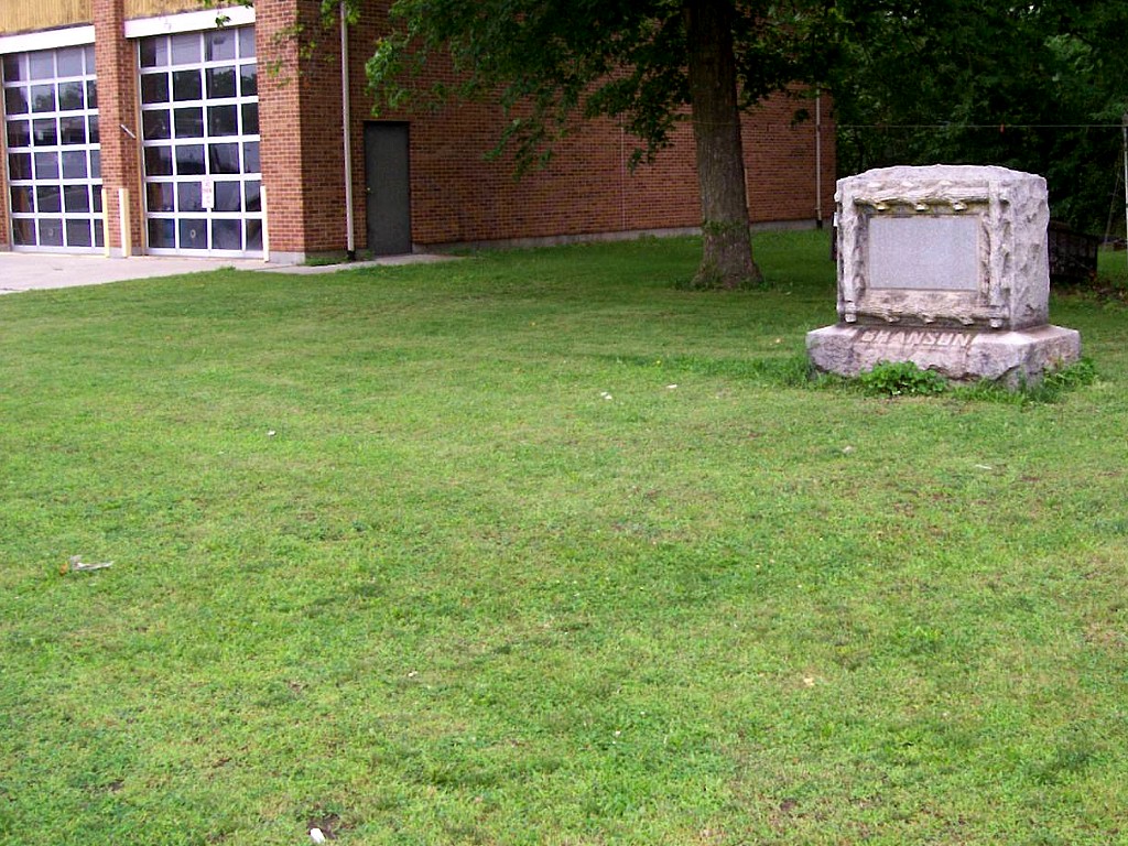 | | Located in south Marion, on the east side of Lincoln Blvd. ,just north of Home Avenue, adjacent to parking area for an abandoned fire station now used for a city bus barn.N40° 32' 36.6" ;W85° 38' 54.7" | | |||||||||||||||||||||||||||||||||||||||||||||||||||||||||||||||||||||||||||||||||||||||||
| * Buckwheat Burial Site | | Ø | # According to ledgend this site is located along the side of the road between a private home and Walnut Creek near Wheeling Pike and CR650E. | | |||||||||||||||||||||||||||||||||||||||||||||||||||||||||||||||||||||||||||||||||||||||||
| Burson Cemetery (Pulley) Updated May 2017 |
 | | Located on the southeast corner of CR500E and Montpelier Pike (The frontage road on the south side (eastbound) of SR18)N40° 33' 11" ;W85° 34' 96" | | |||||||||||||||||||||||||||||||||||||||||||||||||||||||||||||||||||||||||||||||||||||||||
| Center Cemetery (Scott) Updated Feb 2013 |
 | | Located west of Fairmount,on a small rise in a field about 1/2 mile south of CR800S and 1/2 mile east of CR200E (a long walk, no road access)N40° 25' 50.7" ;W85° 42' 02.9" | | |||||||||||||||||||||||||||||||||||||||||||||||||||||||||||||||||||||||||||||||||||||||||
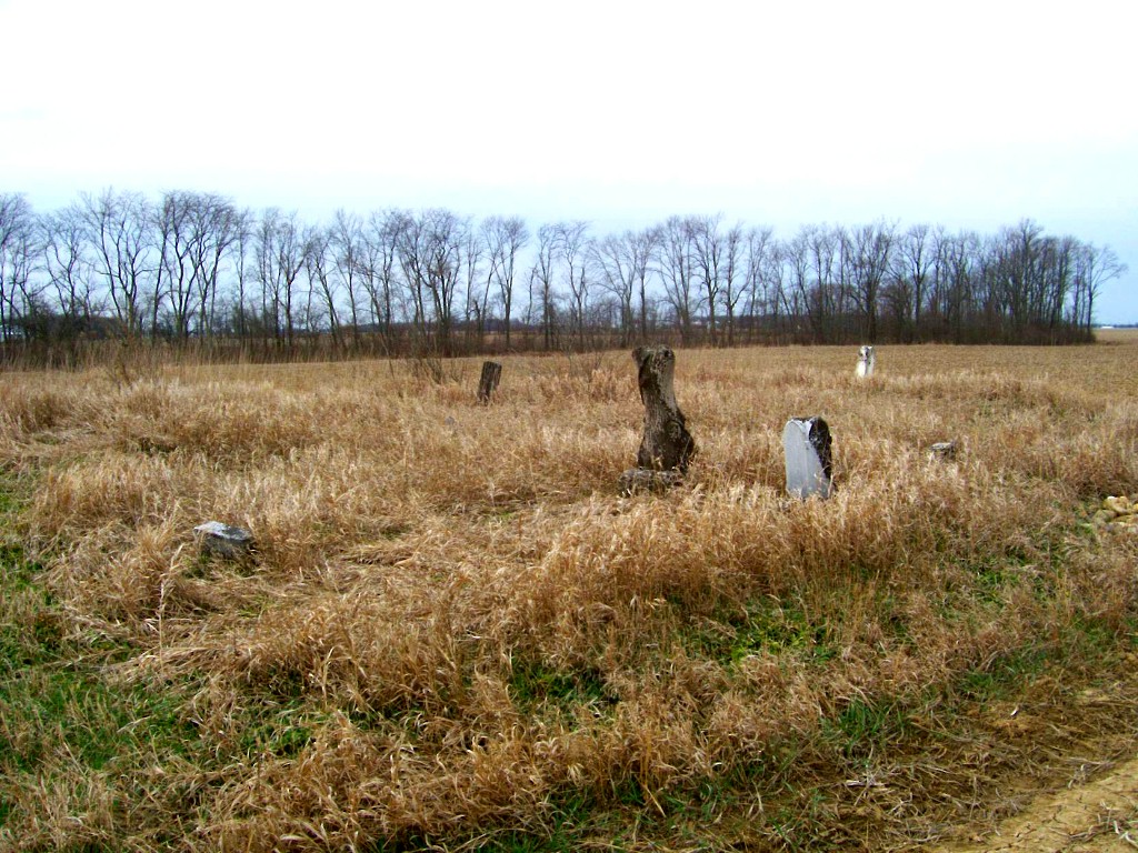
| Conner Cemetery | 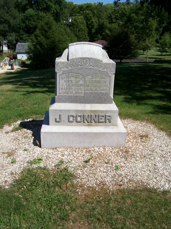 | | This single marker is located in north Marion, on private property on the southeast corner of Conner Drive and Michael Drive.N40° 36' 21.7" ,W85° 40' 43.5" | | |||||||||||||||||||||||||||||||||||||||||||||||||||||||||||||||||||||||||||||||||||||||||
| Converse IOOF Cemetery Updated November 2019 |
 | | Located east of Converse on the north side of CR165 N west of CR900W to the railroad crossingN40° 34' 37" ;W85° 50' 52" | | |||||||||||||||||||||||||||||||||||||||||||||||||||||||||||||||||||||||||||||||||||||||||
| Cory Cemetery (Corey, Black Creek, Carey, Cary) Updated May 2017 |
 | | Located northeast of Van Buren at the eastern end of CR550N, east of CR1000E.(note: CR550N runs only from 1000E to the cemetery, is gravel only, and looks like a driveway)N40° 37' 56" ;W85° 28' 24" | | |||||||||||||||||||||||||||||||||||||||||||||||||||||||||||||||||||||||||||||||||||||||||
| Curtis Cemetery (Oatess) |
 | | Located north of Marion on the west side of Lagro Road, south of CR450N. Cemetery is about 75 feet off of road.(note: Lagro Road joins CR450N for about 1/4 mile to the east of CR00EW before turning south again. It is off this southern branch, just before it curves to the east, that the cemetery lies. It is difficult to see from the road.)N40° 36' 51" ;W85° 40' 18" | | |||||||||||||||||||||||||||||||||||||||||||||||||||||||||||||||||||||||||||||||||||||||||
| Deer Creek Cemetery Updated Feb 2013 |
 | | Located east of the Marion Airport, behind some houses on the south side of Old Kokomo Road, at the southern end of Harmon Drive. It lies in two sections divided by a deep ravine. Please ask permission before crossing private property.N40° 29' 34" ;W85° 40' 12" | | |||||||||||||||||||||||||||||||||||||||||||||||||||||||||||||||||||||||||||||||||||||||||
| Doyle Cemetery Updated Feb 2013 | 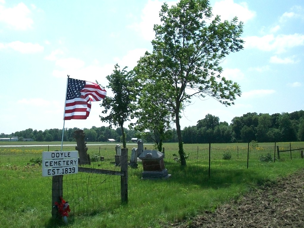 | | Located southeast of Van Buren, cemetery is about 300 yards south of CR300N about 1/4 mile east of CR1000E, in the middle of a farm field. (In 2011 a path is being constructed from CR 300N to the Cemetery) N40° 35' 39" ;W85° 28' 52" In 2011 the restored cemetery was rededicated. Read the Story. | | |||||||||||||||||||||||||||||||||||||||||||||||||||||||||||||||||||||||||||||||||||||||||
| Drook Cemetery (Parsons) Updated Feb 2013 |
 | | Located northeast of Converse, on a hilltop about 1000 feet east of CR900W, midway between CR300N and CR400N.N40° 36' 14" ;W85° 50' 36" | | |||||||||||||||||||||||||||||||||||||||||||||||||||||||||||||||||||||||||||||||||||||||||
| Dunn Cemetery (Massey) Updated Feb 2013 |
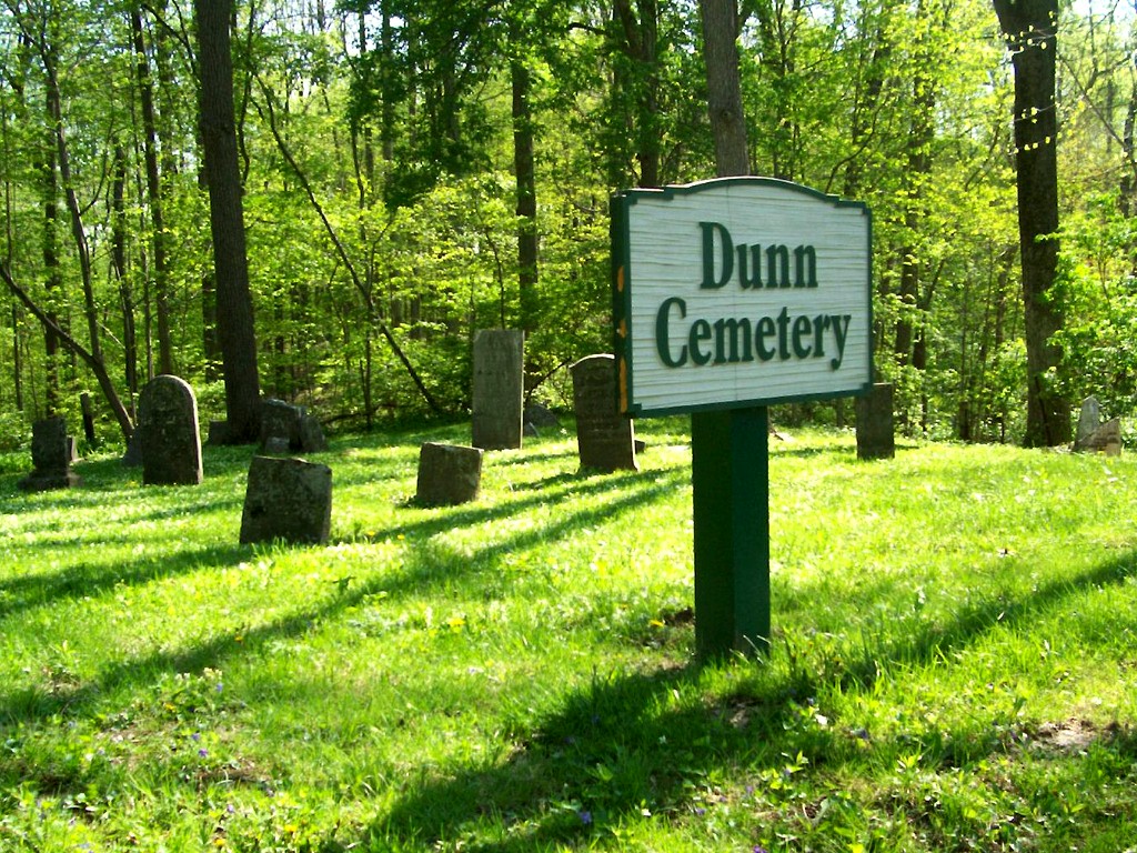 | | Located northwest of Marion north of the curve in Shildmyer Road, about 1/4 mile west of SR15.(Note: Shildmyer Road goes west from SR15 about 1.5 miles north of the SR15/SR9 junction north of Marion)N40° 35' 47" ;W85° 41' 29" | | |||||||||||||||||||||||||||||||||||||||||||||||||||||||||||||||||||||||||||||||||||||||||
| Estates of Serenity (Marion IOOF, Friends) |   | Ø | Located on the east side of Marion southeast of the junction of Lincoln Blvd and Pennsylvania St. Sections MapN40° 32' 15" ;W85° 38' 23" Searchable Database at Marion Library (Log-in not required) | | |||||||||||||||||||||||||||||||||||||||||||||||||||||||||||||||||||||||||||||||||||||||||
| Fairview Cemetery (Bradford, Hicks, Hix) Updated Feb 2013 |
  | | Located northeast of Marion, 200 yards south of CR450N, about .03 mile west of CR300E. An unimproved lane leads to the cemetery.N40° 37' 01" ;W85° 37' 11" | | |||||||||||||||||||||||||||||||||||||||||||||||||||||||||||||||||||||||||||||||||||||||||
| Farrville Cemetery (Lever Chapel, Leverich) Updated January 2019 | 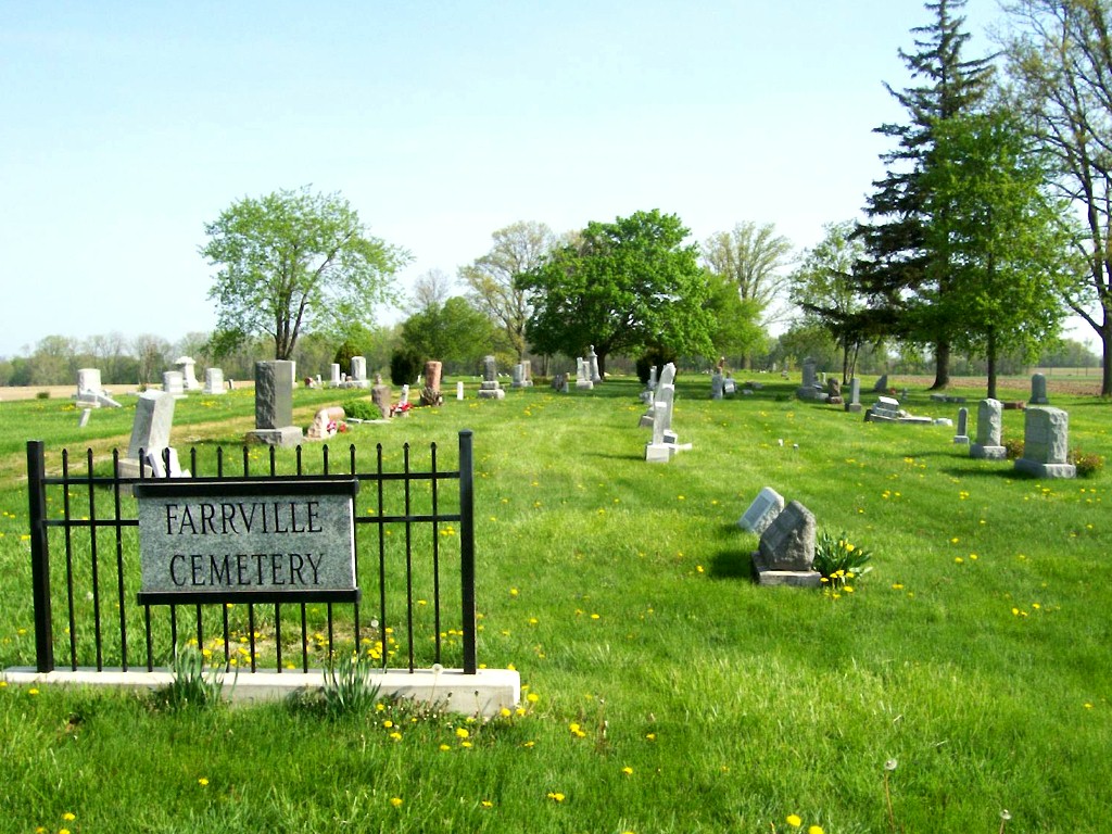 | | Located southeast of Van Buren, on the north side of CR200N, about 1/4 mile east of CR1000E.N40° 34' 55" ;W85° 28' 49" | | |||||||||||||||||||||||||||||||||||||||||||||||||||||||||||||||||||||||||||||||||||||||||
| Fletcher Chapel Cemetery Updated Feb 2013 |
 | | Located northeast of Marion, on the west side of CR500E, about 150 yards north of CR200N (Salem Pike)N40° 35' 01" ;W85° 34' 48" | | |||||||||||||||||||||||||||||||||||||||||||||||||||||||||||||||||||||||||||||||||||||||||
| * Foster Cemetery | | Ø | # Formerly located northeast of the intersection of East 23rd Street and the Railroad. | | |||||||||||||||||||||||||||||||||||||||||||||||||||||||||||||||||||||||||||||||||||||||||
| Galbreath Cemetery (Alel) Updated May 2019 |  | | This very small cemetery is located on the north side of SR22 about 1/4 mile east of CR700W (1 1/4 mile east of SR13)N40° 28' 46" ;W85° 48' 04" | | |||||||||||||||||||||||||||||||||||||||||||||||||||||||||||||||||||||||||||||||||||||||||
| * Gallatin Street Cemetery (Old City Cemetery) | | Ø | # Formerly located near 5th Street and Gallatin Street. {All but 3 interred relocated} | | |||||||||||||||||||||||||||||||||||||||||||||||||||||||||||||||||||||||||||||||||||||||||
| * Gas City Cemetery | | Ø | # Formerly located in Gas City, southeast of South H Street and Seventh Street. {All interred moved to Riverside Cemetery} |  | |||||||||||||||||||||||||||||||||||||||||||||||||||||||||||||||||||||||||||||||||||||||||
| Grant Memorial Park |   | Ø | This very large cemetery is located in south Marion on the northwest corner of Western Ave (SR9) and 26th Street.(Note: There is no access from the highway, but only from 26th street about 1/4 mile west. Sections MapN40° 32' 24" ;W85° 40' 33" Searchable Database at Marion Public Library (Log-in not required) | | |||||||||||||||||||||||||||||||||||||||||||||||||||||||||||||||||||||||||||||||||||||||||
| Griffin Cemetery (Futrell) |  |
|
Located northwest of Gas City, west of Garthwaite Rd. A gravel road at the top of the hill south of CR200S and south of Eastridge Drive goes west and ends near the cemetery. It is on private property. Please ask permission before crossing private property.N40° 31' 13" ;W85° 37' 10.5"
| | |||||||||||||||||||||||||||||||||||||||||||||||||||||||||||||||||||||||||||||||||||||||||
| Harmony Cemetery (Harmony Baptist) Updated May 2014 (Restorations) | 
| | Located west of Matthews on the northeast corner of Wheeling Pike and CR1125 S.N40° 23' 25" ;W85° 30' 33" | | |||||||||||||||||||||||||||||||||||||||||||||||||||||||||||||||||||||||||||||||||||||||||
| * Hendricks Cemetery | | Ø | # (Pleasant Township - location unknown. Believed to be in the area west of Fox Station) | | |||||||||||||||||||||||||||||||||||||||||||||||||||||||||||||||||||||||||||||||||||||||||
| Hults Cemetery Updated Feb 2013 |
 | | Located west of CR900E and north of CR200S. A gravel driveway leads south from the driveway of 8886 E. 200 S. Stop and ask for permission to enter private property.N40° 31' 20.7" ;W85° 30' 17.2" | | |||||||||||||||||||||||||||||||||||||||||||||||||||||||||||||||||||||||||||||||||||||||||
| Hummel Cemetery (Lobdell, Watson) | 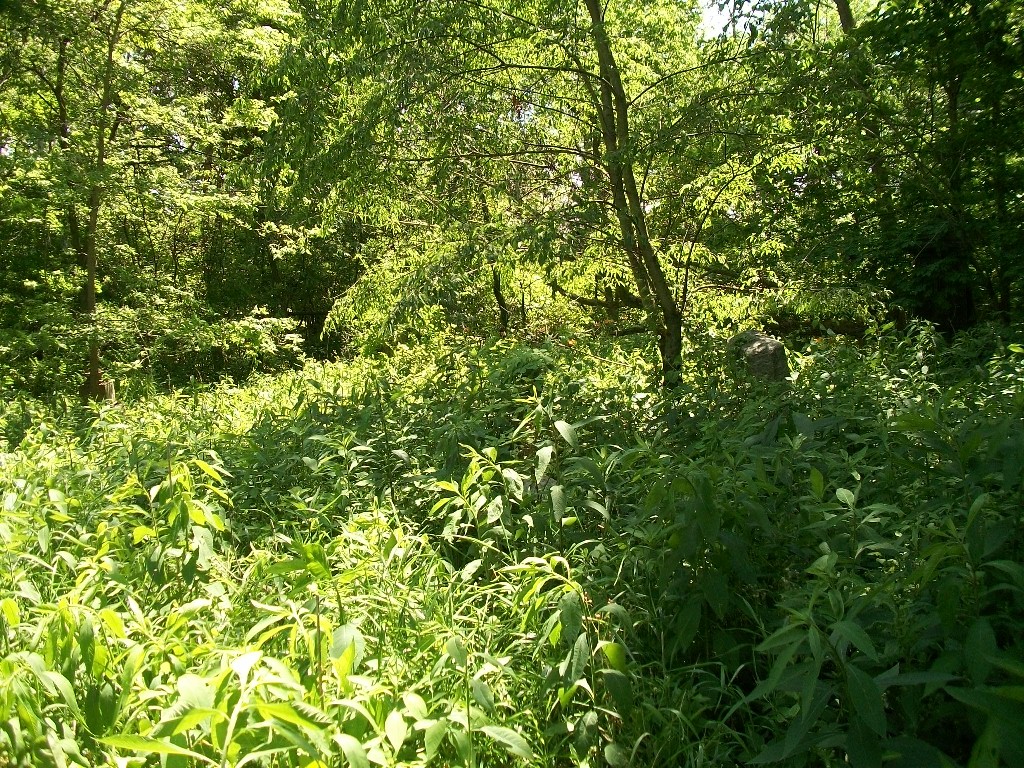 | | Located on private property, in a woods about 150 feet east of CR00EW, north of CR600N and north of Metocinah Creek. Access across private property restricted by cattle lot with electrified fence. Access from CR00EW is steep and wet. Cemetery badly overgrown with vegitation knee to shoulder high. Lots of poison ivy and thorns.N40° 38' 48" ,W85° 40" 29' | | |||||||||||||||||||||||||||||||||||||||||||||||||||||||||||||||||||||||||||||||||||||||||
| Indian Cemetery (God' s Acres, Meshingomeshia) Updated Feb 2013 | 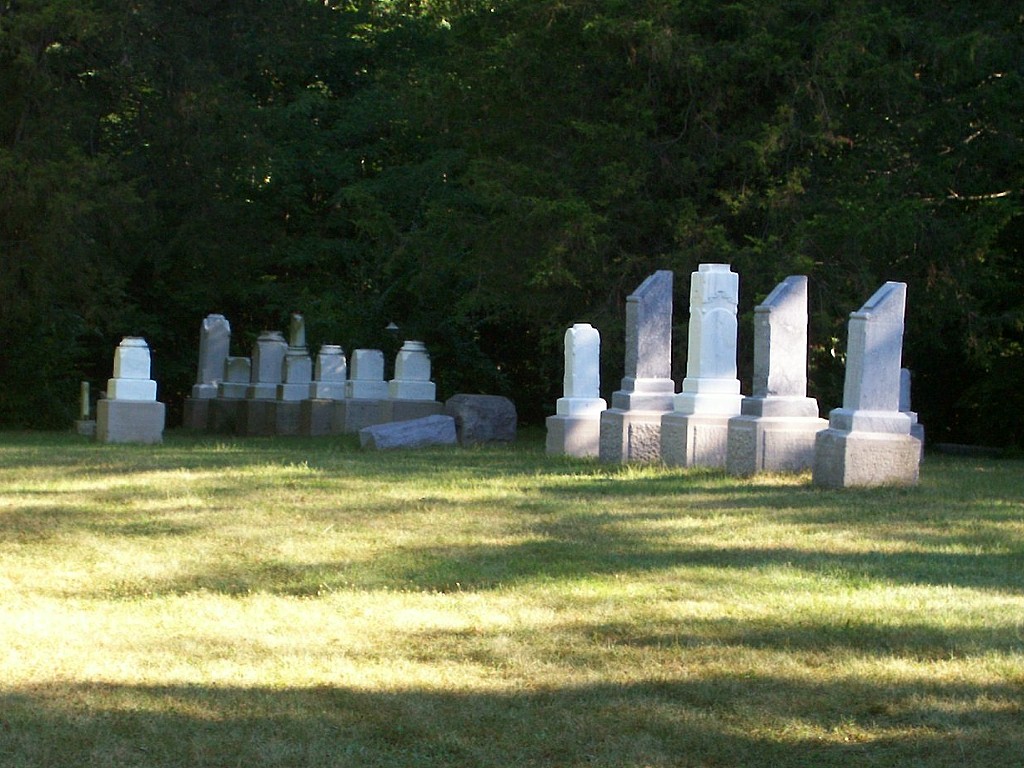 | | Located north of CR600N, between CR250W and CR 300W. A small driveway leads from an historic marker on the north side of CR600N to a wooden fence & gate surrounding the old Indian school and the cemetery behind it.N40° 38' 28" ;W85° 43' 50" | | |||||||||||||||||||||||||||||||||||||||||||||||||||||||||||||||||||||||||||||||||||||||||
| Jefferson Cemetery Updated November 2019 |   | | Located west of Upland on the southwest corner of SR22 and CR800E.N40° 28' 42" ;W85° 31' 26" | | |||||||||||||||||||||||||||||||||||||||||||||||||||||||||||||||||||||||||||||||||||||||||
| * Johnson Cemetery | | Ø | Location unknown. (My research and correspondence with Johnson descendants lead me to believe this is a colloquial reference to the Ballinger/Hog Creek Cemetery above. ...jp) | | |||||||||||||||||||||||||||||||||||||||||||||||||||||||||||||||||||||||||||||||||||||||||
| * Jonesboro Cemetery | | Ø | # Formerly located in southeast Jonesboro, near a steep ravine on Muncie Pike, north of Wheeling Pike. {All interred were moved to Riverside Cemetery} | | |||||||||||||||||||||||||||||||||||||||||||||||||||||||||||||||||||||||||||||||||||||||||
| * Kelley / McClain Cemetery | | Ø | # Although the exact former location of this cemetery is unknown, it is believed to have been in the area between CR700S and CR800S, between CR900W and CR1000W(County Line) | | |||||||||||||||||||||||||||||||||||||||||||||||||||||||||||||||||||||||||||||||||||||||||
| Knox Chapel Cemetery (Old Knox Chapel) Updated March 2017 |  | | Located southeast of Point Isabel, on CR1000S about 1/2 mile west of CR700W. Old Knox Chapel cemetery is on the north side of the road. N40° 24' 26" ;W85° 48' 49" | | |||||||||||||||||||||||||||||||||||||||||||||||||||||||||||||||||||||||||||||||||||||||||
| Knox Cemetery (New Knox Chapel) Updated November 2019 |
 | | Located southeast of Point Isabel, on CR1000S about 1/2 mile west of CR700W. New Knox Chapel cemetery is on the south side of the road.. N40° 24' 24" ;W85° 48' 52" | |
|||||||||||||||||||||||||||||||||||||||||||||||||||||||||||||||||||||||||||||||||||||||||
| * Lake Branch Cemetery | | Ø | (Location unknown - possibly Jefferson Township) | | |||||||||||||||||||||||||||||||||||||||||||||||||||||||||||||||||||||||||||||||||||||||||
| Lee Cemetery (St. Joseph) Updated Feb 2013 |
 | | Located northwest of Van Buren, on the south side of CR600N, about 1/4 mile west of CR700W . N40° 38' 17" ;W85° 32' 51" | | |||||||||||||||||||||||||||||||||||||||||||||||||||||||||||||||||||||||||||||||||||||||||
| Levengood Cemetery (Lavengood) Updated Feb 2013 |
 | | Located northeast of Upland, on the south side of CR300 S. about 100 yards west of the intersection with CR 1100 E. N40° 30' 29" ;W85° 27' 55.5" | | |||||||||||||||||||||||||||||||||||||||||||||||||||||||||||||||||||||||||||||||||||||||||
| Little Ridge Cemetery |  | Ø | Located southwest of Fairmount, on CR1050S, about 1/4 mile east of CR200W. N40° 24' 01" ;W85° 42' 17" | | |||||||||||||||||||||||||||||||||||||||||||||||||||||||||||||||||||||||||||||||||||||||||
| Lugar Creek Cemetery (McKinney) Updated Feb 2013 |
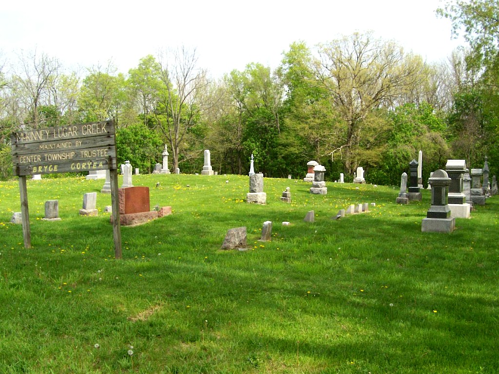 | | Located east of Marion, on the north side of CR100S, about 1/4 mile west of CR600E. N40° 32' 20' ;W85° 33' 52" | | |||||||||||||||||||||||||||||||||||||||||||||||||||||||||||||||||||||||||||||||||||||||||
| Maple Grove Cemetery (Overman, Raypholtz) Updated November 2019 |  | | Located north of Sweetser, on the northeast corner of CR250N and CR500W. N40° 35' 23" ;W85° 46' 10" | | |||||||||||||||||||||||||||||||||||||||||||||||||||||||||||||||||||||||||||||||||||||||||
| Marion National Cemetery (Veterans Affairs, VA) | 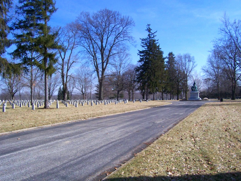 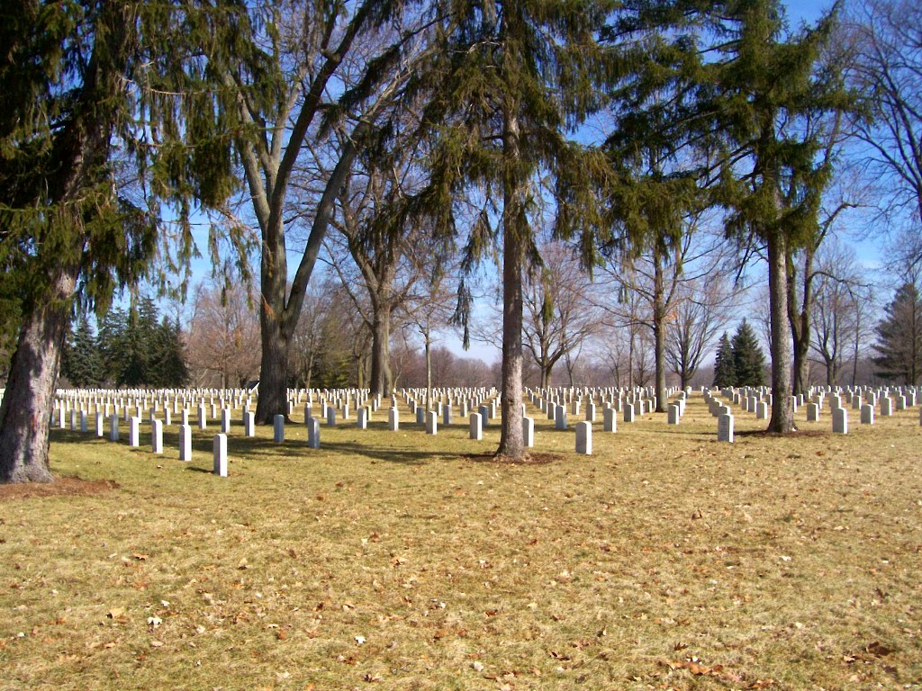 | Ø | Located in east Marion, near the Veteran' s Home. The main entrance is on 38th Street, west of Lincoln Blvd, near the railroad. N40° 31' 12" ;W85° 37' 44" Searchable database at Interment.net | | |||||||||||||||||||||||||||||||||||||||||||||||||||||||||||||||||||||||||||||||||||||||||
| Matthews Cemetery Updated November 2019 |  | | Located on the northeast side of Matthews, near the Covered Bridge. From Massachusetts Ave. in Matthews, go east on 6th Street, which curves into 4th street. Cemetery is about 3/4 mile from Massachusetts Ave. N40° 23' 20" ;W85° 29' 18" | | |||||||||||||||||||||||||||||||||||||||||||||||||||||||||||||||||||||||||||||||||||||||||
| McCormick Cemetery (Fankboner) |
 | | Located southeast of Gas City, south of Wheeling Pike, west of CR500E. A large historical sign on the south side of Wheeling Pike indicates the cemetery is 200 yards south of this spot. (This is not quite right.) Stop at home just east of this sign and ask for directions and permission to enter private property.N40° 26' 53" ;W85° 35' 03" | | |||||||||||||||||||||||||||||||||||||||||||||||||||||||||||||||||||||||||||||||||||||||||
| McKinley Cemetery (Oak Chapel) |
 | | Located northeast of Upland, on the west side of CR1175 (1115) W, between CR100S and 200S. It is across the road from the Oak Chapel United Methodist Church.(Note: this road is numbered 1175 at SR18 and 1115 at 200S. N40° 31' 52" ;W85° 27' 29" | | |||||||||||||||||||||||||||||||||||||||||||||||||||||||||||||||||||||||||||||||||||||||||
| Mier Cemetery (Mills, Van Pixler) | 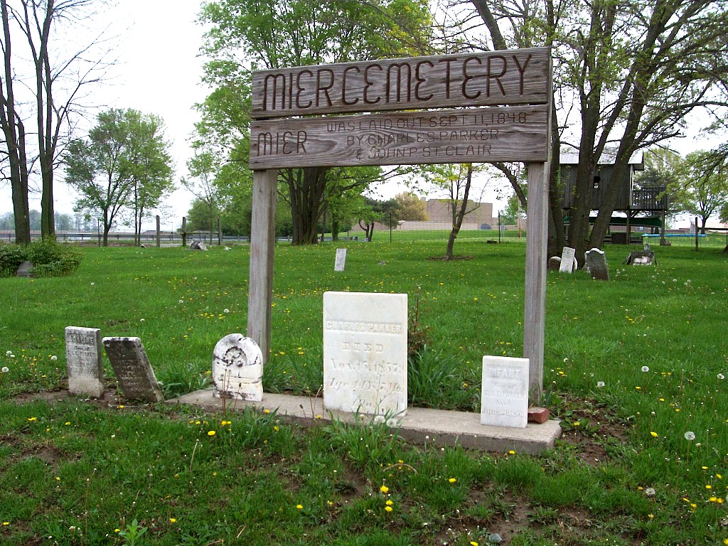 | | Located on the east side of CR800E, about 1/2 mile north of the west junction of SR18 and SR13.(note: CR800W is the northern extension of the road which is SR13 south of SR18, and meets SR13 again across fron Oak Hill School)N40° 34' 44" ;85° 49' 32" | | |||||||||||||||||||||||||||||||||||||||||||||||||||||||||||||||||||||||||||||||||||||||||
| * Miles Cemetery | | Ø | # Although the exact former location of this cemetery is unknown, it is believed to have been located on the north side of the creek between CR400s and CR500S, between CR1100E and CR1200E(County Line). (Note: There is a Miles Cemetery located about 1 mile east of here in Blackford Co. - See "Neighbors" below.) | | |||||||||||||||||||||||||||||||||||||||||||||||||||||||||||||||||||||||||||||||||||||||||
| Missinewa Battlefield Cemetery |  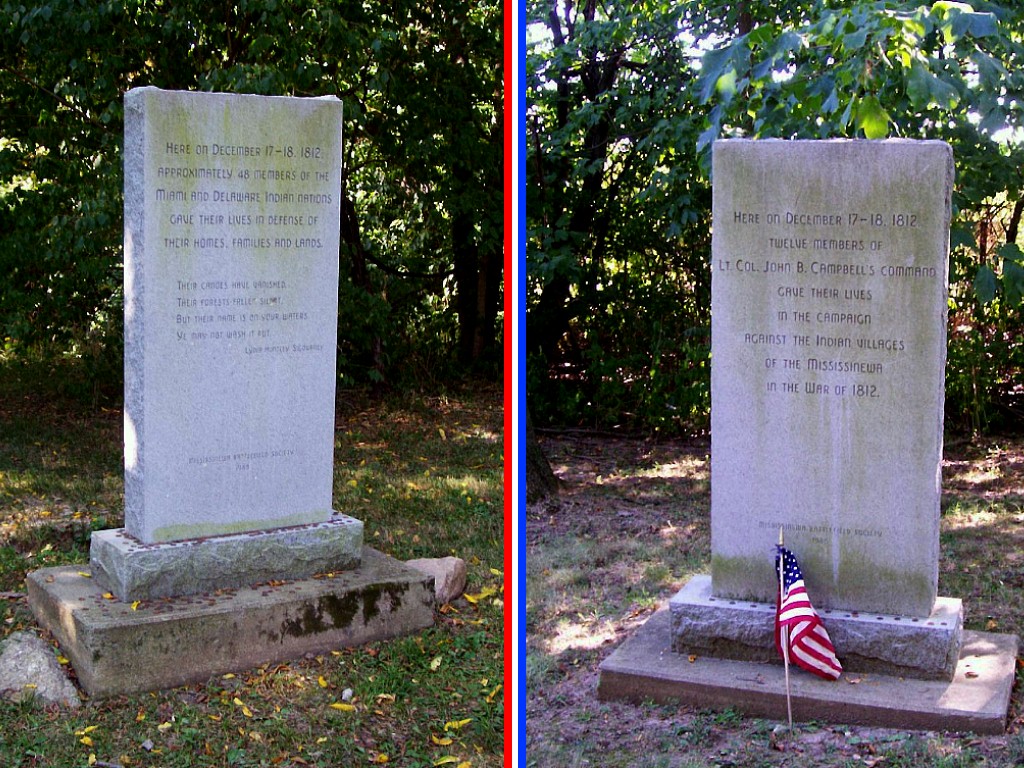 | | The parking lot for the cemetery and monuments is on the west side of CR300W, south of CR600N.N40° 37' 47" ;W85° 44' 06" | | |||||||||||||||||||||||||||||||||||||||||||||||||||||||||||||||||||||||||||||||||||||||||
| * Mississinewa Quaker (Friends) Cemetery | | Ø | Once an independent cemetery, it is now the northwest part of Estates of Serenity | | |||||||||||||||||||||||||||||||||||||||||||||||||||||||||||||||||||||||||||||||||||||||||
| Mittank Cemetery (McKeever, Trask) |
 | | Located southwest of Upland. Go north on Wheeling Pike from SR26 (4 way stop west of I-69). Turn east on CR875 S, curve north on CR800E, and turn east on CR850S, then left on the first driveway. Stop at house at end of driveway to ask for permission & directions. (Cemetery is about 200 yards toward river through thick undergrowth)N40° 25' 54.5" ;W85° 31' 10" | | |||||||||||||||||||||||||||||||||||||||||||||||||||||||||||||||||||||||||||||||||||||||||
| Morris Chapel Cemetery Updated July 2016 |
 | | Located north of Marion on the southwest corner of SR9 and CR450N. Cemetery is between the church and the highway. N40° 37' 06" ;W85° 38' 32" | | |||||||||||||||||||||||||||||||||||||||||||||||||||||||||||||||||||||||||||||||||||||||||
| Mount Hope Cemetery (County Farm, Potter' s Field) |
|  | Located on the west side of Garthwaite Rd., north of Gas City about 3/4 mile north of Mississinewa High School and 1/2 mile south of Grant County Recycling Center. There are no markers.N40° 30' 18" ;W85° 36' 57" | | |||||||||||||||||||||||||||||||||||||||||||||||||||||||||||||||||||||||||||||||||||||||||
| New Hope Cemetery (Field, Paxton) | 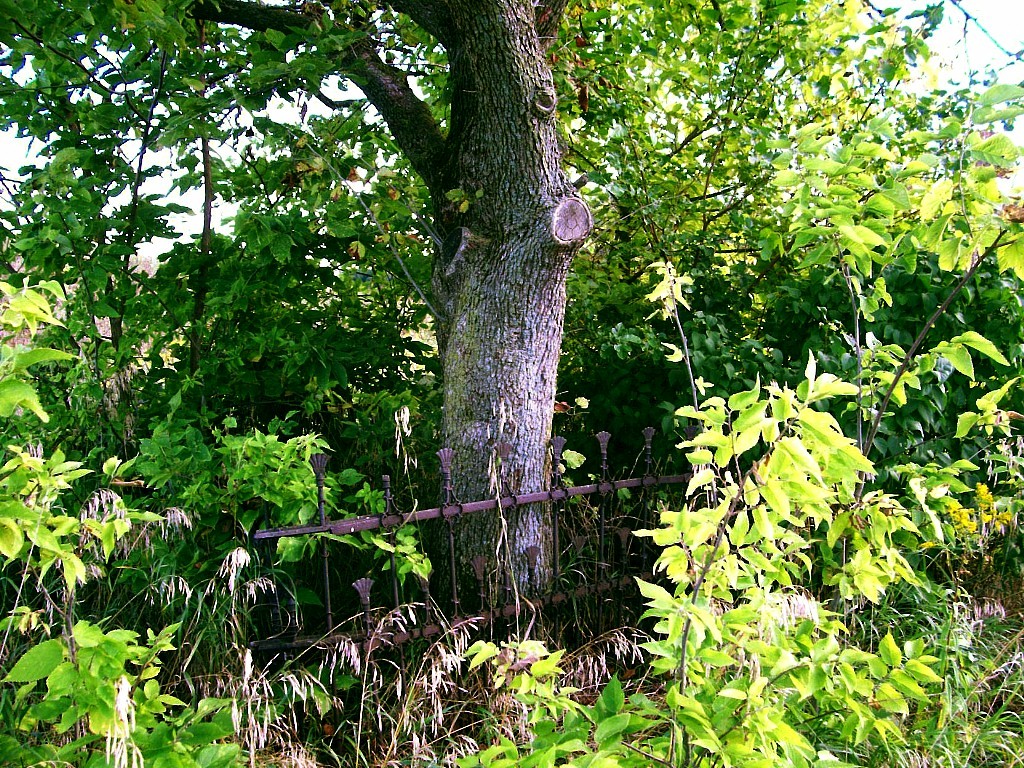 | | Located east of Marion, on the north side of CR200S, about 1/4 mile west of 400E. About 100 yards from the road, behind a field surrounded by a clapboard fence, in the midst of a small copse of trees and brush. (Very hard to see due to overgrowth. Look for wrought iron fence.)N40° 31' 29.5" ;W85° 36' 05.2" | | |||||||||||||||||||||||||||||||||||||||||||||||||||||||||||||||||||||||||||||||||||||||||
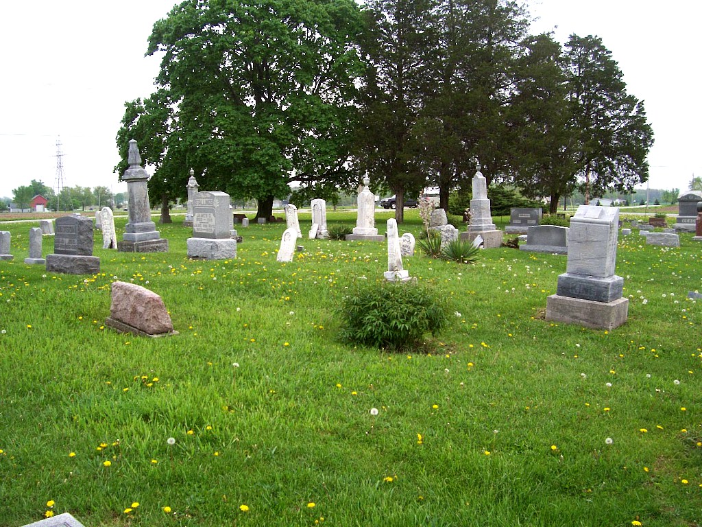
| Normal Cemetery | 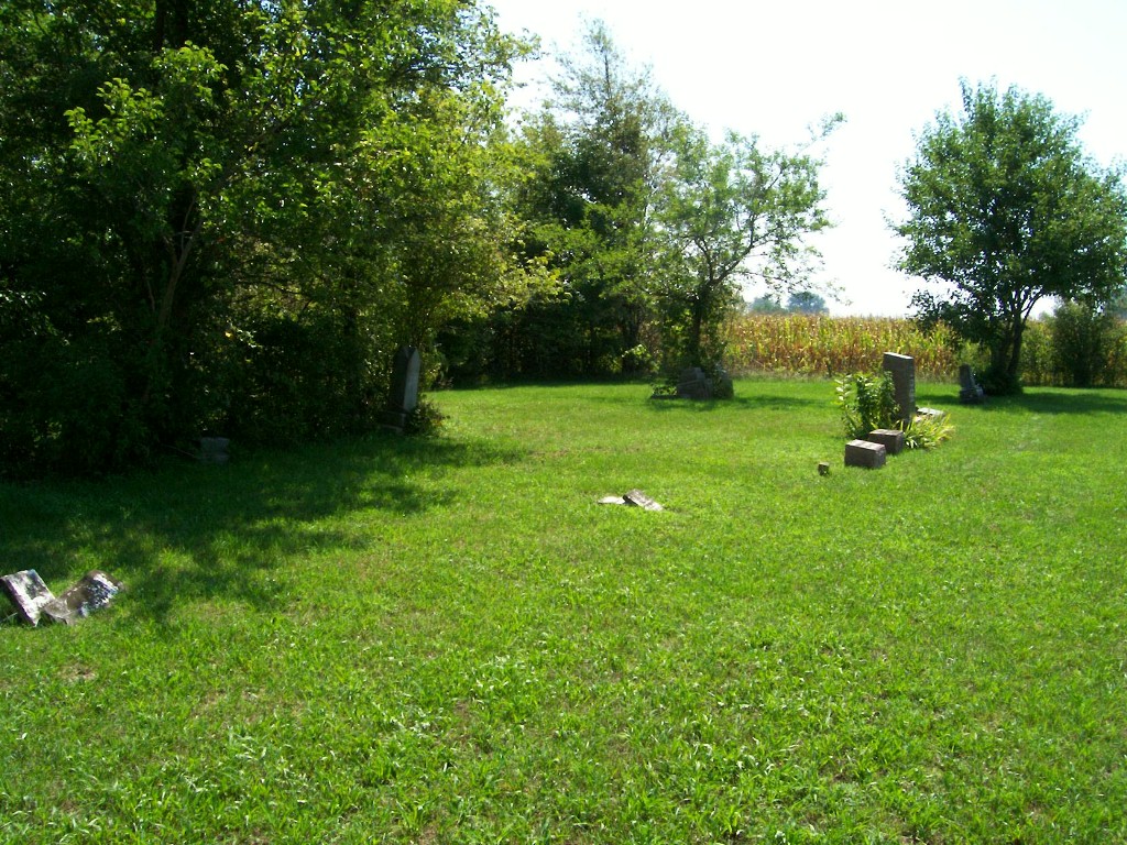 |
|
Located behind the church about 100 yards west of SR13 on the south side of CR600S. N40° 27' 52" ;W85° 49' 34" | | |||||||||||||||||||||||||||||||||||||||||||||||||||||||||||||||||||||||||||||||||||||||||
| Null Cemetery | 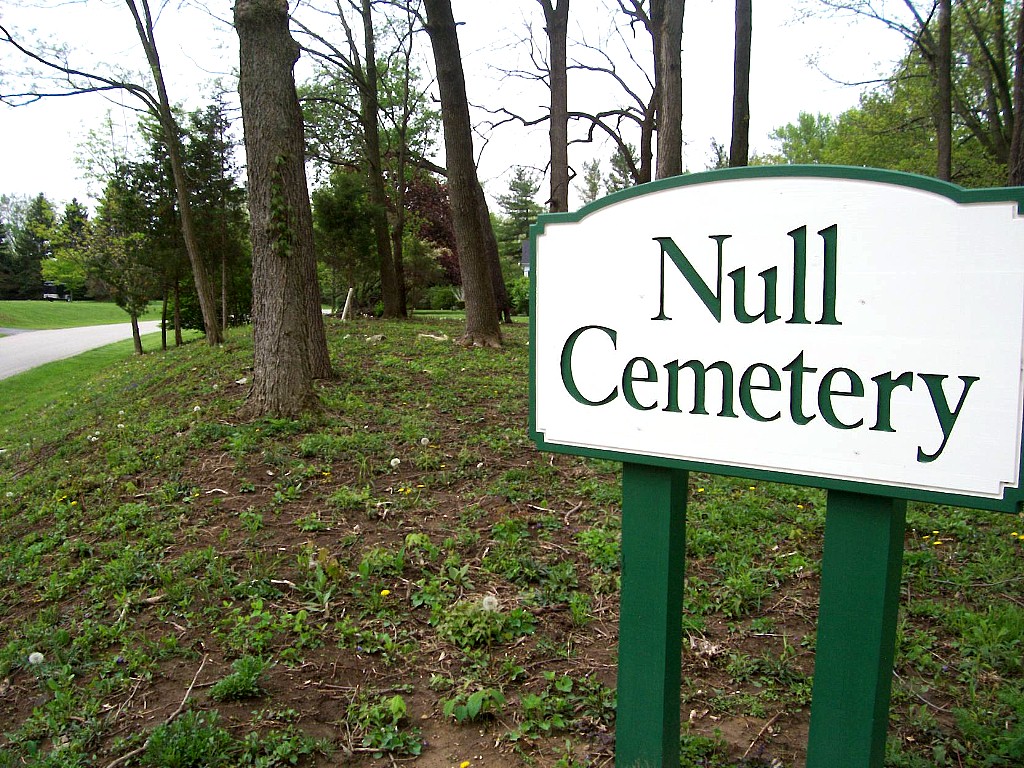 | | Located in north Marion on the southwest corner of Lawson Drive and Lantern Lane, atop a steep hillside.(Lawson Drive goes west from SR15 just north of Shady Hills golf course. Lantern Lane is first left westbound.)N40° 35' 20" ;W85° 41' 22" | | |||||||||||||||||||||||||||||||||||||||||||||||||||||||||||||||||||||||||||||||||||||||||
| Oak Ridge Cemetery Updated Feb 2013 |  | | Located west of Fairmount, on the south side of CR800S, just west of CR100W. It is across the road from the Friends Church.N40° 26' 13" ;W85° 41' 34" | | |||||||||||||||||||||||||||||||||||||||||||||||||||||||||||||||||||||||||||||||||||||||||
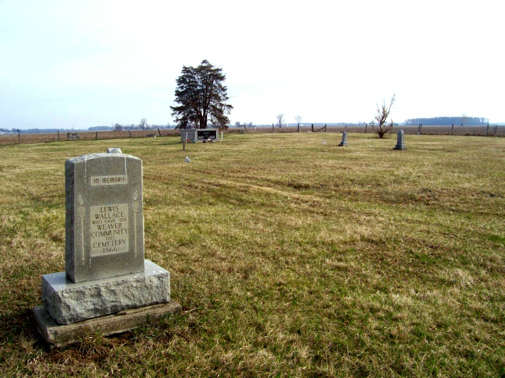
| Old Weaver Cemetery (Baptist Church Cemetery) |
 | | Located southwest of Marion, about 1/4 mile south of SR 22 and 1/4 mile west of CR 300 W, in a small woods in the middle of a field.N40° 28' 35" ;W85° 44' 04" (Note:On Wikimapia® view, homestead buildings on right no longer exists [2010] and woods to left are being cleared.) | | |||||||||||||||||||||||||||||||||||||||||||||||||||||||||||||||||||||||||||||||||||||||||
| Park Cemetery |   | Ø | Located on the north edge of Fairmount, on the west side of CR150E., about 3/4 mile north of SR26 on Main Street, Fairmount. N40° 25' 53" ;W85° 38' 43" | | |||||||||||||||||||||||||||||||||||||||||||||||||||||||||||||||||||||||||||||||||||||||||
| Pence Cemetery |  |
| Located on the east edge of Converse, south of SR18. A large sign on the south side of SR18 about 1/2 mile west of CR900W points to the cemetery which is about 1/4 mile south of the Highway on private property. Please ask permission before crossing private property.N40° 34' 28" ,W85° 51' 16" | | |||||||||||||||||||||||||||||||||||||||||||||||||||||||||||||||||||||||||||||||||||||||||
| Point Isabel Cemetery Updated Feb 2013 |  | | Located on the north side of SR26, about 1/2 mile west of SR13.N40° 25' 18" ;W85° 50' 01" | | |||||||||||||||||||||||||||||||||||||||||||||||||||||||||||||||||||||||||||||||||||||||||
| * Potter' s Field Cemetery(County Infirmary) | | Ø | Formerly located on the northwest corner of Western Avenue and 16th Street in Marion. It was at the northeast corner of what is now a parking lot.N40° 32' 48" ,W85° 40' 30" Approximate former location. No longer exists. | | |||||||||||||||||||||||||||||||||||||||||||||||||||||||||||||||||||||||||||||||||||||||||
| Prickett Cemetery | 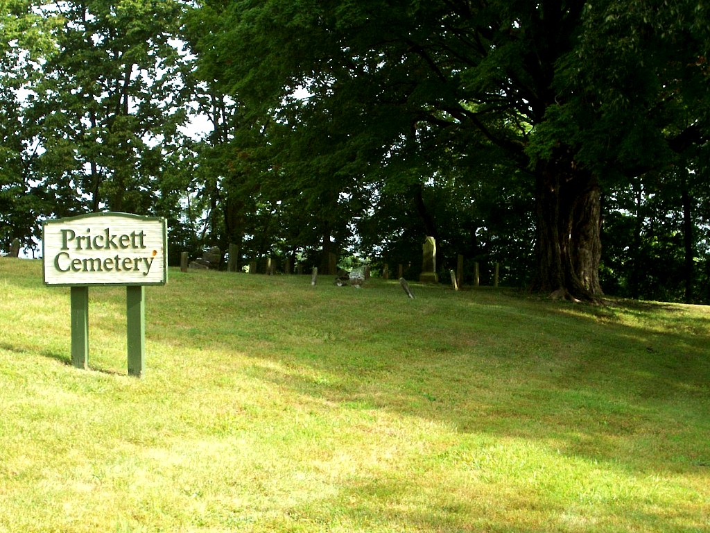 | | Located northwest of Marion on the north side of Frances Slocum Trail, about 1/10 mile east of CR200W. N40° 36' 33.5" ;W85° 42' 40" | | |||||||||||||||||||||||||||||||||||||||||||||||||||||||||||||||||||||||||||||||||||||||||
| Puckett Cemetery (Howe) Updated January 2019 |
 | | Located east of Marion, on the north side of CR200S (38th Street), about 1/4 mile east of CR500E. N40° 31' 39" ;W85° 34' 24" | | |||||||||||||||||||||||||||||||||||||||||||||||||||||||||||||||||||||||||||||||||||||||||
| Rev.Reade Gravesite |  | 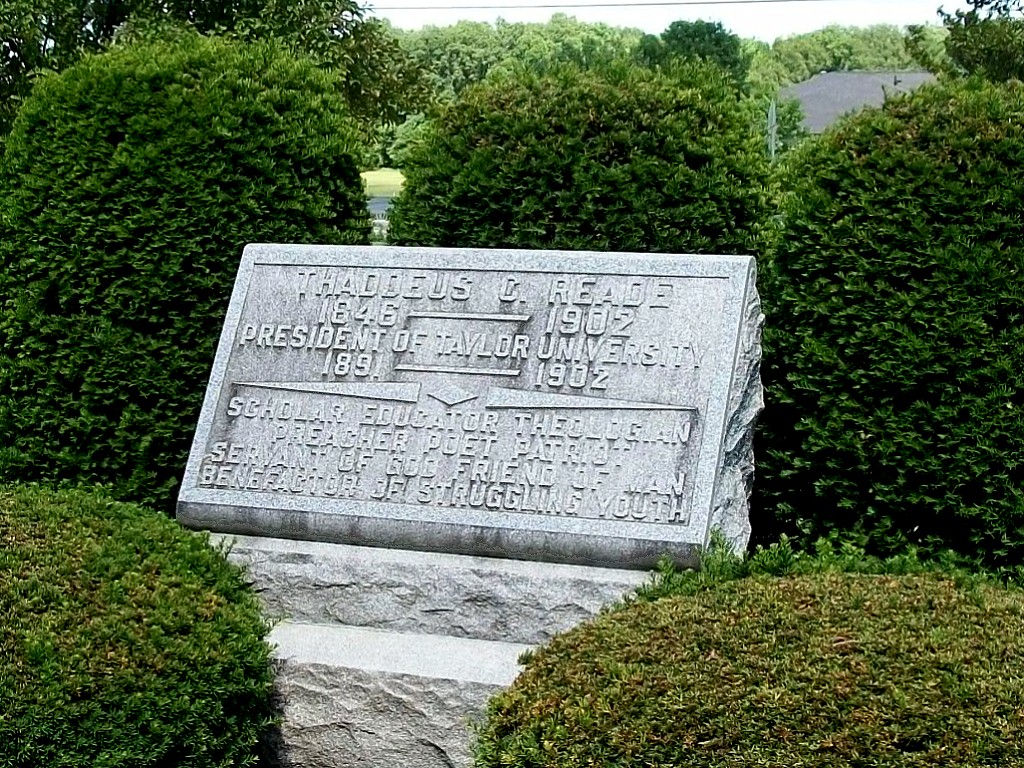 | Located on the campus of Taylor University in Upland, north of the university entrance off SR22. Monument lies on the east side of the first northbound drive after entering from SR22.N40° 27' 28.5" ;W85° 39' 40" | | |||||||||||||||||||||||||||||||||||||||||||||||||||||||||||||||||||||||||||||||||||||||||
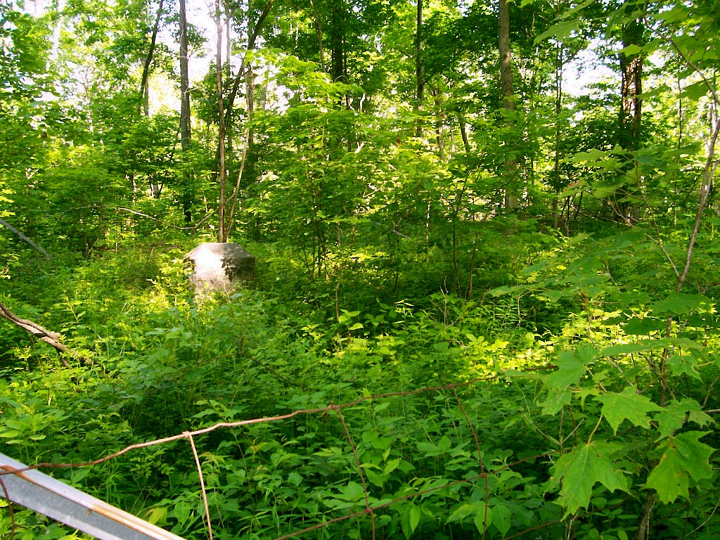
| Renbarger Cemetery | | Ø | #Located northeast of Marion, on the east side of the Mississinewa River, about 1/2 mile west of a house at the end of Harreld Rd. It is on private property.N40° 36' 8.8" ,W85° 40' 23.6" Approximate location. Not confirmed | | |||||||||||||||||||||||||||||||||||||||||||||||||||||||||||||||||||||||||||||||||||||||||
| Riverside Cemetery (East Jonesboro, Harrisburg) Updated November 2019 |  | | Located on the western edge of Gas City, about 1 block south of SR22 on West Street or Broadway.N40° 29' 10" ;W85° 37' 21" | ||||||||||||||||||||||||||||||||||||||||||||||||||||||||||||||||||||||||||||||||||||||||||
| * Rock Dam Cemetery (Renner Family Cemetery) | | Ø | # the exact location of the cemetery is unknown. It was south of Gas City in the area northwest of CR400E and CR600S. | | |||||||||||||||||||||||||||||||||||||||||||||||||||||||||||||||||||||||||||||||||||||||||
| Rowland Cemetery Updated Feb 2013 | 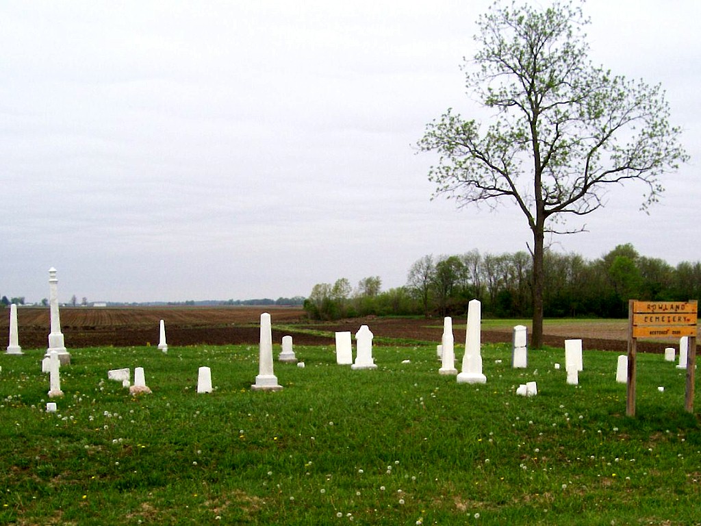 | | Located southwest of Sweetser, on the west side of CR600W, about 200 yards north of CR00NS.N40° 33' 13" ;W85° 47' 16" | | |||||||||||||||||||||||||||||||||||||||||||||||||||||||||||||||||||||||||||||||||||||||||
| Salem Cemetery Updated Feb 2013 |  | | Located on the east side of Marion, southwest of the junction of CR200N (Salem Pike)and King Rd.(CR200E).N40° 34' 53" ;W85° 38' 13" | | |||||||||||||||||||||||||||||||||||||||||||||||||||||||||||||||||||||||||||||||||||||||||
| Selby Cemetery |  |  | Located on the west side of CR362E, north of SR26. Stop at the house at the end of the gravel road for permission to cross private property. The cemetery lies along the left side of a grass driveway about 400 yards further northeast. There is only one headstone. Please ask permision before entering private property.N40° 25' 51.3" ;W85° 35' 51" | | |||||||||||||||||||||||||||||||||||||||||||||||||||||||||||||||||||||||||||||||||||||||||
| Shiloh Cemetery Updated May 2014 (Restorations) |  | | Located southeast of Upland, on the west side of CR1000E, just north of the junction of CR800S. N40° 25' 15" ;W85° 29' 04" | | |||||||||||||||||||||||||||||||||||||||||||||||||||||||||||||||||||||||||||||||||||||||||
| Thrailkill Cemetery Updated November 2019 |  | | Located north of Swayzee, on the east side of SR13, about a mile south of SR18.N40° 33' 31" ;W85° 49' 30" | | |||||||||||||||||||||||||||||||||||||||||||||||||||||||||||||||||||||||||||||||||||||||||
| Tinkle Cemetery (Landess, Landessville) Updated Feb 2013 |
 | | Located south of Landess, on the east side of CR600E, 1/2 mile north of CR300N. N40° 33' 31" ;W85° 49' 30" | | |||||||||||||||||||||||||||||||||||||||||||||||||||||||||||||||||||||||||||||||||||||||||
| Union Cemetery | | Ø | #Located southeast of Fairmount, about 1/4 mile south of CR1100S where CR200E ends. It is on private property. There are no monuments.N40° 23' 32.6" ,W85° 38' 11.3" Approximate location. Not confirmed | | |||||||||||||||||||||||||||||||||||||||||||||||||||||||||||||||||||||||||||||||||||||||||
| Union Chapel Cemetery (Beekman) Updated Feb 2013 |  | | Located northeast of Marion, on the northeast corner of CR550N and CR500E.N40° 38' 03" ;W85° 34' 45" | | |||||||||||||||||||||||||||||||||||||||||||||||||||||||||||||||||||||||||||||||||||||||||
| Van Buren Cemetery (Masonic) Updated November 2019 |  | | Located south of Van Buren on the east side of SR5 (CR900E), south of CR400N.N40° 26' 32" ;W85° 30' 13" | | |||||||||||||||||||||||||||||||||||||||||||||||||||||||||||||||||||||||||||||||||||||||||
| Walnut Creek Cemetery (Overman) | 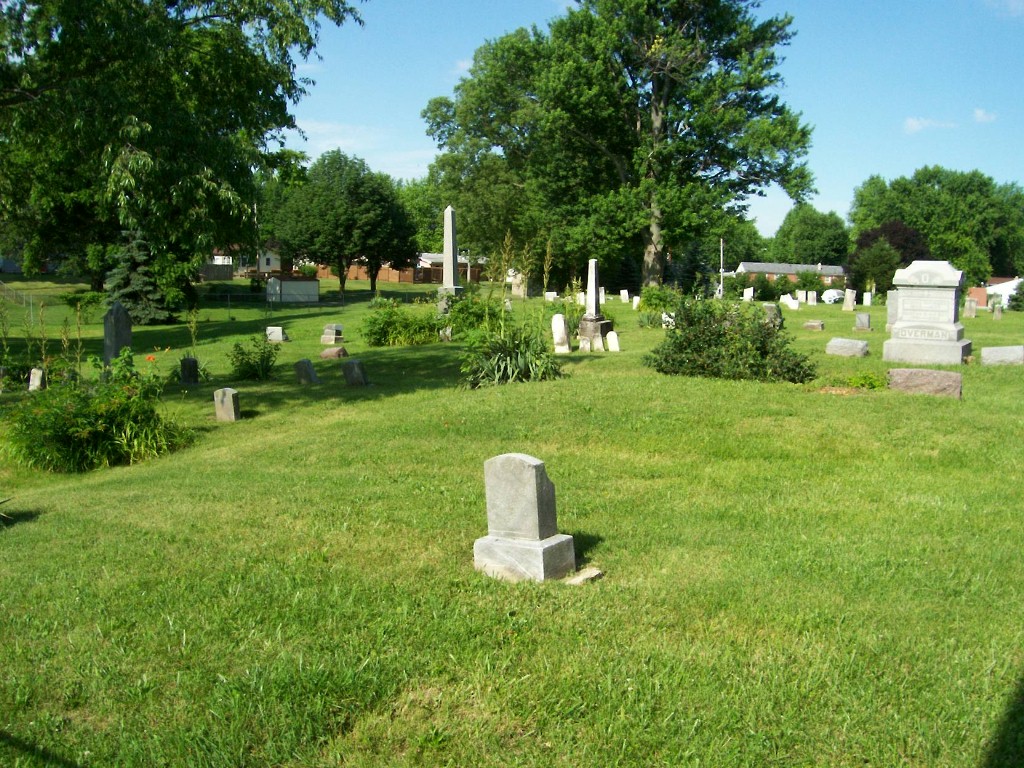  | | Located on the north side of Gas City, on the south side of North " H" street, about one block east of Missisinewa High School.N40° 29' 42" ;W85° 36' 23" | | |||||||||||||||||||||||||||||||||||||||||||||||||||||||||||||||||||||||||||||||||||||||||
| Weaver Cemetery Updated Feb 2013 |
 | | Located southwest of Marion, on the north side of CR600S, between CR250W and CR300W (about 1.2 miles west of SR37).N40° 27' 58" ;W85° 43' 37" | | |||||||||||||||||||||||||||||||||||||||||||||||||||||||||||||||||||||||||||||||||||||||||
| * Weston/Lewis Cemetery | | Ø | # The exact location of this cemetery is unknown. It was on a ridge on the eastern border of " The Prairie" northwest of Fowlerton, in the area south of SR26, between CR450E and CR525E. | | |||||||||||||||||||||||||||||||||||||||||||||||||||||||||||||||||||||||||||||||||||||||||
| Whiteneck Cemetery |  | | Located northwest of the intersection of CR500N and CR500W, on the banks of Cart Creek. It is on private property. A grass road(?) runs between two rundown barns about 1/4 mile to the start of the cemetery. Cemetery consists of two sections (E-W) divided by a deep, but not steep valley. Of the 60 plus stones, only two are standing in their original location. The rest are down, broken, or both.N40° 37' 41" ,W85° 46' 30" | | |||||||||||||||||||||||||||||||||||||||||||||||||||||||||||||||||||||||||||||||||||||||||
| * Woodruff Cemetery | | Ø | # The exact location of this cemetery is unknown. It was on the east bank of the Missisinewa River, south of Griffin Cemetery. | |
Near Neighbors
Cemeteries located near the Grant County Borders,
where Grant County individuals are or may be interred.
| Balsley Cemetery (Blackford Co.) Updated July 2019 |
 |
| Located about 3/4 mile inside Blackford County, 2/10 mile west of Blackford CR300W, about 3/4 mile north of SR18. A driveable grass driveway leads to the west to cemetery gate.N40° 33' 49" ;W85° 25' 56" | |
| Elizabethtown Cemetery (Delaware Co.) Updated November 2019 |
 | | Located in far northern Delaware County, about 250 yards south of the Grant County line and 600 yards from Blackford County. It lies on the north side of Delaware CR1275N (via 1270N) about 3/10 mile east of Delaware CR370W.N40° 22' 36" ;W85° 27' 03" | |
| Gardens of Memory (Huntington Co.) |   | Ø | Located north of Marion on the east side of SR9 about ¾ mile north of the county line. Actually located in Huntington County, but often refered to as Gardens of Memory, Marion. N40° 39' 52" ;W85° 36' 50" | |
| Leffler Cemetery (Blackford Co.) |  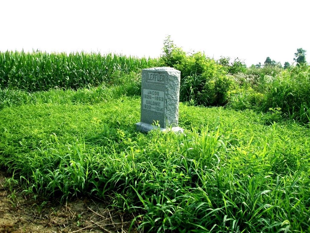 | | Located in Blackford County northeast of Upland, about 75 yards east of County Line Road (1200 E.), between Grant CR400S & Blackford CR350 N. It is not visible from the road in summer when corn is up.N40° 29' 59" ;W85° 26' 44" | |
| Miles Cemetery (Blackford Co.) |
 | | Located about 1 mile inside Blackford County on northwest corner of Blackford CR200N (Grant CR500S) and Blackford CR300W.N40° 28' 46" ;W85° 25' 38" | |
| Olive Branch Cemetery (Delaware Co.) Updated May 2019 | 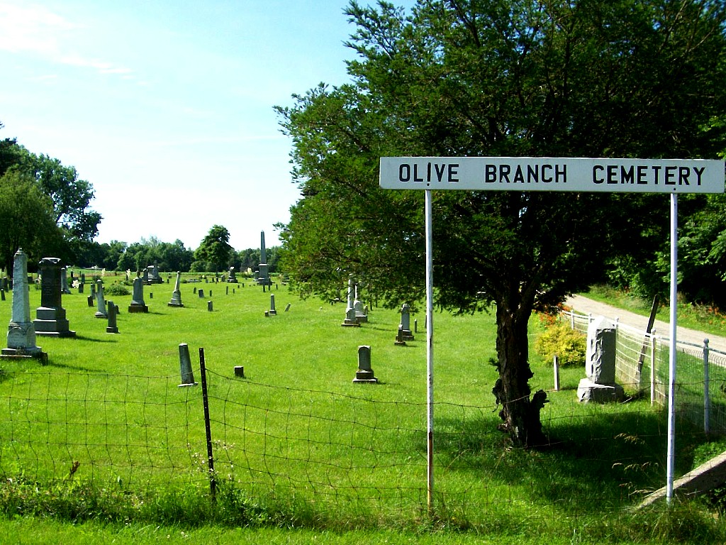  | | Located east of Matthews,at the end of CR1050E. From the Covered Bridge in Matthews go north on CR990E to CR1100S, turn east to CR1100W, then south on 1100 to CR1175 S [at cemetery sign]. This road turns south after about 1/2 mile to become CR1050E, which borders the cemetery at its end. Actually in Delaware County.N40° 22' 43' ;W85° 28' 22" Major restoration completed in Summer 2014 - Photos updated. Includes both old & restored photos. | |
| Rigdon Cemetery (Independence) (Madison Co.) Updated Feb 2013 | 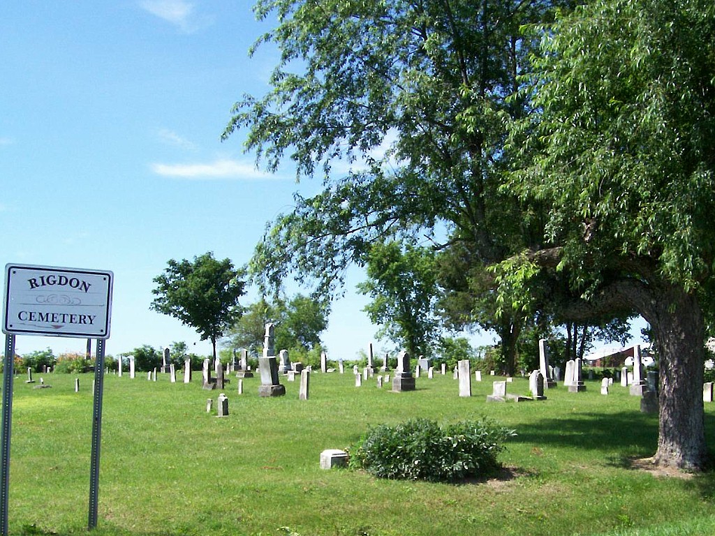  | | Located on the south side of Grant CR1200S about 1/10 mile east of SR37 in Rigdon.N40° 22' 43" ;W85° 46' 20" | |
| Wheeling Cemetery (Delaware Co.) Photos added June 2014 |
 | | Located one mile into Delaware County, about 2 miles southeast of Matthews on the north side of Wheeling Pike. Heavily overgrown and very thick with mosquitos.N40° 21' 49" ;W85° 28' 09" | |
Note: Cemeteries with  symbol have been photographed and are awaiting editing and name matching.
Watch for them over the next few months...jp

©  |